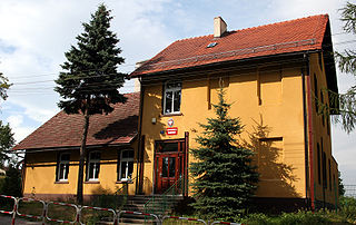
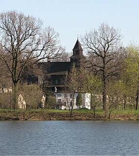
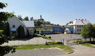
Rudyszwałd

Last updated
Rudyszwałd
Village
Rudyszwald.jpg
Poland adm location map.svg
Red pog.svg
Rudyszwałd
Coordinates: 49°57′N18°17′E / 49.950°N 18.283°E / 49.950; 18.283
Country Flag of Poland.svg Poland
Voivodeship Silesian
County Racibórz
Gmina Krzyżanowice
First mentioned 1305
Elevation 200 m (700 ft)
Population (approx.) 790

Rudyszwałd [ruˈdɨʂfau̯t] (German : Ruderswald) is a village in the administrative district of Gmina Krzyżanowice, within Racibórz County, Silesian Voivodeship, in southern Poland, close to the Czech border. [1] It lies approximately 6 kilometres (4 mi) south of Krzyżanowice, 16 km (10 mi) south of Racibórz, and 62 km (39 mi) south-west of the regional capital Katowice.

German language West Germanic language

German is a West Germanic language that is mainly spoken in Central Europe. It is the most widely spoken and official or co-official language in Germany, Austria, Switzerland, South Tyrol (Italy), the German-speaking Community of Belgium, and Liechtenstein. It is also one of the three official languages of Luxembourg and a co-official language in the Opole Voivodeship in Poland. The languages which are most similar to German are the other members of the West Germanic language branch: Afrikaans, Dutch, English, the Frisian languages, Low German/Low Saxon, Luxembourgish, and Yiddish. There are also strong similarities in vocabulary with Danish, Norwegian and Swedish, although those belong to the North Germanic group. German is the second most widely spoken Germanic language, after English.

Village Small clustered human settlement smaller than a town

A village is a clustered human settlement or community, larger than a hamlet but smaller than a town, with a population ranging from a few hundred to a few thousand. Though villages are often located in rural areas, the term urban village is also applied to certain urban neighborhoods. Villages are normally permanent, with fixed dwellings; however, transient villages can occur. Further, the dwellings of a village are fairly close to one another, not scattered broadly over the landscape, as a dispersed settlement.

Gmina Krzyżanowice Gmina in Silesian, Poland

Gmina Krzyżanowice is a rural gmina in Racibórz County, Silesian Voivodeship, in southern Poland, on the Czech border. Its seat is the village of Krzyżanowice, which lies approximately 10 kilometres (6 mi) south of Racibórz and 60 km (37 mi) south-west of the regional capital Katowice.

The village has an approximate population of 790.

The village was first mentioned in a Latin document of Diocese of Wrocław called Liber fundationis episcopatus Vratislaviensis from around 1305 as item in Rudolfwald debent esse XXIII) mansi. [2] [3] The name, Rudolph plus wald (German: a wood), indicates ethnically German settlement.

Roman Catholic Archdiocese of Wrocław archdiocese

The Archdiocese of Wrocław is a Latin Rite archdiocese of the Catholic Church named after its capital Wrocław in Poland. From its founding as a bishopric in 1000 until 1821, it was under the Archbishopric of Gniezno in Greater Poland. From 1821 to 1930 it was subjected directly to the Apostolic See. Between 1821 and 1972 it was officially known as (Arch)Diocese of Breslau.

Liber fundationis episcopatus Vratislaviensis is a Latin manuscript catalog of documents compiled in the later 13th or in the early 14th century. It lists towns and villages obliged to pay a tithe to the Bishopric of Wrocław. As a primary source it helps to recreate territorial extent, structure and revenues of the contemporary Diocese of Wrocław, additionally hundreds of villages in Silesia were being attested for the first time in their history, hence the importance of the document. The exact date of the document is not determined, but most often it is believed to be compiled in 1305, during Henryk of Wierzbna bishophood, who tried to reorganize bishopric's finances.

Rudolph (name) Name list

Rudolph or Rudolf or Rodolphe is a male first name, and, less commonly, a surname. It is a Germanic name deriving from two stems: Hrōþi, Hruod or Hrōð, meaning "fame", "glory", and olf meaning "wolf". It is a common name in many germanic-language speaking countries in Europe, but in the North-American countries it is rare.

Related Research Articles

Studzionka Village in Silesian, Poland

Studzionka is a village in the administrative district of Gmina Pszczyna, within Pszczyna County, Silesian Voivodeship, in southern Poland. It lies approximately 13 kilometres (8 mi) west of Pszczyna and 36 km (22 mi) south-west of the regional capital Katowice.

Marklowice Village in Silesian, Poland

Marklowice is a village in Wodzisław County, Silesian Voivodeship, in southern Poland. It is the seat of the gmina called Gmina Marklowice. It lies approximately 6 kilometres (4 mi) east of Wodzisław Śląski and 43 km (27 mi) south-west of the regional capital Katowice. Between 1975 and 1994 Marklowice was part of the town Wodzisław Śląski.

Mszana Village in Silesian, Poland

Mszana is a village in Wodzisław County, Silesian Voivodeship, in southern Poland. It is the seat of the gmina called Gmina Mszana. It lies approximately 6 kilometres (4 mi) south-east of Wodzisław Śląski and 47 km (29 mi) south-west of the regional capital Katowice.

Nadolice Wielkie Village in Lower Silesian, Poland

Nadolice Wielkie is a village in the administrative district of Gmina Czernica, within Wrocław County, Lower Silesian Voivodeship, in south-western Poland. Prior to 1945 it was in Germany. It lies approximately 4 kilometres (2 mi) north of Czernica and 14 km (9 mi) east of the centrum regional capital Wrocław.

Muglinov neighborhood of Ostrava

Muglinov is a part of the city of Ostrava, Moravian-Silesian Region in the Czech Republic. Administratively it is a part of the district of Slezská Ostrava.

Hrušov (Ostrava) neighborhood of Ostrava

Hrušov is a part of the city of Ostrava, Moravian-Silesian Region in the Czech Republic. Hrušov is historically a market town, now administratively a part of the district of Slezská Ostrava.

Słupsko, Silesian Voivodeship Village in Silesian, Poland

Słupsko is a village in the administrative district of Gmina Rudziniec, within Gliwice County, Silesian Voivodeship, in southern Poland. It lies approximately 9 kilometres (6 mi) north-east of Rudziniec, 20 km (12 mi) north-west of Gliwice, and 41 km (25 mi) north-west of the regional capital Katowice. The village has a population of 411.

Rusinowice Village in Silesian, Poland

Rusinowice is a village in the administrative district of Gmina Koszęcin, within Lubliniec County, Silesian Voivodeship, in southern Poland. It lies approximately 6 kilometres (4 mi) west of Koszęcin, 8 km (5 mi) south-east of Lubliniec, and 47 km (29 mi) north-west of the regional capital Katowice. The village has a population of 1,336. It is located near to the Polish nature reserve Jeleniak Mikuliny.

Golasowice Village in Silesian, Poland

Golasowice is a village in the administrative district of Gmina Pawłowice, within Pszczyna County, Silesian Voivodeship, in southern Poland. It lies approximately 5 kilometres (3 mi) south-west of Pawłowice, 20 km (12 mi) west of Pszczyna, and 43 km (27 mi) south-west of the regional capital Katowice. The village has a population of 1,210.

Jarząbkowice, Silesian Voivodeship Village in Silesian, Poland

Jarząbkowice is a village in the administrative district of Gmina Pawłowice, within Pszczyna County, Silesian Voivodeship, in southern Poland. It lies approximately 7 kilometres (4 mi) south of Pawłowice, 20 km (12 mi) south-west of Pszczyna, and 44 km (27 mi) south-west of the regional capital Katowice.

Krzyżowice, Silesian Voivodeship Village in Silesian, Poland

Krzyżowice is a village in the administrative district of Gmina Pawłowice, within Pszczyna County, Silesian Voivodeship, in southern Poland. It lies approximately 5 kilometres (3 mi) north-west of Pawłowice, 20 km (12 mi) west of Pszczyna, and 38 km (24 mi) south-west of the regional capital Katowice.

Pielgrzymowice, Silesian Voivodeship Village in Silesian, Poland

Pielgrzymowice is a village in the administrative district of Gmina Pawłowice, within Pszczyna County, Silesian Voivodeship, in southern Poland. It lies approximately 23 kilometres (14 mi) south-west of Pszczyna and 46 km (29 mi) south-west of the regional capital Katowice.

Warszowice Village in Silesian, Poland

Warszowice is a village in the administrative district of Gmina Pawłowice, within Pszczyna County, Silesian Voivodeship, in southern Poland. It lies approximately 17 kilometres (11 mi) west of Pszczyna and 35 km (22 mi) south-west of the regional capital Katowice.

Bełk, Silesian Voivodeship Village in Silesian, Poland

Bełk is a village in the administrative district of Gmina Czerwionka-Leszczyny, within Rybnik County, Silesian Voivodeship, in southern Poland. It lies approximately 7 kilometres (4 mi) south of Czerwionka-Leszczyny, 13 km (8 mi) north-east of Rybnik, and 25 km (16 mi) south-west of the regional capital Katowice.

Stanowice, Silesian Voivodeship Village in Silesian, Poland

Stanowice is a village in the administrative district of Gmina Czerwionka-Leszczyny, within Rybnik County, Silesian Voivodeship, in southern Poland. It lies approximately 6 kilometres (4 mi) south of Czerwionka-Leszczyny, 11 km (7 mi) north-east of Rybnik, and 27 km (17 mi) south-west of the regional capital Katowice.

Świerklany Dolne Village in Silesian, Poland

Świerklany Dolne is a village in the administrative district of Gmina Świerklany, within Rybnik County, Silesian Voivodeship, in southern Poland. It lies approximately 4 kilometres (2 mi) south-east of Jankowice Rybnickie, 8 km (5 mi) south of Rybnik, and 40 km (25 mi) south-west of the regional capital Katowice.

Świerklany Górne Village in Silesian, Poland

Świerklany Górne is a village in the administrative district of Gmina Świerklany, within Rybnik County, Silesian Voivodeship, in southern Poland. It lies approximately 4 kilometres (2 mi) south-east of Jankowice Rybnickie, 8 km (5 mi) south of Rybnik, and 40 km (25 mi) south-west of the regional capital Katowice.

Wierzbica Górna Village in Opole, Poland

Wierzbica Górna is a village in the administrative district of Gmina Wołczyn, within Kluczbork County, Opole Voivodeship, in south-western Poland. It lies approximately 6 kilometres (4 mi) west of Wołczyn, 18 km (11 mi) west of Kluczbork, and 41 km (25 mi) north of the regional capital Opole.

Ruptawa

Ruptawa is a sołectwo in the south of Jastrzębie-Zdrój, Silesian Voivodeship, southern Poland. It was an independent village but became administratively part of Jastrzębie-Zdrój in 1975.

Skrzeczkowice is a sołectwo in the northern part Jastrzębie-Zdrój, Silesian Voivodeship, southern Poland. It was an independent village but became administratively part of Jastrzębie-Zdrój in 1975. It has na area of 248,84 ha and on December 31, 2012 it had 728 inhabitants.

References


Coordinates: 49°57′N18°17′E / 49.950°N 18.283°E / 49.950; 18.283

Geographic coordinate system Coordinate system

A geographic coordinate system is a coordinate system that enables every location on Earth to be specified by a set of numbers, letters or symbols. The coordinates are often chosen such that one of the numbers represents a vertical position and two or three of the numbers represent a horizontal position; alternatively, a geographic position may be expressed in a combined three-dimensional Cartesian vector. A common choice of coordinates is latitude, longitude and elevation. To specify a location on a plane requires a map projection.