
The Purna River is a river of Western India. It is one of the chief tributaries of the Tapti river and empties into it at Changdev in Jalgaon, Maharashtra.
Jalgaon is a district in the northern part of Maharashtra, India. The headquarters is the city of Jalgaon.

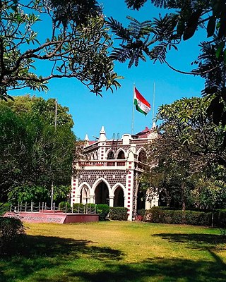
Muktainagar, also known as Edlabad is a town in the eastern part of Jalgaon district in northern Maharashtra and is the administrative seat of Muktainagar taluka.
Bodwad is a small town in Jalgaon district of Maharashtra in India. It is the administrative center of the state Maharshtra in Bodwad Taluka.
Raver is a city and municipal council in Jalgaon district in the Indian state of Maharashtra. It is the administrative center of Raver Taluka. Raver is famous for the Bhagvan Dattatreya-temple which is 200 years old and was founded by Sachidanand Swami Maharaj. Built in the old Mughal Kaleen tradition, it also has some ancient photos of Bhagvan Dattreyay in form of Malaang Fakir, Bhagwan Dattreyay's Charan Paduka. It is part of the Khandesh region.
Warwat Bakal is a Gram Panchayat, in Sangrampur tehsil of Buldhana district, includes in Vidarbha region in the state of Maharashtra, India.
Chopda Assembly constituency is one of the 288 Vidhan Sabha constituencies of Maharashtra state in western India. This constituency is located in the Jalgaon district and it is reserved for the candidates belonging to Scheduled tribes. It is currently held by Jagdishchandra Walvi of the Nationalist Congress Party.

Raver Assembly constituency is one of the 288 Vidhan Sabha constituencies of Maharashtra state in western India. This constituency is located in the Jalgaon district.
Ashti is a major village in Partur taluka of Jalna district in Maharashtra state of India.
Bori is a village in Jintur taluka of Parbhani district in Maharashtra state of India.
Zari is a major village in Parbhani taluka of Parbhani district of Maharashtra state in India.
Charthana is a major village in Jintur taluka of Parbhani district in Maharashtra state of India. It used to be known as Charukshetra Nagari in honor to the name of king Charudatta. There are near about 360 temples of Mahadeva, some of which are under the ground. The Archaeological Survey of India (ASI) has acquired the remaining temples for conservation. Gokuleshwar mandir, Barav, Dwipmal, and Nartirtha are places of interest among many others.
Bhogaon is a major village in the Jintur taluka of Parbhani district in Maharashtra, a state of India.

Rajur is a town in Latur district of Maharashtra state of India. rajur is 60 km away from district headquarter Latur.
Daithana is a major village in Parbhani taluka of Parbhani district in Indian state of Maharashtra. Village is located on Parbhani-Gangakhed state highway, 24 km away from Parbhani city.
Kothadi is a village in Muktainagar taluka of Jalgaon district in the state Indian of Maharashtra. Kothadi's name is also written and pronounced as Kothali in Hindi and English. This village is administered by a Gram panchayat.
Ghodasgaon is a village in Muktainagar taluka of Jalgaon district in Maharashtra. It is located near the Purna river in Muktainagar.
North Maharashtra is a geographical region in the Maharashtra state of India. It comprises the Nashik, Dhule, Nandurbar, and Jalgaon districts. It borders the state of Gujarat to the northwest, Paschim Maharashtra to the south, Konkan to the west, and Vidarbha and Marathwada regions of Maharashtra to the east.
Dolarkheda is a village in the Muktainagar taluka of Jalgaon district in Maharashtra, India. It is situated in the foothills of the Satpura Mountains and is located in a reserved forest.
Hartala is a village in Muktainagar taluka of Jalgaon district in Maharashtra, India. It is located near National Highway 53.

