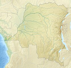
Ruki River

Last updated

Ruki River
Democratic Republic of the Congo relief location map.jpg
Red pog.svg
Mouth location in the Democratic Republic of the Congo
Location
CountryDemocratic Republic of the Congo
Physical characteristics
Source 
  coordinates 0°19′17″S18°58′58″E / 0.321419°S 18.982817°E / -0.321419; 18.982817
Mouth Congo River
  coordinates
0°04′47″N18°17′34″E / 0.079782°N 18.292829°E / 0.079782; 18.292829
Length105 km (65 mi)
Basin size173,790 km2 (67,100 sq mi)
Discharge 
  location Ingende
  average4,450 m3/s (157,000 cu ft/s) [1]
Basin features
River system Congo River
Tributaries 
  leftMomboyo River
  right Busira River
River Ruki as seen at the top left Rivers of center DRC.png
River Ruki as seen at the top left

The Ruki (Swahili : Mto Ruki) is a river in the Democratic Republic of the Congo. It is a left tributary of the Congo River. It may be seen as the lower reach of the Busira River, which in turn may be seen as the lower reach of the Tshuapa River.

Contents

Location

The Ruki is a major river in the Cuvette Centrale of the middle Congo River basin. [2] The watershed covers about 14,000,000 square kilometres (5,400,000 sq mi). [3] The drainage basin is almost entirely pristine lowland forest and swamp forest. [4] As of 2020, 248 species of fish had been identified in 26 families. [2] The main rivers are the Ruki-Busira, Momboyo-Luilaka, Tshuapa, Lomela and Salonga. [5] The most important town in the river basin is Boende on the Tshuapa, 29 kilometres (18 mi) upstream from where it joins the Lomela to form the Busira. [6]

The Ruki River forms above Ingende where the Momboyo River joins the Busira River from the left and flows in a west-northwest direction. [7] It enters the Congo from the east, flowing past the north of the town of Mbandaka. [8] The Ruki and its main tributary the Busira can be navigated year round, since the depth is always more than 1 metre (3 ft 3 in) and reaches 2 metres (6 ft 7 in) in the flood period. High water is in March-April and November. Low water is in February and June-July. [3]

The Ruki itself is just 103 kilometres (64 mi) long, and extends downstream from the mouth of the Momboyo, which is 2 kilometres (1.2 mi) above Ingende. Higher up it is called the Busira as far as the confluence of the Tshuapa and the Lomela. The Busira section is 305 kilometres (190 mi) long, and the whole Ruki-Busira waterway is 408 kilometres (254 mi) long. [5] The Ruki-Busira receives four navigable tributaries: the Momboyo at 103 kilometres (64 mi) from its mouth, the Salonga at 233 kilometres (145 mi), just upstream from Lotoko, and the Tshuapa and Lomela which converge to form the river. [3]

Colonial period

The explorer Henry Morton Stanley visited the region, and called the Ruki the Mohindu River. [9] A local man from Bungata named the river Buruki (Ruki) or Mohindu, meaning "Black". [10] Stanley explored it for about 80 miles (130 km), and based on its size and reports of the local people he estimated that it might be navigable for about 650 miles (1,050 km). [9]

The African Queen

The Ruki River was used as a location for the movie The African Queen starring Humphrey Bogart and Katharine Hepburn. A 1951 article in Life magazine describes how the influx of filmmakers broke the "sweltering monotony of life along the dank, disease-ridden shores" of the river. Forest was cleared to create a "cluster of tasteful native huts". Filming took seven weeks. [11]

Notes

    1. "Introduction" (PDF).
    2. 1 2 Kesner-Reyes 2020.
    3. 1 2 3 Lederer 1973, p. 14.
    4. Drake et al.
    5. 1 2 Lederer 1973, p. 13.
    6. Lederer 1973, p. 58.
    7. Ruki River ... Encyclopaedia Britannica.
    8. Way: Моандака (238294439).
    9. 1 2 Stanley 1885, p. 344.
    10. Stanley 1885, p. 32.
    11. Katie and Bogie Hit the Congo.

    Sources

    Related Research Articles

    <span class="mw-page-title-main">Congo River</span> River in central Africa

    The Congo River, formerly also known as the Zaire River, is the second-longest river in Africa, shorter only than the Nile, as well as the third-largest river in the world by discharge volume, following the Amazon and Ganges rivers. It is the world's deepest recorded river, with measured depths of around 220 m (720 ft). The Congo–Lualaba–Luvua–Luapula–Chambeshi River system has an overall length of 4,700 km (2,900 mi), which makes it the world's ninth-longest river. The Chambeshi is a tributary of the Lualaba River, and Lualaba is the name of the Congo River upstream of Boyoma Falls, extending for 1,800 km (1,100 mi).

    <span class="mw-page-title-main">Salonga National Park</span> National park in the Democratic Republic of the Congo

    Salonga National Park is a national park in the Democratic Republic of the Congo located in the Congo River basin. It is Africa's largest tropical rainforest reserve covering about 36,000 km2 or 3,600,000 hectares. It extends into the provinces of Mai Ndombe, Equateur, Kasaï and Sankuru. In 1984, the national park was inscribed on the UNESCO World Heritage List for its protection of a large swath of relatively intact rainforest and its important habitat for many rare species. In 1999, the site has been listed as endangered due to poaching and housing construction. Following the improvement in its state of conservation, the site was removed from the endangered list in 2021.

    Sankuru Nature Reserve is a protected area in the Democratic Republic of the Congo. It was created in November 2007 to protect a forest area home to bonobo, okapi and African forest elephant. The reserve has not been managed effectively, and suffers from ongoing deforestation and bushmeat hunting.

    <span class="mw-page-title-main">Tshuapa River</span> River in Democratic Republic of the Congo

    The Tshuapa River or Rivière Tshwapa is a river in Democratic Republic of the Congo, the main tributary of the Busira River.

    The Busira River is a river in the Democratic Republic of the Congo. It is the main tributary of the Ruki River, which in turn is a tributary of the Congo River. The Busira may be seen as the upper reach of the Ruki River. It is navigable year round.

    The Itimbiri River is a right tributary of the Congo River, which it joins above Bumba. At one time it was important as a navigable waterway for transporting good from the northeast of the country down to the Congo.

    The Ikelemba River is a river in the Democratic Republic of the Congo. It is a left tributary of the Congo River.

    <span class="mw-page-title-main">Momboyo River</span> River in Democratic Republic of the Congo

    The Momboyo River is a river in the Democratic Republic of the Congo. It joins the Busira River to form the Ruki River, a tributary of the Congo River. The Momboya and its main tributary the Luilaka are navigable for 545 kilometres (339 mi) from its mouth.

    The Lomela River is a river in the Democratic Republic of the Congo. It is one of the main tributaries of the Busira River, which forms where the Lomela meets the Tshuapa River. The Busira is in turn the main tributary of the Ruki River, which enters the Congo River to the north of Mbandaka.

    The Salonga River is a river in the Democratic Republic of the Congo. It is a tributary of the Busira River.

    Ingende is a town in the Province of Équateur in the Democratic Republic of the Congo, the headquarters of Ingende Territory.

    Busira, or Busira Manene, is a village in the Province of Équateur in the Democratic Republic of the Congo, in Busira Territory.

    Elinga-Mpango or Elingampango is a community in the Sankuru province of the Democratic Republic of the Congo.

    Bokote is a community on the Busira River in the Province of Équateur in the Democratic Republic of the Congo. In the colonial period it held a trading post and a Catholic mission.

    Lotoko is a community on the Busira River in the Province of Équateur in the Democratic Republic of the Congo. In the colonial period it held a trading post.

    Monieka is a community on the Busira River in the Province of Équateur in the Democratic Republic of the Congo. In the colonial period it held a trading post and a Protestant mission.

    <span class="mw-page-title-main">Bus Bloc</span>

    The Bus Bloc, or Bloc de la Busira-Momboyo, was a huge concession in the Congo Free State, later the Belgian Congo, operated by the Société anonyme belge pour le commerce du Haut-Congo (SAB). It covered land along and between the Busira River and Momboyo River. In the early days the SAB exploited the local people ruthlessly in their demands for rubber, and many died.

    Bomputu is a community on the Salonga River in the province of Tshuapa in the Democratic Republic of the Congo. In the colonial period it held a trading post.

    <span class="mw-page-title-main">Cuvette Centrale Province</span> Province in Democratic Republic of the Congo

    Cuvette Centrale Province was a province of the Democratic Republic of the Congo that existed between 1963 and 1966 during the Congo Crisis.