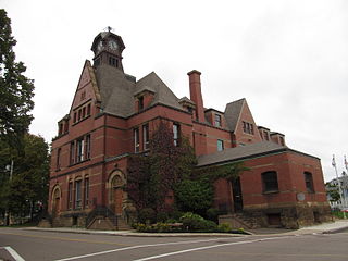
Summerside is a Canadian city in Prince County, Prince Edward Island. It is the second largest city in the province and the primary service centre for the western part of the island.

Queens County is a county in the province of Prince Edward Island, Canada. It is the largest county in the province by population with 89,770 (2021) and land. Charlottetown is the county seat of Queens County, and is the largest city and the capital of Prince Edward Island.

Confederation Centre of the Arts is a cultural centre dedicated to the visual and performing arts located in the city of Charlottetown, Prince Edward Island, Canada.

Holland College is the provincial community college for the Canadian province of Prince Edward Island (PEI). It is named after the British Army engineer and surveyor Captain Samuel Holland. A significant percentage of college enrolment are international students on student visas.

Cape Tormentine is a rural community and former local service district in southeastern New Brunswick, Canada. It is located on the Northumberland Strait at the Abegweit Passage, the shortest crossing between Prince Edward Island and the mainland. It once flourished as a transportation hub between New Brunswick and Prince Edward Island but has been in decline since 1997 when the ferry service was closed due to the opening of the Confederation Bridge. At the Canada 2011 Census the population was 108, three quarters what it was at the 2006 census.

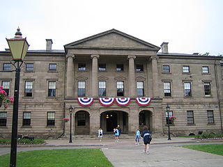
Province House is where the Prince Edward Island Legislature, known as the Legislative Assembly of Prince Edward Island, has met since 1847. The building is located at the intersection of Richmond and Great George Streets in Charlottetown; it is Canada's second-oldest seat of government.

Cavendish is an unincorporated rural community in the township of Lot 23, Queens County, Prince Edward Island, Canada.

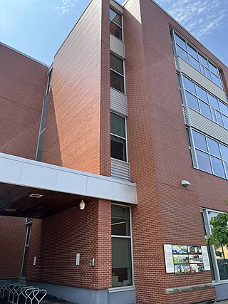
The Jean Canfield Building is a Government of Canada office building located in Charlottetown, Prince Edward Island. It is named after Jean Canfield, the first woman elected to the Legislative Assembly of Prince Edward Island.

New Glasgow is an unincorporated area located in Queens County in the central portion of Prince Edward Island, south-west of North Rustico. It is situated amongst beautiful rolling hills on the Hunter River. New Glasgow has several popular tourist destinations, including the famous New Glasgow Lobster Suppers, the renowned Glasgow Hills Golf course, the Prince Edward Island Preserve Company, The Mill Restaurant and the FarmHouse Inn
Freeland is a Canadian rural community in Prince County, Prince Edward Island.
Hunter River is a municipality that holds community status in Prince Edward Island, Canada. It is located in Queens County southwest of North Rustico. It is situated on the Hunter River.

Route 2, also known as Veterans Memorial Highway and the All Weather Highway, is a 216-kilometre (134 mi) two-lane uncontrolled access highway traversing Prince Edward Island, Canada from Tignish to Souris. Route 2 was recognized as the first numbered highway in the province in 1890, when it opened between Charlottetown and Summerside.

Dalvay-by-the-Sea is a National Historic Site of Canada located on the north shore of Prince Edward Island at the eastern end of Prince Edward Island National Park. The most significant feature of Dalvay is the Queen Anne Revival style hotel, originally constructed as a home for an American industrialist.
Bedeque is a former municipality that previously held community status in the Canadian province of Prince Edward Island. It was dissolved through its amalgamation with the Community of Central Bedeque on November 17, 2014 to create the Community of Bedeque and Area.

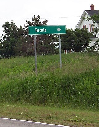
Toronto is an unincorporated area and civic address community in Queens County, Prince Edward Island, Canada. It is part of Lot 23 in Grenville Parish. It lies 4 miles (6.4 km) southwest of North Rustico on Route 241.
Long River is an unincorporated community, in Queens County. Long River is in Lot 20 of Statistics Canada

South Rustico, formerly called Rustico, is an unincorporated rural community in the township of Lot 24, Queens County, Prince Edward Island, Canada.
Oyster Bed Bridge is an unincorporated rural community in the township of Lot 24, Queens County, Prince Edward Island, Canada.
Grand River is an unincorporated area in Prince Edward Island, Canada. It is located in Prince County, northeast of Wellington. It is named for the Grand River, which it is situated upon.


