
Vågsbygd is a borough and district in the city of Kristiansand in Vest-Agder county, Norway. It is the largest borough and district in Kristiansand. Until 1965, Vågsbygd was a part of Oddernes municipality. The borough includes the districts of Flekkerøy, Voiebyen, Vågsbygd/Augland, and Slettheia. The Kristiansand Cannon Museum on Kroodden is an authentic fortress from World War II.
Hannevika or Hannevig / Hannevik is a neighbourhood in the city of Kristiansand in Vest-Agder county, Norway. It is located in the borough of Grim and in the district of Tinnheia. The neighborhood is located along the European route E39 highway and the start of Norwegian County Road 456. Hannevika is a large industrial area. Glencore and Hennig-Olsen Iskremfabrikk are the two largest industries located there. Hannevika is located southeast of Eigevannskollen, northeast of Kartheia, and south of Kolsberg.
Ternevig is a neighbourhood in the city of Kristiansand in Vest-Agder county, Norway. The neighborhood is located in the borough of Vågsbygd and in the district of Voiebyen. Ternevig is northeast of Møvik, southeast of Voie, east of Møviklia, and west of the ocean and the island of Andøya. There is a small hospital located in Ternevig serving the borough of Vågsbygd. There is also a marina located in this neighborhood.

Voie is a neighbourhood in the city of Kristiansand in Vest-Agder county, Norway. The neighborhood is located in the borough of Vågsbygd and in the district of Voiebyen. Voie lies along Norwegian County Road 456 and County Road 457. The only road to the island of Andøya goes past the neighborhood of Voie. It lies northwest of Møvik and northeast of Steindalen.

Kjøita or Kjøita Park is a neighbourhood in the city of Kristiansand in Vest-Agder county, Norway. It's located along the eastern shore of the Otra river in the borough of Lund. The neighborhood of Oddemarka lies to the east, Gimle lies to the north, and the centre of Lund lies to the southeast. Kjøita Park is an industrial park.
Kongshavn is a neighbourhood in the city of Kristiansand in Vest-Agder county, Norway. It's located in the borough of Oddernes and in the district of Randesund. The neighborhood of Frikstad lies to the north and Tømmerstø lies to the northwest. Kongshavn Pier is a large harbor with connections to islands outside of Randesund.
Holte is a neighbourhood in the city of Kristiansand in Vest-Agder county, Norway. It's located in the borough of Oddernes and in the district of Randesund. The neighborhood of Tømmerstø lies to the south and Frikstad lies to the east. Holte Junior High is the only junior high in Randesund.
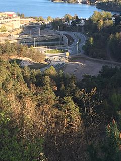
Kroodden is a neighbourhood in the city of Kristiansand in Vest-Agder county, Norway. The neighborhood is located in the borough of Vågsbygd and in the district of Voiebyen. The Kristiansand Cannon Museum is located to the west of Kroodden. Kroodden is south of Spinneren along the coast. From Kroodden, the Flekkerøy Tunnel leads across the strait to the island of Flekkerøy.
Spinneren is a neighbourhood in the city of Kristiansand in Vest-Agder county, Norway. The neighborhood is located in the borough of Vågsbygd and in the district of Voiebyen. Spinneren is located along the coast, south of Møvik and north of Kroodden.
Skutevika is a neighbourhood in the city of Kristiansand in Vest-Agder county, Norway. The neighborhood is located in the borough of Vågsbygd and in the district of Voiebyen. Skutevika is north of Kroodden, south of Møviklia, east of Steindalen, and west of Spinneren.
Steindalen is a neighbourhood in the city of Kristiansand in Vest-Agder county, Norway. The neighborhood is located in the borough of Vågsbygd and in the district of Voiebyen. Steindalen is north of Kroodden, south of Voieåsen, east of Voietun, and west of Møviklia.
Voieåsen is a neighbourhood in the city of Kristiansand in Vest-Agder county, Norway. The neighborhood is located in the borough of Vågsbygd and in the district of Voiebyen. Voieåsen is north of Møviklia, south of Voie, east of Voielia, and west of Møvik.
Voielia is a neighbourhood in the city of Kristiansand in Vest-Agder county, Norway. The neighborhood is located in the borough of Vågsbygd and in the district of Voiebyen. Voielia is north of Voietun, south of Rådyr, east of Bråvann, and west of Voieåsen.
Smiebrygga is a neighbourhood in the city of Kristiansand in Vest-Agder county, Norway. It is located in the borough of Vågsbygd and in the district of Vågsbygd. Smiebrygga is north of Kjosbukta, south of Auglandskollen, east of Kjosneset, and west of the ocean.
Storenes is a neighbourhood in the city of Kristiansand in Vest-Agder county, Norway. It is located in the borough of Vågsbygd and in the district of Vågsbygd. The neighborhood is located along the Kristiansandsfjorden, southeast of Augland.
Vestheiene is a neighbourhood in the city of Kristiansand in Vest-Agder county, Norway. It is located in the borough of Grim and in the district of Hellemyr. Vestheiene is located to the east of Breimyr and west of Hellemyrtoppen. Solkollen lies to the north of Vestheiene.
Hellemyrtoppen is a neighbourhood in the city of Kristiansand in Vest-Agder county, Norway. It is located in the borough of Grim and in the district of Hellemyr. Hellemyrtoppen is located just north of the European route E39 highway. It is north of Rige, east of Vestheiene, and west of Fjellro.
Solkollen is a neighbourhood in the city of Kristiansand in Vest-Agder county, Norway. It is located in the borough of Grim and in the district of Hellemyr. Solkollen is located to the north of Breimyr, to the west of the lake Eigevann, and to the north of Vestheiene.

Hamresanden is a 3-kilometre (1.9 mi) long beach in the municipality of Kristiansand in Vest-Agder county, Norway. The sandy beach is located at Hamre in the district of Tveit, along the Topdalsfjorden at the mouth of the river Topdalselva. It is located near Kristiansand Airport, Kjevik. Hamresanden goes from Grovikheia in Hånes to Ve.
Elisenhøy is a neighbourhood in the city of Kristiansand in Vest-Agder county, Norway. It is located in the borough of Grim and in the district of Grim. It is located on the south side of the Norwegian National Road 9, east of Klappane and Grim torv, northwest of Fagervoll, and south of Krossen.


