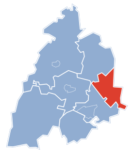
Zdechovice is a village in the Pardubice Region of the Czech Republic. It has cca 650 inhabitants.
Tapacocha District is one of ten districts of the province Recuay in Peru.

Błenna B is a village in the administrative district of Gmina Izbica Kujawska, within Włocławek County, Kuyavian-Pomeranian Voivodeship, in north-central Poland. It lies approximately 12 kilometres (7 mi) south-east of Izbica Kujawska, 33 km (21 mi) south of Włocławek, and 77 km (48 mi) south of Toruń.
Kazimierowo is a village in the administrative district of Gmina Michałowo, within Białystok County, Podlaskie Voivodeship, in north-eastern Poland, close to the border with Belarus.

Łukiany is a village in the administrative district of Gmina Zabłudów, within Białystok County, Podlaskie Voivodeship, in north-eastern Poland. It lies approximately 10 kilometres (6 mi) north of Zabłudów and 14 km (9 mi) east of the regional capital Białystok.
Olszynka is a village in the administrative district of Gmina Korycin, within Sokółka County, Podlaskie Voivodeship, in north-eastern Poland.

Borzytuchom is a village in Bytów County, Pomeranian Voivodeship, in northern Poland. It is the seat of the gmina called Gmina Borzytuchom. It lies approximately 12 kilometres (7 mi) north-west of Bytów and 85 km (53 mi) west of the regional capital Gdańsk.

Stemplew is a village in the administrative district of Gmina Świnice Warckie, within Łęczyca County, Łódź Voivodeship, in central Poland. It lies approximately 3 kilometres (2 mi) south-west of Świnice Warckie, 21 km (13 mi) west of Łęczyca, and 47 km (29 mi) north-west of the regional capital Łódź.

Otaqlı is a village in the Kalbajar Rayon of Azerbaijan.

Niwa is a settlement in the administrative district of Gmina Nielisz, within Zamość County, Lublin Voivodeship, in eastern Poland. It lies approximately 20 kilometres (12 mi) north-west of Zamość and 59 km (37 mi) south-east of the regional capital Lublin.
Olszewo-Tosie is a village in the administrative district of Gmina Stupsk, within Mława County, Masovian Voivodeship, in east-central Poland.

Pępowo is a village in the administrative district of Gmina Żukowo, within Kartuzy County, Pomeranian Voivodeship, in northern Poland. It lies approximately 4 kilometres (2 mi) north-east of Żukowo, 14 km (9 mi) east of Kartuzy, and 16 km (10 mi) west of the regional capital Gdańsk.

Zajączkowo is a settlement in the administrative district of Gmina Dziemiany, within Kościerzyna County, Pomeranian Voivodeship, in northern Poland. It lies approximately 7 kilometres (4 mi) west of Dziemiany, 23 km (14 mi) south-west of Kościerzyna, and 74 km (46 mi) south-west of the regional capital Gdańsk.

Radzanek is a village in the administrative district of Gmina Maszewo, within Goleniów County, West Pomeranian Voivodeship, in north-western Poland. It lies approximately 4 kilometres (2 mi) north-west of Maszewo, 15 km (9 mi) east of Goleniów, and 31 km (19 mi) east of the regional capital Szczecin.

Glendale is an unincorporated community in Humboldt County, California. It is located on the Mad River 4 miles (6 km) east-northeast of Arcata, at an elevation of 92 feet.
Dogo, Niger is a village and rural commune in Niger.

Crna Bara is a village in the municipality of Vlasotince, Serbia. According to the 2002 census, the village has a population of 224 people.

Viševce is a village in the municipality of Vranje, Serbia. According to the 2002 census, the village has a population of 92 people.

Božići is a village in the municipality of Srebrenica, Bosnia and Herzegovina.
Aney is a village and rural commune in Niger.


