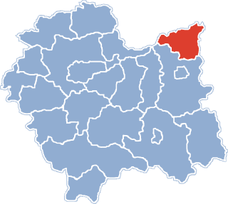
Pasieka-Kolonia is a village in the administrative district of Gmina Kraśnik, within Kraśnik County, Lublin Voivodeship, in eastern Poland.
Podjałówka is a village in the administrative district of Gmina Supraśl, within Białystok County, Podlaskie Voivodeship, in north-eastern Poland.
Dziewiczy Ług is a village in the administrative district of Gmina Szudziałowo, within Sokółka County, Podlaskie Voivodeship, in north-eastern Poland, close to the border with Belarus.

Tum is a village in the administrative district of Gmina Góra Świętej Małgorzaty, within Łęczyca County, Łódź Voivodeship, in central Poland. It lies approximately 3 kilometres (2 mi) east of Łęczyca and 35 km (22 mi) north-west of the regional capital Łódź. The village has an approximate population of 600.

Marchocice is a village in the administrative district of Gmina Racławice, within Miechów County, Lesser Poland Voivodeship, in southern Poland. It lies approximately 4 kilometres (2 mi) west of Racławice, 12 km (7 mi) east of Miechów, and 35 km (22 mi) north-east of the regional capital Kraków.

Kropidło is a village in the administrative district of Gmina Słaboszów, within Miechów County, Lesser Poland Voivodeship, in southern Poland. It lies approximately 4 kilometres (2 mi) south-west of Słaboszów, 15 km (9 mi) east of Miechów, and 40 km (25 mi) north-east of the regional capital Kraków.

Skokówka is a village in the administrative district of Gmina Zamość, within Zamość County, Lublin Voivodeship, in eastern Poland. It lies approximately 4 kilometres (2 mi) south-west of Zamość and 78 km (48 mi) south-east of the regional capital Lublin.

Kępa Lubawska is a village in the administrative district of Gmina Pacanów, within Busko County, Świętokrzyskie Voivodeship, in south-central Poland. It lies approximately 9 kilometres (6 mi) south of Pacanów, 29 km (18 mi) south-east of Busko-Zdrój, and 70 km (43 mi) south-east of the regional capital Kielce.

Jędrzejowice is a village in the administrative district of Gmina Bodzechów, within Ostrowiec County, Świętokrzyskie Voivodeship, in south-central Poland. It lies approximately 6 kilometres (4 mi) west of Ostrowiec Świętokrzyski and 50 km (31 mi) east of the regional capital Kielce.

Zagorzyce is a village in the administrative district of Gmina Bogoria, within Staszów County, Świętokrzyskie Voivodeship, in south-central Poland. It lies approximately 5 kilometres (3 mi) east of Bogoria, 16 km (10 mi) north-east of Staszów, and 56 km (35 mi) south-east of the regional capital Kielce.

Gałczyn is a village in the administrative district of Gmina Glinojeck, within Ciechanów County, Masovian Voivodeship, in east-central Poland. It lies approximately 5 kilometres (3 mi) south-west of Glinojeck, 29 km (18 mi) west of Ciechanów, and 83 km (52 mi) north-west of Warsaw.

Stara Trzcianka is a village in the administrative district of Gmina Grębków, within Węgrów County, Masovian Voivodeship, in east-central Poland. It lies approximately 4 kilometres (2 mi) south of Grębków, 20 km (12 mi) south of Węgrów, and 64 km (40 mi) east of Warsaw.
Sosnowice is a village in the administrative district of Gmina Zwoleń, within Zwoleń County, Masovian Voivodeship, in east-central Poland.
Bystrek is a settlement in the administrative district of Gmina Ceków-Kolonia, within Kalisz County, Greater Poland Voivodeship, in west-central Poland.
Stary Nakwasin is a village in the administrative district of Gmina Koźminek, within Kalisz County, Greater Poland Voivodeship, in west-central Poland.

Zawada is a village in the administrative district of Gmina Mstów, within Częstochowa County, Silesian Voivodeship, in southern Poland. It lies approximately 4 kilometres (2 mi) south-east of Mstów, 15 km (9 mi) east of Częstochowa, and 67 km (42 mi) north of the regional capital Katowice.

Starnice, German: Starnitz, is a village in the administrative district of Gmina Dębnica Kaszubska, within Słupsk County, Pomeranian Voivodeship, in northern Poland. It lies approximately 5 kilometres (3 mi) east of Dębnica Kaszubska, 16 km (10 mi) south-east of Słupsk, and 91 km (57 mi) west of the regional capital Gdańsk.

Bielkowo is a village in the administrative district of Gmina Kobylanka, within Stargard County, West Pomeranian Voivodeship, in north-western Poland. It lies approximately 3 kilometres (2 mi) south of Kobylanka, 12 km (7 mi) west of Stargardf, and 21 km (13 mi) south-east of the regional capital Szczecin.

Kocury is a village in the administrative district of Gmina Połczyn-Zdrój, within Świdwin County, West Pomeranian Voivodeship, in north-western Poland. It lies approximately 12 kilometres (7 mi) south-east of Połczyn-Zdrój, 33 km (21 mi) east of Świdwin, and 114 km (71 mi) east of the regional capital Szczecin.

Skorkov is a village and municipality in Mladá Boleslav District in the Central Bohemian Region of the Czech Republic. It is located 26 kilometres (16 mi) northeast of Prague.


