
Mallorca, or Majorca, is the largest island in the Balearic Islands, which are part of Spain and located in the Mediterranean.

Valldemossa is a village and municipality on the island of Majorca, part of the Spanish autonomous community of the Balearic Islands. It is famous for one landmark: the Royal Charterhouse of Valldemossa, built at the beginning of the 14th century, when the mystic and philosopher Ramon Llull lived in this area of Majorca.

Balearic is the collective name for the dialects of Catalan spoken in the Balearic Islands: mallorquí in Mallorca, eivissenc in Ibiza, and menorquí in Menorca.
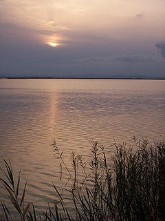
The Albufera, La Albufera or L'Albufera de València, is a freshwater lagoon and estuary on the Gulf of Valencia coast of the Valencian Community in eastern Spain. It is the main portion of the Parc Natural de l'Albufera de València, with a surface area of 21,120 hectares. The natural biodiversity of the nature reserve allows a great variety of flora and fauna to thrive and be observed year-round. Though once a saltwater lagoon, dilution due to irrigation and canals draining into the estuary and the sand bars increasing in size had converted it to freshwater by the seventeenth century.

Alcúdia (Catalan pronunciation: [əlˈkuðiə]) is a municipality and township of the Spanish autonomous community of the Balearic Islands. It is the main tourist centre in the North of Majorca on the eastern coast. It is a large resort popular with families. Most of the hotels are located in Port d'Alcúdia and Platja d'Alcúdia, along the 14 km (8.7 mi) long beach that stretches all the way to Ca'n Picafort. In Alcúdia, the old town is well preserved with houses dating back to the 13th century. The old town is surrounded by a medieval wall.

The Balearic Sea is a body of water in the Mediterranean Sea near the Balearic Islands. The Ebro River flows into this small sea.

Visit Mallorca Stadium is a football stadium located in Palma de Mallorca, Balearic Islands, Spain, and serves as the home ground of RCD Mallorca. It is the largest stadium in the Balearic Islands and the 26th largest in Spain. The stadium was renamed during the 2020 COVID-19 pandemic in a conjoined effort with Consell de Mallorca, and other public entities to reactivate tourist activities on the island, its main resource.

The Gymnesians, or Gymnesic Islands, is a collective name given to the two largest Balearic islands, Mallorca and Menorca, distinguishing them from the Pityuses, or Pine Islands, Ibiza and Formentera.
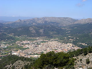
Andratx is a municipality on Mallorca, one of the Balearic Islands, along the Mediterranean east coast of Spain. It is located on the southwest tip of the island.
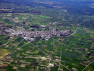
Santa Margalida is a municipality with a population of 10,204 located in the northeast of the Spanish Balearic Island Majorca.

Sant Lluís is a municipality on the tip of south-east Menorca in the Spanish Balearic Islands.
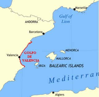
The Gulf of Valencia, is a gulf or inlet of the western Mediterranean Sea, on the eastern coast of Spain. Its limits are the Cap de la Nau headland in the south, while the northern limit is diffuse: for some it is the Cape of Vinaròs; and for others it is the Ebre Delta. When the Cape of Vinaròs is used the Gulf of Valencia's coast is entirely within the Valencian Community. When the Ebre Delta is used its northern coast is within southern Catalonia.

Colom Island is a small island of 143 acres (0.58 km2), located about 200 metres (656 ft) from the north-east coast of Menorca. In the past it was used as a pesthouse and later as farmland. It belonged to the Roca family from Mahón starting in 1904, when it was bought by Mr. Antonio Roca Várez. In 2018, United States billionaire Alex Meruelo purchased the island for 3.2 million Euros. There is a single 100 square meter home on the island. It is currently part of the Natural Park of the Albufera of Es Grau.

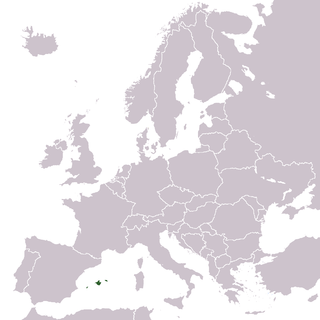
The Balearic Islands are a Spanish archipelago in the Balearic Sea, near the eastern coast of the Iberian Peninsula.

The Socialist Party of Majorca, officially PSM–Entesa after the incorporation of Entesa per Mallorca (ExM) in February 2013, is a political party in Majorca, Spain. The PSM defines itself as socialist, environmentalist, and Catalan nationalist, from a Majorcan point of view.

The Valldemossa Charterhouse is a palace in Valldemossa, Mallorca that was residence of the king Sancho of Majorca former royal residence and Royal Charterhouse.

S'illot is a small tourist town on the south east coast of the Balearic Island of Mallorca, Spain, divided between the council areas of Manacor and Sant Llorenç des Cardassar. The two districts are separated by the river Torrent de Ca n'Amer which is spanned by a large bridge in the town. A range of seaside leisure activities take place in the town. At the entrance to the town there is prehistoric settlement that is well preserved.
A Natural Area of Special Interest is a protected area within the Balearic Islands, Spain that is below the level of a natural park.
The Cabrera Archipelago Maritime-Terrestrial National Park is a national park that includes the whole of the Cabrera Archipelago in the Balearic Islands, an autonomous community that is part of Spain. The park is the largest in Spain, covering 908 square kilometres (351 sq mi) including 895 square kilometres (346 sq mi) of sea area. The park attracts relatively few visitors due to its remoteness. There is no permanent population, but there might be at any given time just under 100 National Park staff members and other personnel on the islands.

Fonts Ufanes is an intermittent spring located near the Sant Miquel hermitage, in Campanet municipality of the north of Majorca. The underground water flows from the mountains to Sant Miquel stream, which l'Albufera is the base level.


