Saint-Honoré-de-Témiscouata, Quebec

Last updated
Saint-Honoré-de-Témiscouata
Saint-Honore-de-Temiscouata.jpg
Saint-Honore-de-Temiscouata Quebec location diagram.png
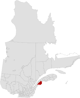
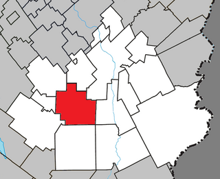
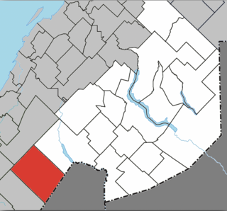
Location within Témiscouata RCM
Canada Eastern Quebec location map.png
Red pog.svg
Saint-Honoré-de-Témiscouata
Location in eastern Quebec
Coordinates: 47°42′N69°08′W / 47.700°N 69.133°W / 47.700; -69.133 Coordinates: 47°42′N69°08′W / 47.700°N 69.133°W / 47.700; -69.133 [1]
CountryFlag of Canada.svg  Canada
Province Flag of Quebec.svg  Quebec
Region Bas-Saint-Laurent
RCM Témiscouata
ConstitutedJanuary 1, 1881
Government
[2]
  MayorRichard Dubé
   Federal riding Rimouski-Neigette—
Témiscouata—Les Basques
   Prov. riding Rivière-du-Loup-Témiscouata
Area
  Total262.10 km2 (101.20 sq mi)
  Land264.63 km2 (102.17 sq mi)
 There is an apparent contradiction between two authoritative sources
Population
  Total780
  Density2.9/km2 (8/sq mi)
  Pop 2006-2011
Decrease2.svg 3.3%
  Dwellings
381
Time zone UTC−5 (EST)
  Summer (DST) UTC−4 (EDT)
Postal code(s)
Area code(s) 418 and 581
Highways
Quebec Autoroute 85.svgTrans-Canada Highway shield.svg A-85 (TCH)

Qc185.svgTrans-Canada Highway shield.svg Route 185 (TCH)
Qc291.svg Route 291
Website www.sainthonore
detemiscouata.ca

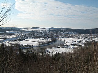
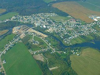
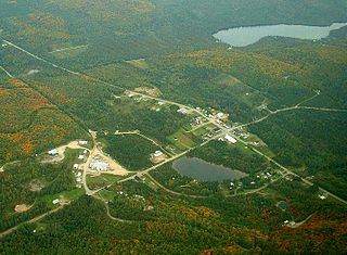
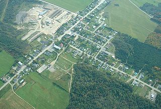
Saint-Honoré-de-Témiscouata (Canada 2011 Census population 780) is a municipality in the region of Bas-Saint-Laurent, Quebec, Canada.

Bas-Saint-Laurent Administrative region in Quebec, Canada

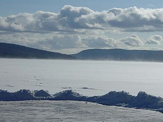
The Bas-Saint-Laurent, is an administrative region of Quebec located along the south shore of the lower Saint Lawrence River in Quebec. The river widens at this place, later becoming a bay which discharges into the Atlantic Ocean and is often nicknamed "Bas-du-Fleuve" (Lower-River). The region is formed by 8 regional county municipalities and 114 municipalities. In the south it borders Maine and New-Brunswick, as well as the regions of Chaudière-Appalaches and Gaspésie–Îles-de-la-Madeleine

Quebec Province of Canada

Quebec is one of the thirteen provinces and territories of Canada. It is bordered to the west by the province of Ontario and the bodies of water James Bay and Hudson Bay; to the north by Hudson Strait and Ungava Bay; to the east by the Gulf of Saint Lawrence and the province of Newfoundland and Labrador; and to the south by the province of New Brunswick and the U.S. states of Maine, New Hampshire, Vermont, and New York. It also shares maritime borders with Nunavut, Prince Edward Island, and Nova Scotia. Quebec is Canada's largest province by area and its second-largest administrative division; only the territory of Nunavut is larger. It is historically and politically considered to be part of Central Canada.

Contents

See also

Related Research Articles

Saint-Louis-du-Ha! Ha! Parish municipality in Quebec, Canada

Saint-Louis-du-Ha! Ha! is a parish municipality in the Témiscouata Regional County Municipality in Quebec, near the south shore of the Saint Lawrence River in Canada. It is located southeast of Rivière-du-Loup and west of Cabano along the Trans-Canada Highway, about halfway to Edmundston in New Brunswick. The population of Saint-Louis-du-Ha! Ha! is 1,318. Its economy is mainly agricultural.

Beauce-Sartigan Regional County Municipality Regional county municipality in Quebec, Canada

Beauce-Sartigan is a regional county municipality in the Chaudière-Appalaches region of Quebec, Canada. The county seat is Saint-Georges.

Témiscouata Regional County Municipality Regional county municipality in Quebec, Canada

Témiscouata is a regional county municipality in the Bas-Saint-Laurent region of Quebec, Canada. It is located southeast of Rivière-du-Loup, bordering New Brunswick, and is centred on Lake Témiscouata. Its seat is Témiscouata-sur-le-Lac.

Rimouski-Neigette—Témiscouata—Les Basques Federal electoral district

Rimouski-Neigette—Témiscouata—Les Basques is a federal electoral district in Quebec, Canada, that has been represented in the House of Commons of Canada since 2004.

Dégelis City in Quebec, Canada

Dégelis is a city in Témiscouata Regional County Municipality within the Bas-Saint-Laurent region of Quebec. Its population in the Canada 2011 Census was 3,051. The Madawaska River flows from Lake Témiscouata, through Degelis, to join the Saint John River at 32 kilometres (20 mi) to the East at Edmundston, New Brunswick.

Pohénégamook City in Quebec, Canada

Pohénégamook, Quebec is a Canadian town on the Canada–United States border in Quebec's Témiscouata Regional County Municipality.

Quebec Route 291 highway in Quebec

Route 291 is 55 km two-lane north/south highway in Quebec, Canada, which starts in Rivière-du-Loup at the junction of Route 132 just east of Autoroute 20 and ends in Saint-Honoré-de-Témiscouata at the junction of Route 185.

Saint-Honoré refers to various places named after Honoratus of Amiens :

Packington, Quebec Parish municipality in Quebec, Canada

Packington is a parish municipality in the Canadian province of Quebec, located in the Témiscouata Regional County Municipality in the Bas-Saint-Laurent region.

Saint-Michel-du-Squatec, Quebec Municipality in Quebec, Canada

Saint-Michel-du-Squatec is a municipality in the Canadian province of Quebec, located in the Témiscouata Regional County Municipality.

Saint-Marc-du-Lac-Long Parish municipality in Quebec, Canada

Saint-Marc-du-Lac-Long is a parish municipality in the Canadian province of Quebec, located in the Témiscouata Regional County Municipality.

Saint-Juste-du-Lac, Quebec Municipality in Quebec, Canada

Saint-Juste-du-Lac is a municipality in the province of Quebec, Canada, located within the Témiscouata Regional County Municipality in the Bas-Saint-Laurent region. As of the Canada 2011 Census, the municipality had a population of 585.

Saint-Pierre-de-Lamy, Quebec Municipality in Quebec, Canada

Saint-Pierre-de-Lamy is a municipality in the Canadian province of Quebec, located in Témiscouata Regional County Municipality. The municipality had a population of 112 in the Canada 2011 Census.

Auclair, Quebec Municipality in Quebec, Canada

Auclair is a municipality in the Canadian province of Quebec, located in the Témiscouata Regional County Municipality. The municipality had a population of 444 as of the Canada 2011 Census.

Biencourt, Quebec Municipality in Quebec, Canada

Biencourt is a municipality in the Canadian province of Quebec, and located in the Témiscouata Regional County Municipality. The municipality had a population of 506 in the Canada 2011 Census.

Saint-Honoré-de-Shenley, Quebec Municipality in Quebec, Canada

Saint-Honoré-de-Shenley is a municipality in the Beauce-Sartigan Regional County Municipality in the Chaudière-Appalaches region of Quebec, Canada. Its population is 1,610 as of 2011.

Saint-Jean-de-la-Lande, Quebec Municipality in Quebec, Canada

Saint-Jean-de-la-Lande is a municipality in Témiscouata Regional County Municipality in the Bas-Saint-Laurent region of Quebec, Canada.

Rivière-Bleue, Quebec Municipality in Quebec, Canada

Rivière-Bleue is a municipality in Quebec with more or less 1500 inhabitants. The municipality is located in the Bas-Saint-Laurent region on the border of the province of New-Brunswick and Canada–United States border with Maine.

Saint-Elzéar-de-Témiscouata, Quebec Municipality in Quebec, Canada

Saint-Elzéar-de-Témiscouata is a municipality in the Témiscouata Regional County Municipality in the Bas-Saint-Laurent region of Quebec, Canada.

Saint-Athanase, Quebec Municipality in Quebec, Canada

Saint-Athanase is a municipality in Témiscouata Regional County Municipality in the Bas-Saint-Laurent region of Quebec, Canada, located on the Canada–United States border.

References

  1. Reference number 335979 of the Commission de toponymie du Québec (in French)
  2. 1 2 Geographic code 13090 in the official Répertoire des municipalités (in French)
  3. 1 2 "(Code 2413090) Census Profile". 2011 census . Statistics Canada. 2012.

Commons-logo.svg Media related to Saint-Honoré-de-Témiscouata at Wikimedia Commons