Saint-Pierre-de-Lamy | |
---|---|
Municipality | |
Location within Témiscouata RCM | |
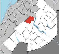
Coordinates: 47°47′N69°00′W / 47.783°N 69.000°W Coordinates: 47°47′N69°00′W / 47.783°N 69.000°W [1] | |
Country | |
Province | |
Region | Bas-Saint-Laurent |
RCM | Témiscouata |
Constituted | June 4, 1977 |
Government [2] | |
• Mayor | Gaston Caron |
• Federal riding | Rimouski-Neigette— Témiscouata—Les Basques |
• Prov. riding | Rivière-du-Loup-Témiscouata |
Area [2] [3] | |
• Total | 114.10 km2 (44.05 sq mi) |
• Land | 111.12 km2 (42.90 sq mi) |
Population (2011) [3] | |
• Total | 112 |
• Density | 1.0/km2 (3/sq mi) |
• Pop 2006-2011 | |
• Dwellings | 88 |
Time zone | EST (UTC−5) |
• Summer (DST) | EDT (UTC−4) |
Postal code(s) | G0L 4B0 |
Area code(s) | 418 and 581 |
Highways |
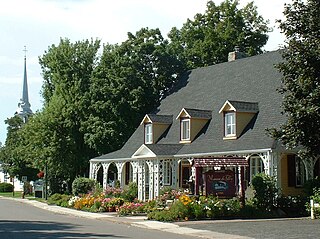
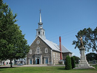
Saint-Pierre-de-Lamy is a municipality in the Canadian province of Quebec, located in Témiscouata Regional County Municipality. The municipality had a population of 112 in the Canada 2011 Census.
The provinces and territories of Canada are the sub-national governments within the geographical areas of Canada under the authority of the Canadian Constitution. In the 1867 Canadian Confederation, three provinces of British North America—New Brunswick, Nova Scotia, and the Province of Canada —were united to form a federated colony, becoming a sovereign nation in the next century. Over its history, Canada's international borders have changed several times, and the country has grown from the original four provinces to the current ten provinces and three territories. Together, the provinces and territories make up the world's second-largest country by area.
Quebec is one of the thirteen provinces and territories of Canada. It is bordered to the west by the province of Ontario and the bodies of water James Bay and Hudson Bay; to the north by Hudson Strait and Ungava Bay; to the east by the Gulf of Saint Lawrence and the province of Newfoundland and Labrador; and to the south by the province of New Brunswick and the U.S. states of Maine, New Hampshire, Vermont, and New York. It also shares maritime borders with Nunavut, Prince Edward Island, and Nova Scotia. Quebec is Canada's largest province by area and its second-largest administrative division; only the territory of Nunavut is larger. It is historically and politically considered to be part of Central Canada.
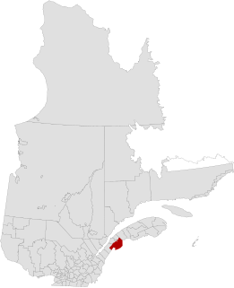
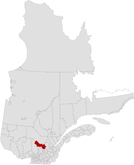
Témiscouata is a regional county municipality in the Bas-Saint-Laurent region of Quebec, Canada. It is located southeast of Rivière-du-Loup, bordering New Brunswick, and is centred on Lake Témiscouata. Its seat is Témiscouata-sur-le-Lac.
Arthabaska Regional County Municipality is a regional county municipality located in the Centre-du-Québec region of Quebec. Its seat is Victoriaville.
Pierre-De Saurel is a regional county municipality in the Montérégie region in southwestern Quebec, Canada. Originally named Le Bas-Richelieu Regional County Municipality, the name change to Pierre-De Saurel took effect on January 1, 2009. Its seat is in Sorel-Tracy. It is located on the Richelieu River, downstream from La Vallée-du-Richelieu Regional County Municipality at the confluence of the Richelieu and Saint Lawrence River.
Mékinac is a regional county municipality (MRC) in the administrative region of Mauricie, in the province of Quebec, Canada. Its seat is Saint-Tite. It is composed of 10 municipalities and 4 unorganized territories.
Minganie is a regional county municipality in the Côte-Nord region of Quebec, Canada. It includes Anticosti Island. Its seat is Havre-Saint-Pierre.
Saint-Constant is a city in southwestern Quebec, Canada. It is located on the south shore of Montreal in the Roussillon Regional County Municipality of the Montérégie region. The population as of the Canada 2016 Census was 27,359.
L'Assomption is an off-island suburb of Montreal, in southwestern Quebec, Canada on the L'Assomption River. It is the seat of the Regional County Municipality of L'Assomption. It is located on the outer fringes of the Montreal urban area.
Pohénégamook, Quebec is a Canadian town on the Canada–United States border in Quebec's Témiscouata Regional County Municipality.
Saint-Odilon-de-Cranbourne is a parish municipality in Robert-Cliche Regional County Municipality the Chaudière-Appalaches region of Quebec, Canada. Its population is 1,459 as of the Canada 2011 Census. The parish's name honours Reverend Pierre-François-Xavier-Odilon-Marie-Alphonse Paradis, first priest of Saint-Odilon-de-Cranbourne, while "Cranbourne" comes from Cranborne, a village in East Dorset, England.
Dosquet is a municipality in Lotbinière Regional County Municipality in the Chaudière-Appalaches region of Quebec, Canada. Its population was 887 as of the Canada 2011 Census.
Saint-Antoine-de-Tilly is a municipality in the Municipalité régionale de comté de Lotbinière in Quebec, Canada. It is part of the Chaudière-Appalaches region and the population is 1,462 as of 2009.
Saint-Pierre-les-Becquets is a municipality in the Centre-du-Québec region of the province of Quebec in Canada.
Saint-Pierre is a village municipality in Joliette Regional County Municipality in the Lanaudière region of Quebec, Canada.
Saint-Philippe-de-Néri is a parish municipality in the Canadian province of Quebec, located in the Kamouraska Regional County Municipality.
Massueville is a village municipality in Pierre-De Saurel Regional County Municipality, Quebec, Canada. The population as of the Canada 2011 Census was 516.
Saint-Lambert-de-Lauzon is a municipality in La Nouvelle-Beauce Regional County Municipality in Quebec, Canada. It is part of the Chaudière-Appalaches region and the population is 6,177 as of the Canada 2011 Census. Prior to June 22, 2013 it was a parish municipality.
Sainte-Marie is a city in the province of Quebec. It is the seat of the Municipalité régionale de la Nouvelle-Beauce, in Chaudière-Appalaches. The population was 12,889 as of the Canada 2011 Census, and was 99.0% French-speaking as of 2006. It is located 59 kilometres (37 mi) south-east of Quebec City, on the Chaudière River.
Saint-Sulpice is a municipality in the Lanaudière region of Quebec, Canada, part of the L'Assomption Regional County Municipality. It is located on the north shore of the Saint Lawrence River and includes most of Verchères Islands.
Saint-Pierre-de-l'Île-d'Orléans is a municipality in the Capitale-Nationale region of Quebec, Canada, part of the L'Île-d'Orléans Regional County Municipality. It is situated on the west side of Orléans Island, and accessible by Quebec Route 368 and the Île d'Orléans Bridge which connects Saint-Pierre with the Beauport borough of Quebec City. Until 1997, it was known simply as Saint-Pierre.
Mont-Saint-Pierre is a village municipality in Quebec, Canada, located in the regional county municipality of La Haute-Gaspésie in the administrative region of Gaspésie–Îles-de-la-Madeleine.
Saint-Pierre-de-la-Rivière-du-Sud is a parish municipality in Quebec.
This Bas-Saint-Laurent location article is a stub. You can help Wikipedia by expanding it. |