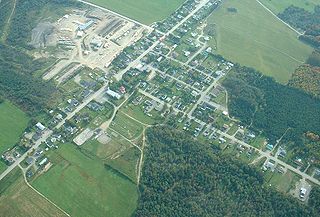
| Saint-Elzéar-de-Témiscouata | |
|---|---|
| Municipality | |
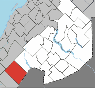
 Location within Témiscouata RCM | |
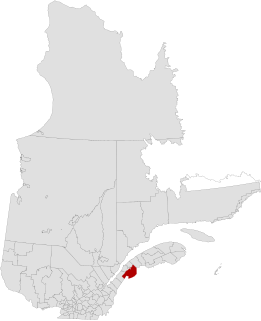
 Saint-Elzéar-de-Témiscouata Location in eastern Quebec | |
| Coordinates: 47°35′N69°06′W / 47.583°N 69.100°W Coordinates: 47°35′N69°06′W / 47.583°N 69.100°W [1] | |
| Country | |
| Province | |
| Region | Bas-Saint-Laurent |
| RCM | Témiscouata |
| Constituted | November 19, 1938 |
| Government [2] | |
| • Mayor | Réjean Deschênes |
| • Federal riding | Rimouski-Neigette— Témiscouata—Les Basques |
| • Prov. riding | Rivière-du-Loup-Témiscouata |
| Area [2] [3] | |
| • Total | 150.70 km2 (58.19 sq mi) |
| • Land | 150.50 km2 (58.11 sq mi) |
| Population (2011) [3] | |
| • Total | 343 |
| • Density | 2.3/km2 (6/sq mi) |
| • Pop 2006-2011 | |
| • Dwellings | 155 |
| Time zone | EST (UTC−5) |
| • Summer (DST) | EDT (UTC−4) |
| Postal code(s) | G0L 2W0 |
| Area code(s) | 418 and 581 |
| Highways | No major routes |
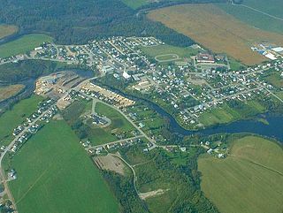
Saint-Elzéar-de-Témiscouata is a municipality in the Témiscouata Regional County Municipality in the Bas-Saint-Laurent region of Quebec, Canada. [2]
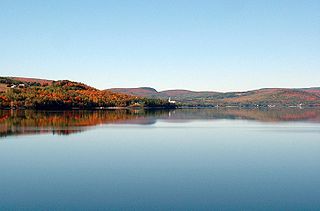
Témiscouata is a regional county municipality in the Bas-Saint-Laurent region of Quebec, Canada. It is located southeast of Rivière-du-Loup, bordering New Brunswick, and is centred on Lake Témiscouata. Its seat is Témiscouata-sur-le-Lac.

The Bas-Saint-Laurent, is an administrative region of Quebec located along the south shore of the lower Saint Lawrence River in Quebec. The river widens at this place, later becoming a bay which discharges into the Atlantic Ocean and is often nicknamed "Bas-du-Fleuve" (Lower-River). The region is formed by 8 regional county municipalities and 114 municipalities. In the south it borders Maine and New-Brunswick, as well as the regions of Chaudière-Appalaches and Gaspésie–Îles-de-la-Madeleine

Quebec is one of the thirteen provinces and territories of Canada. It is bordered to the west by the province of Ontario and the bodies of water James Bay and Hudson Bay; to the north by Hudson Strait and Ungava Bay; to the east by the Gulf of Saint Lawrence and the province of Newfoundland and Labrador; and to the south by the province of New Brunswick and the U.S. states of Maine, New Hampshire, Vermont, and New York. It also shares maritime borders with Nunavut, Prince Edward Island, and Nova Scotia. Quebec is Canada's largest province by area and its second-largest administrative division; only the territory of Nunavut is larger. It is historically and politically considered to be part of Central Canada.
Prior to January 19, 2002, it was known simply as Saint-Elzéar. [4]