Rivière-Bleue, Quebec

Last updated
Rivière-Bleue
Municipality
Riviere-Bleue-gare.jpg
Riviere-Bleue Quebec location diagram.png
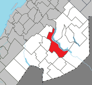
Location within Témiscouata RCM
Canada Eastern Quebec location map.png
Red pog.svg
Rivière-Bleue
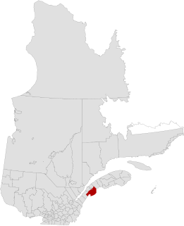
Location in eastern Quebec
Coordinates: 47°26′N69°03′W / 47.433°N 69.050°W / 47.433; -69.050 Coordinates: 47°26′N69°03′W / 47.433°N 69.050°W / 47.433; -69.050 [1]
CountryFlag of Canada.svg  Canada
Province Flag of Quebec.svg  Quebec
Region Bas-Saint-Laurent
RCM Témiscouata
Constituted June 14, 1975
Government [2]
  Mayor Claude H. Pelletier
   Federal riding Rimouski-Neigette—
Témiscouata—Les Basques
   Prov. riding Rivière-du-Loup-Témiscouata
Area [2] [3]
  Total 180.30 km2 (69.61 sq mi)
  Land 174.07 km2 (67.21 sq mi)
Population (2011) [3]
  Total 1,299
  Density 7.5/km2 (19/sq mi)
  Pop 2006-2011Decrease2.svg 7.7%
  Dwellings 766
Time zone EST (UTC−5)
  Summer (DST) EDT (UTC−4)
Postal code(s) G0L 2B0
Area code(s) 418 and 581
HighwaysQc289.svg Route 289
Website www.riviere-bleue.ca

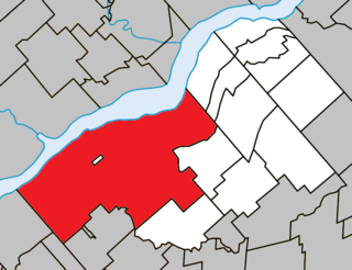
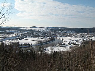
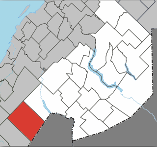
Rivière-Bleue is a municipality in Quebec with more or less 1500 inhabitants. The municipality is located in the Bas-Saint-Laurent region on the border of the province of New-Brunswick and Canada–United States border with Maine.
Quebec Province of Canada

Quebec is one of the thirteen provinces and territories of Canada. It is bordered to the west by the province of Ontario and the bodies of water James Bay and Hudson Bay; to the north by Hudson Strait and Ungava Bay; to the east by the Gulf of Saint Lawrence and the province of Newfoundland and Labrador; and to the south by the province of New Brunswick and the U.S. states of Maine, New Hampshire, Vermont, and New York. It also shares maritime borders with Nunavut, Prince Edward Island, and Nova Scotia. Quebec is Canada's largest province by area and its second-largest administrative division; only the territory of Nunavut is larger. It is historically and politically considered to be part of Central Canada.

Canada–United States border international border between Canada and the USA

The Canada–United States border, officially known as the International Boundary, is the longest international border in the world between two countries. It is shared between Canada and the United States, the second- and fourth-largest countries by area, respectively. The terrestrial boundary is 8,891 kilometres (5,525 mi) long, of which 2,475 kilometres (1,538 mi) is Canada's border with Alaska. Eight Canadian provinces and territories, and thirteen U.S. states are located along the border.
Maine State of the United States of America

Maine is a state in the New England region of the northeastern United States. Maine is the 12th smallest by area, the 9th least populous, and the 38th most densely populated of the 50 U.S. states. It is bordered by New Hampshire to the west, the Atlantic Ocean to the southeast, and the Canadian provinces of New Brunswick and Quebec to the northeast and northwest respectively. Maine is the easternmost state in the contiguous United States, and the northernmost state east of the Great Lakes. It is known for its jagged, rocky coastline; low, rolling mountains; heavily forested interior; and picturesque waterways, as well as its seafood cuisine, especially lobster and clams. There is a humid continental climate throughout most of the state, including in coastal areas such as its most populous city of Portland. The capital is Augusta.

Contents

History

The first settlers arrived in 1860. They were in fact pioneers from Scottish descents coming from the United-States and others from Saint-François-de-Madawaska, New-Brunswick. The catholic mission was founded in 1874 under the name of Saint-Joseph-de-la-Rivière-Bleue and the postal office opened in 1910. The catholic parish was erected and the parish municipality created officially in 1914 under the name of the mission. In 1920, the village municipality is created under the same name. The parish municipality and the village municipality are merged in 1975 under the name of Rivière-Bleue.

The National Transcontinental Railway and the station were crucial to the village’s development: travellers, goods, and forestry and agricultural products came and went by rail. In 1913, the first station was built in Tarte, along a sidetrack named in honour of Israël Tarte, journalist, politician and Minister of Transportation under Wilfrid Laurier. The name Tarte Siding is still in use. On January 4, 1914, the first train stopped at the station, on its way from Edmundston, New-Brunswick. In 1915, the building was carried a mile down the tracks, to Rivière-Bleue. There, the station was expanded to house the family of Arthur Aubut, the first station master to live in Rivière-Bleue. Until the end of World War II, the railway was the only way to travel outside the village in the winter, and the telegraph, which was then a railway monopoly, was the fastest means of communication.

The National Transcontinental Railway (NTR) was a historic railway between Winnipeg and Moncton in Canada. Much of the line is now operated by the Canadian National Railway.

See also

Témiscouata Regional County Municipality Regional county municipality in Quebec, Canada

Témiscouata is a regional county municipality in the Bas-Saint-Laurent region of Quebec, Canada. It is located southeast of Rivière-du-Loup, bordering New Brunswick, and is centred on Lake Témiscouata. Its seat is Témiscouata-sur-le-Lac.

The Crocs River is a tributary of the Saint John River, in Quebec and New Brunswick, in Canada. The Crocs River flows in the southern part of the Gaspé Peninsula, across the following areas:

The Beau Lake is a freshwater lake in the north–south axis through the Saint Francis River. The lake is the center of the boundary between:

Related Research Articles

Saint-Louis-du-Ha! Ha! Parish municipality in Quebec, Canada

Saint-Louis-du-Ha! Ha! is a parish municipality in the Témiscouata Regional County Municipality in Quebec, near the south shore of the Saint Lawrence River in Canada. It is located southeast of Rivière-du-Loup and west of Cabano along the Trans-Canada Highway, about halfway to Edmundston in New Brunswick. The population of Saint-Louis-du-Ha! Ha! is 1,318. Its economy is mainly agricultural.

Bécancour, Quebec City in Quebec, Canada

Bécancour is a city in the Centre-du-Québec region of Québec, Canada; it is the seat of the Bécancour Regional County Municipality. It is located on the south shore of the Saint Lawrence River at the confluence of the Bécancour River, opposite Trois-Rivières.

Dégelis City in Quebec, Canada

Dégelis is a city in Témiscouata Regional County Municipality within the Bas-Saint-Laurent region of Quebec. Its population in the Canada 2011 Census was 3,051. The Madawaska River flows from Lake Témiscouata, through Degelis, to join the Saint John River at 32 kilometres (20 mi) to the East at Edmundston, New Brunswick.

Pohénégamook City in Quebec, Canada

Pohénégamook, Quebec is a Canadian town on the Canada–United States border in Quebec's Témiscouata Regional County Municipality.

Saint Francis River (Canada–United States)

The St. Francis River is a river roughly 75 miles (120 km) long, which forms part of the Canada–United States border. The river rises in a lake of the same name located 12 miles (20 km) east of the Rivière du Loup in Quebec. The portion that forms the boundary starts at the bottom of Lake Pohenegamook at the very northernmost point of New England between Estcourt Station, Maine, and Estcourt, Quebec. The river along the international boundary flows south and then south-east through two deep, narrow lakes to its mouth on the Saint John River at St. Francis, Maine/Saint-François-de-Madawaska, New Brunswick.

Hérouxville Parish municipality in Quebec, Canada

Hérouxville is a parish municipality in the Mékinac Regional County Municipality in the administrative region of Mauricie, in the province of Quebec, Canada. Its watershed is mainly part of the Batiscanie.

Lake Pohenegamook lake in Canada

Lake Pohenegamook is a Canadian lake located in Temiscouata Regional County Municipality (MRC), in administrative region of Bas-Saint-Laurent, in southeastern Quebec immediately north of the International Boundary with Maine at Aroostook County. It is the source of the Saint Francis River.

Sainte-Geneviève-de-Batiscan Parish municipality in Quebec, Canada

Sainte-Geneviève-de-Batiscan is a parish municipality in the Mauricie region of the province of Quebec in Canada. This municipality is part of the Les Chenaux Regional County Municipality in Batiscanie and in the administrative region of Mauricie. It is located along the Batiscan River.

Montcalm Simard was a Canadian politician in the Province of Quebec.

Packington, Quebec Parish municipality in Quebec, Canada

Packington is a parish municipality in the Canadian province of Quebec, located in the Témiscouata Regional County Municipality in the Bas-Saint-Laurent region.

Saint-Marc-du-Lac-Long Parish municipality in Quebec, Canada

Saint-Marc-du-Lac-Long is a parish municipality in the Canadian province of Quebec, located in the Témiscouata Regional County Municipality.

The Southwest Branch Saint John River is a 62.0-mile-long (99.8 km) river in Maine and Quebec. The branch originates in "Little Saint John Lake" on the international boundary between Saint-Zacharie, Quebec and Seboomook Lake Township 5, Range 20, WELS. The branch forms the Canada–United States border as it flows northeasterly to a confluence with the Little Southwest Branch Saint John River in Seboomook Lake Township 9, Range 18, WELS. The Southwest Branch flows briefly into Quebec and then through Maine to its confluence with the Baker Branch Saint John River in Seboomook Lake Township 9, Range 17, WELS. The Southwest Branch finally joins with the Northwest Branch to form the Saint John River.

Saint-Jean-de-la-Lande, Quebec Municipality in Quebec, Canada

Saint-Jean-de-la-Lande is a municipality in Témiscouata Regional County Municipality in the Bas-Saint-Laurent region of Quebec, Canada.

Saint-Athanase, Quebec Municipality in Quebec, Canada

Saint-Athanase is a municipality in Témiscouata Regional County Municipality in the Bas-Saint-Laurent region of Quebec, Canada, located on the Canada–United States border.

Témiscouata-sur-le-Lac City in Quebec, Canada

Témiscouata-sur-le-Lac is a municipality in Quebec, Canada, situated in the MRC of Témiscouata in the Bas-Saint-Laurent region. The city was created on May 5, 2010 from the mergers of the city of Cabano and Notre-Dame-du-Lac. The new city was called Cabano–Notre-Dame-du-Lac until November 13, 2010.

Branche à Jerry creek in Quebec and New Brunswick

The Branche à Jerry is a tributary of the Baker River, flowing in Canada in:

The Boucanée River is a tributary of the lake Pohenegamook, flowing in the southern part of the Gaspé Peninsula, in the municipalities of Saint-Athanase, Quebec and Pohenegamook, Quebec, in Témiscouata Regional County Municipality (RCM), in the administrative region of Bas-Saint-Laurent, in Quebec, in Canada.

References