Saint-Louis, Quebec

Last updated
Saint-Louis
Saint-Louis Quebec location diagram.PNG
Location within Les Maskoutains RCM.
Canada Southern Quebec location map.png
Red pog.svg
Saint-Louis
Location in southern Quebec.
Coordinates: 45°51′N72°59′W / 45.850°N 72.983°W / 45.850; -72.983 Coordinates: 45°51′N72°59′W / 45.850°N 72.983°W / 45.850; -72.983 [1]
CountryFlag of Canada (Pantone).svg  Canada
Province Flag of Quebec.svg  Quebec
Region Montérégie
RCM Les Maskoutains
ConstitutedAugust 29, 1881
Government
  MayorDoris Gosselin
   Federal riding Saint-Hyacinthe—Bagot
   Prov. riding Richelieu
Area
  Total48.40 km2 (18.69 sq mi)
  Land47.07 km2 (18.17 sq mi)
Population
 (2011) [4]
  Total775
  Density16.5/km2 (43/sq mi)
  Pop 2006-2011
Increase2.svg 6.7%
  Dwellings
369
Time zone UTC−5 (EST)
  Summer (DST) UTC−4 (EDT)
Postal code(s)
Area code(s) 450 and 579
HighwaysQc235.svg Route 235
Website mun-st-louis.qc.ca

Saint-Louis is a municipality in southwestern Quebec, Canada in the Regional County Municipality of Les Maskoutains. The population as of the Canada 2011 Census was 775.

Contents

Demographics

Population

Canada census – Saint-Louis community profile
2021 2011
Population740 (+3.9% from 2016)775 (+6.7% from 2006)
Land area47.21 km2 (18.23 sq mi)47.07 km2 (18.17 sq mi)
Population density15.7/km2 (41/sq mi)16.5/km2 (43/sq mi)
Median age45.2 (M: 44.4, F: 45.6)43.7 (M: 43.8, F: 43.6)
Total private dwellings330369
Median household income$50,303
References: 2021 [5] 2011 [4] earlier [6] [7]
Historical Census Data - Saint-Louis, Quebec [8]
YearPop.±%
1991 711    
1996 715+0.6%
YearPop.±%
2001 758+6.0%
2006 726−4.2%
YearPop.±%
2011 775+6.7%

Language

Canada Census Mother Tongue - Saint-Louis, Quebec [8]
CensusTotal
French
English
French & English
Other
YearResponsesCountTrendPop %CountTrendPop %CountTrendPop %CountTrendPop %
2011
775
755Increase2.svg 7.9%97.42%5Decrease2.svg 50.0%0.64%5Decrease2.svg 50.0%0.64%10Steady2.svg 0.0%1.29%
2006
730
700Decrease2.svg 7.9%95.89%10Increase2.svg n/a%1.37%10Increase2.svg n/a%1.37%10Increase2.svg n/a%1.37%
2001
760
760Increase2.svg 6.3%100.00%0Steady2.svg 0.0%0.00%0Steady2.svg 0.0%0.00%0Steady2.svg 0.0%0.00%
1996
715
715n/a100.00%0n/a0.00%0n/a0.00%0n/a0.00%

See also

Related Research Articles

Lac-Saint-Jean-Est Regional County Municipality Regional county municipality in Quebec, Canada

Lac-Saint-Jean-Est is a regional county municipality in the Saguenay–Lac-Saint-Jean region of Quebec, Canada. The seat is Alma. In 2016, 99.3% reported that they spoke French most often at home, according to the census.

La Vallée-du-Richelieu Regional County Municipality Regional county municipality in Quebec, Canada

La Vallée-du-Richelieu(The Valley of the Richelieu) is a regional county municipality in the Montérégie region in southwestern Quebec, Canada. Its seat is McMasterville.

Le Val-Saint-François Regional County Municipality Regional county municipality in Quebec, Canada

Le Val-Saint-François is a regional county municipality in the Estrie region of Quebec, Canada. The seat is Richmond.

Saint-Télesphore, Quebec Municipality in Quebec, Canada

Saint-Télesphore is a municipality located in Vaudreuil-Soulanges Regional County Municipality, Quebec (Canada). The population as of the 2021 Canadian census was 754. The municipality is situated west of Saint-Polycarpe, south of Sainte-Justine-de-Newton, north of Rivière-Baudette and east of the provincial border near North Lancaster, Ontario.

Beauharnois, Quebec City in Quebec, Canada

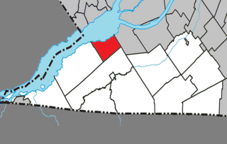
Beauharnois is a city located in the Beauharnois-Salaberry Regional County Municipality of southwestern Quebec, Canada, and is part of the Greater Montreal Area. The city's population as of the Canada 2011 Census was 12,011. It is home to the Beauharnois Hydroelectric Power Station, as well as the Beauharnois Lock of the Saint Lawrence Seaway.

Saint-Noël, Quebec Village municipality in Quebec, Canada

Saint-Noël is a village municipality in the Canadian province of Quebec, located in La Matapédia Regional County Municipality.

Pointe-des-Cascades, Quebec Village municipality in Quebec, Canada

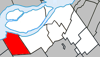
Pointe-des-Cascades is a village municipality in Vaudreuil-Soulanges Regional County Municipality in the Montérégie region of Quebec, Canada. It is located on a spit of land where the St. Lawrence River flows into Lake Saint-Louis. The river has here a significant drop, forming several cascades which give the village its name.

Saint-Mathieu, Quebec Municipality in Quebec, Canada

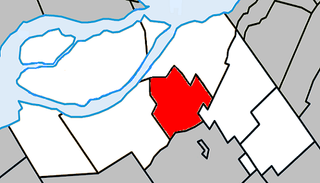
Saint-Mathieu is a municipality situated in the Montérégie administrative region in Quebec, Canada. The population as of the Canada 2016 Census was 2,156. It is part of the Roussillon Regional County Municipality.

Sainte-Barbe, Quebec Municipality in Quebec, Canada

Sainte-Barbe is a municipality of Quebec, located within Le Haut-Saint-Laurent Regional County Municipality in the Montérégie administrative region. The population as of the Canada 2021 Census was 1,609.

Saint-Stanislas-de-Kostka, Quebec Municipality in Quebec, Canada

Saint-Stanislas-de-Kostka is a municipality of Quebec, Canada, located within the Beauharnois-Salaberry Regional County Municipality in the Montérégie administrative region. The population as of the Canada 2021 Census was 1,852.

Saint-Louis-de-Gonzague, Montérégie, Quebec Parish municipality in Quebec, Canada

Saint-Louis-de-Gonzague is a parish municipality in the Beauharnois-Salaberry Regional County Municipality in the Montérégie region of Quebec, Canada. The population as of the Canada 2021 Census was 1,950.

Saint-Étienne-de-Beauharnois, Quebec Municipality in Quebec, Canada

Saint-Étienne-de-Beauharnois is a municipality of Quebec, Canada, located within the Beauharnois-Salaberry Regional County Municipality in the Montérégie administrative region. The population as of the Canada 2021 Census was 1,099.

Saint-Sébastien, Montérégie, Quebec Municipality in Quebec, Canada

Saint-Sébastien is a municipality in Le Haut-Richelieu Regional County Municipality in the Montérégie region of Quebec, Canada. The population as of the Canada 2021 Census was 692.

Saint-Damase, Montérégie, Quebec Municipality in Quebec, Canada

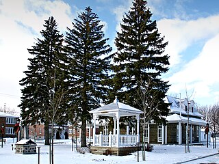
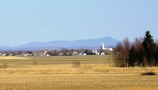
Saint-Damase is a municipality located in Les Maskoutains Regional County Municipality in the Montérégie region of Quebec. The population as of the Canada 2011 Census was 2,506. The municipality was created on October 5, 2001, by the merger of the Parish and the Village of Saint-Damase.

Saint-Bernard-de-Michaudville Municipality in Quebec, Canada

Saint-Bernard-de-Michaudville is a municipality in southwestern Quebec, Canada in the Regional County Municipality of Les Maskoutains. The population as of the Canada 2021 Census was 616. The community was officially renamed from the Parish of Saint-Bernard-Partie-Sud to the Municipality of Saint-Bernard-de-Michaudville on July 19, 1997.

Mont-Saint-Pierre, Quebec Village municipality in Quebec, Canada

Mont-Saint-Pierre is a village municipality in Quebec, Canada, located in the regional county municipality of La Haute-Gaspésie in the administrative region of Gaspésie–Îles-de-la-Madeleine.

Saint-Maxime-du-Mont-Louis, Quebec Municipality in Quebec, Canada

Saint-Maxime-du-Mont-Louis is a municipality in Quebec, Canada. Located in the administrative region of Gaspésie–Îles-de-la-Madeleine and the regional county municipality of La Haute-Gaspésie, the municipality comprises the communities of Mont-Louis, Ruisseau-des-Olives, L'Anse-Pleureuse, Les Côtes-du-Portage and Gros-Morne.

Saint-Zénon-du-Lac-Humqui Parish municipality in Quebec, Canada

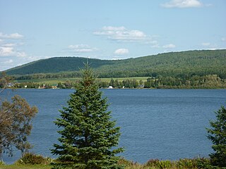
Saint-Zénon-du-Lac-Humqui is a parish municipality in Quebec, Canada.

Saint-Alexandre-des-Lacs Parish municipality in Quebec, Canada

Saint-Alexandre-des-Lacs is a parish municipality in Quebec, Canada.

Saint-Damase, Bas-Saint-Laurent, Quebec Parish municipality in Quebec, Canada

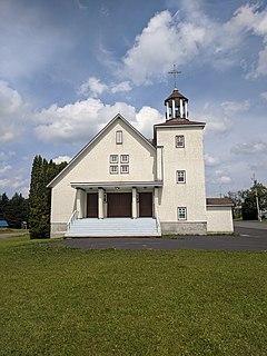
Saint-Damase is a parish municipality in Quebec, Canada.

References

  1. Reference number 402098 of the Commission de toponymie du Québec (in French)
  2. 1 2 Ministère des Affaires municipales, des Régions et de l'Occupation du territoire: Saint-Louis
  3. Parliament of Canada Federal Riding History: SAINT-HYACINTHE--BAGOT (Quebec)
  4. 1 2 3 "2011 Community Profiles". 2011 Canadian Census . Statistics Canada. March 21, 2019. Retrieved 2014-03-22.
  5. "2021 Community Profiles". 2021 Canadian Census . Statistics Canada. February 4, 2022. Retrieved 2022-04-27.
  6. "2006 Community Profiles". 2006 Canadian Census . Statistics Canada. August 20, 2019.
  7. "2001 Community Profiles". 2001 Canadian Census . Statistics Canada. July 18, 2021.
  8. 1 2 Statistics Canada: 1996, 2001, 2006, 2011 census