Saint-Simon, Québec

Last updated

Saint-Simon
Saint-Simon 11.jpg
Route 224 and the church.
Armoirie Saint-Simon.png
Saint-Simon (Monteregie) Quebec location diagram.PNG
Location within Les Maskoutains RCM
Canada Southern Quebec location map.png
Red pog.svg
Saint-Simon
Location in southern Quebec
Coordinates: 45°44′N72°52′W / 45.733°N 72.867°W / 45.733; -72.867 [1]
CountryFlag of Canada (Pantone).svg  Canada
Province Flag of Quebec.svg  Quebec
Region Montérégie
RCM Les Maskoutains
ConstitutedJuly 1, 1855
Government
  MayorNormand Corbeil
   Federal riding Saint-Hyacinthe—Bagot
   Prov. riding Saint-Hyacinthe
Area
  Total69.90 km2 (26.99 sq mi)
  Land69.07 km2 (26.67 sq mi)
Population
 (2016) [5]
  Total1,413
  Density20.5/km2 (53/sq mi)
  Pop 2011-2016
Increase2.svg 14.8%
  Dwellings
546
Time zone UTC−5 (EST)
  Summer (DST) UTC−4 (EDT)
Postal code(s)
Area code(s) 450 and 579
Highways
Quebec Autoroute 20.svgTrans-Canada Highway shield.svg A-20 (TCH)

Qc116.svg R-116
Qc211.svg R-211
Qc224.svg R-224
Website www.saint-simon.ca

Saint-Simon is a municipality in southwestern Quebec, Canada on the Yamaska River in Les Maskoutains Regional County Municipality. The population as of the Canada 2016 Census was 1,413.

Contents

Demographics

Population

Canada census – Saint-Simon community profile
2021 2016 2011
Population1,386 (-1.9% from 2016)1,413 (+14.8% from 2011)1,231 (+0.2% from 2006)
Land area69.05 km2 (26.66 sq mi)69.07 km2 (26.67 sq mi)68.99 km2 (26.64 sq mi)
Population density20.1/km2 (52/sq mi)20.5/km2 (53/sq mi)17.8/km2 (46/sq mi)
Median age38.8 (M: 39.2, F: 38)36.6 (M: 37.2, F: 36.0)38.7 (M: 38.6, F: 38.8)
Private dwellings540 (total) 546 (total) 489 (total) 
Median household income$69,163$57,023
References: 2021 [6] 2016 [7] 2011 [8] earlier [9] [10]
Historical Census Data - Saint-Simon, Montérégie, Quebec [11]
YearPop.±%
1991 1,203    
1996 1,168−2.9%
2001 1,118−4.3%
2006 1,228+9.8%
2011 1,231+0.2%
2016 1,413+14.8%

Language

Canada Census Mother Tongue - Saint-Simon, Montérégie, Quebec [11]
CensusTotal
French
English
French & English
Other
YearResponsesCountTrendPop %CountTrendPop %CountTrendPop %CountTrendPop %
2016
1,390
1,365Increase2.svg 13.3%98.2%5Decrease2.svg 50.0%0.4%0Steady2.svg 0.0%0.0%15Increase2.svg 50.0%1.1%
2011
1,225
1,205Increase2.svg 2.1%98.37%10Increase2.svg n/a%0.82%0Steady2.svg 0.0%0.00%10Decrease2.svg 66.7%0.82%
2006
1,210
1,180Increase2.svg 7.3%97.52%0Decrease2.svg 100.0%0.00%0Steady2.svg 0.0%0.00%30Increase2.svg 100.0%2.48%
2001
1,125
1,100Increase2.svg 1.4%97.78%10Increase2.svg n/a%0.89%0Steady2.svg 0.0%0.00%15Decrease2.svg 80.0%1.33%
1996
1,160
1,085n/a93.53%0n/a0.00%0n/a0.00%75n/a6.47%

Communities

See also

Related Research Articles

<span class="mw-page-title-main">Melbourne, Quebec</span> Township municipality in Quebec, Canada

Melbourne is a township municipality located in Le Val-Saint-François Regional County Municipality in the Estrie region of Quebec, Canada.

<span class="mw-page-title-main">Acton Vale, Quebec</span> City in Quebec, Canada

Acton Vale is an industrial town in southcentral Quebec, Canada. It is the seat of the Acton Regional County Municipality and is in the Montérégie administrative region. Its population in the Canada 2021 Census was 7,605. The town covers an area of 90.96 km2.

<span class="mw-page-title-main">Saint-Liboire</span> Municipality in Quebec, Canada

Saint-Liboire is a municipality in the municipalité régionale de comté des Maskoutains in Québec, Canada, located in the administrative region of Montérégie. The population as of the 2011 Canadian Census was 3,051.

<span class="mw-page-title-main">Saint-Henri, Chaudière-Appalaches, Quebec</span> Municipality in Quebec, Canada

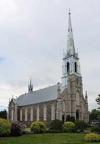
Saint-Henri is a municipality of 5,611 people, 20 km south of Lévis, in the Bellechasse Regional County Municipality. It is sometimes known as Saint-Henri-de-Lévis, and was historically known as Saint-Henri-de-Lauzon.

<span class="mw-page-title-main">Princeville, Quebec</span> City in Quebec, Canada

Princeville is a city in the Canadian province of Quebec, located in L'Érable Regional County Municipality in the Centre-du-Québec region.

<span class="mw-page-title-main">Sainte-Christine-d'Auvergne, Quebec</span> Municipality in Quebec, Canada

Sainte-Christine-d'Auvergne is a small village in the Portneuf Regional County in the province of Quebec, Canada. It is located on the south shore of the Sainte-Anne River on Route 354, between St-Casimir and St-Raymond.

<span class="mw-page-title-main">Napierville</span> Municipality in Quebec, Canada

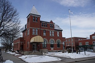
Napierville is a municipality in the Jardins de Napierville Regional County Municipality in Quebec, Canada, situated in the Montérégie administrative region. The population as of the 2021 Canadian Census was 4,020. It is the location of the seat of the Jardins de Napierville Regional County Municipality. It is surrounded by the municipality of Saint-Cyprien-de-Napierville.

<span class="mw-page-title-main">Saint-Michel, Quebec</span> Municipality in Quebec, Canada

Saint-Michel is a municipality in the Jardins de Napierville Regional County Municipality in Quebec, Canada, situated in the Montérégie administrative region. The population as of the Canada 2021 Census was 3,521.

<span class="mw-page-title-main">Saint-Alexis-des-Monts, Quebec</span> Parish municipality in Quebec, Canada

Saint-Alexis-des-Monts is a parish municipality in the Mauricie region of the province of Quebec in Canada.

<span class="mw-page-title-main">Saint-Adelme, Quebec</span> Parish municipality in Quebec, Canada

Saint-Adelme is a parish municipality in the Canadian province of Quebec, located in La Matanie Regional County Municipality in the Bas-Saint-Laurent region.

<span class="mw-page-title-main">Hope, Quebec</span> Township municipality in Quebec, Canada

Hope is a township municipality in the Canadian province of Quebec, located within the Bonaventure Regional County Municipality. Its population was 568 in the Canada 2016 Census.

<span class="mw-page-title-main">Saint-Godefroi, Quebec</span> Township municipality in Quebec, Canada

Saint-Godefroi is a township municipality in the Canadian province of Quebec, located within the Bonaventure Regional County Municipality. The township had a population of 380 in the Canada 2016 Census.

<span class="mw-page-title-main">Saint-Blaise-sur-Richelieu, Quebec</span> Municipality in Quebec, Canada

Saint-Blaise-sur-Richelieu is a municipality in the Canadian province of Quebec. The population as of the Canada 2016 Census was 2,066. The town was founded in 1892.

<span class="mw-page-title-main">Saint-Amable</span> City in Quebec, Canada

Saint-Amable is a town 38.1 km (23.7 mi) east of Montreal in southwestern Quebec, Canada, within the Marguerite-D'Youville Regional County Municipality. The population as of the 2016 Canadian Census was 12,167.

<span class="mw-page-title-main">Saint-Émile-de-Suffolk, Quebec</span> Municipality in Quebec, Canada

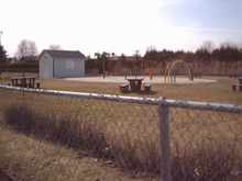
Saint-Émile-de-Suffolk is a municipality in the Outaouais region of Quebec, Canada, part of the Papineau Regional County Municipality. Until 1994 it was known as United Township Municipality of Suffolk-et-Addington.

<span class="mw-page-title-main">Saint-Mathieu, Quebec</span> Municipality in Quebec, Canada

Saint-Mathieu is a municipality situated in the Montérégie administrative region in Quebec, Canada. The population as of the Canada 2016 Census was 2,156. It is part of the Roussillon Regional County Municipality.

<span class="mw-page-title-main">Saint-Sébastien, Montérégie, Quebec</span> Municipality in Quebec, Canada

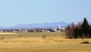
Saint-Sébastien is a municipality in Le Haut-Richelieu Regional County Municipality in the Montérégie region of Quebec, Canada. The population as of the Canada 2021 Census was 692.

<span class="mw-page-title-main">Saint-Marcel-de-Richelieu</span> Municipality in Quebec, Canada

Saint-Marcel-de-Richelieu is a municipality in southwestern Quebec, Canada in the Regional County Municipality of Les Maskoutains. The population as of the Canada 2021 Census was 507.

<span class="mw-page-title-main">Saint-Bernard-de-Michaudville</span> Municipality in Quebec, Canada

Saint-Bernard-de-Michaudville is a municipality in southwestern Quebec, Canada in the Regional County Municipality of Les Maskoutains. The population as of the Canada 2021 Census was 616. The community was officially renamed from the Parish of Saint-Bernard-Partie-Sud to the Municipality of Saint-Bernard-de-Michaudville on July 19, 1997.

<span class="mw-page-title-main">Saint-Alphonse, Gaspésie–Îles-de-la-Madeleine, Quebec</span> Municipality in Quebec, Canada

Saint-Alphonse is a municipality in Quebec, Canada.

References

  1. "Reference number 402073 in Banque de noms de lieux du Québec". toponymie.gouv.qc.ca (in French). Commission de toponymie du Québec.
  2. 1 2 Ministère des Affaires municipales, des Régions et de l'Occupation du territoire: Saint-Simon (Montérégie)
  3. Parliament of Canada Federal Riding History: SAINT-HYACINTHE--BAGOT (Quebec)
  4. "Census Profile, 2016 Census - Saint-Simon, Municipalité [Census subdivision], Quebec and Saint-Raymond [Population centre], Quebec". 8 February 2017.
  5. "Census Profile, 2016 Census - Saint-Simon, Municipalité [Census subdivision], Quebec and Saint-Raymond [Population centre], Quebec". 8 February 2017.
  6. "2021 Community Profiles". 2021 Canadian Census . Statistics Canada. February 4, 2022. Retrieved 2022-04-27.
  7. "2016 Community Profiles". 2016 Canadian Census . Statistics Canada. August 12, 2021. Retrieved 2022-05-22.
  8. "2011 Community Profiles". 2011 Canadian Census . Statistics Canada. March 21, 2019. Retrieved 2014-03-22.
  9. "2006 Community Profiles". 2006 Canadian Census . Statistics Canada. August 20, 2019.
  10. "2001 Community Profiles". 2001 Canadian Census . Statistics Canada. July 18, 2021.
  11. 1 2 Statistics Canada: 1996, 2001, 2006, 2011, 2016 census