Saint-Simon, New Brunswick

Last updated

Saint-Simon
Settlement
Vue de Saint-Simon-detail.jpg
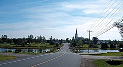
Entrance to Saint-Simon
Canada New Brunswick location map 2.svg
Red pog.svg
Location of Saint-Simon in New Brunswick
Coordinates: 47°46′38″N64°53′21″W / 47.7773°N 64.8892°W / 47.7773; -64.8892
Country Canada
Province New Brunswick
County Gloucester
Population
 (2011)
  Total
724
  Density40/km2 (100/sq mi)
Time zone UTC-4 (AST)
  Summer (DST) UTC-3 (ADT)

Saint-Simon or St. Simon is a settlement in Gloucester County, New Brunswick, Canada. It is located in the Acadian Peninsula.

Contents

Saint-Simon is primarily a francophone community.

The former local service district of St. Simon included Saint-Simon and several nearby communities.

Demographics

In the 2021 Census of Population conducted by Statistics Canada, St. Simon had a population of 648 living in 307 of its 333 total private dwellings, a change of

Education

Since the closure of the École Lorette-Doiron, French-speaking students benefit from schools in Caraquet. The town of Shippagan is home to the CCNB-Péninsule acadienne campus of the Université de Moncton.

English-speaking people have a school in Brantville which welcomes students from kindergarten to eighth grade. They must then continue their studies in Miramichi. The closest English higher education institutions are in Fredericton, the provincial capital, or Miramichi.

There is a public library in Caraquet. However, the Bookmobile North makes a stop in the village. [2] [3]

See also

References

  1. "Population and dwelling counts: Canada and designated places". Statistics Canada. February 9, 2022. Retrieved January 2, 2025.
  2. New Brunswick Public Library Service. "Bookmobile schedule by stop" . Retrieved 29 October 2014.
  3. "Education and Early Childhood Development". 4 August 2011. Archived from the original on 19 May 2012. Retrieved 29 October 2014.

47°46′37″N64°53′20″W / 47.777°N 64.889°W / 47.777; -64.889