Saint Helena has a known history of over 500 years since its recorded discovery by the Portuguese in 1502. Claiming to be Britain's second oldest colony, after Bermuda, this is one of the most remote settlements in the world and was for several centuries of vital strategic importance to ships sailing to Europe from Asia and South Africa. Since the early 19th century, the British occasionally used the island as a place of exile, most notably for Napoleon Bonaparte, Dinuzulu kaCetshwayo and over 5,000 Boer prisoners.

The Danish West Indies or Danish Antilles or Danish Virgin Islands were a Danish colony in the Caribbean, consisting of the islands of Saint Thomas with 32 square miles (83 km2); Saint John with 19 square miles (49 km2); and Saint Croix with 84 square miles (220 km2). The islands have belonged to the United States since they were purchased in 1917. Water Island was part of the Danish West Indies until 1905, when the Danish state sold it to the East Asiatic Company, a private shipping company.
Jamaica Plain is a neighborhood of 4.4 square miles (11 km2) in Boston, Massachusetts. Settled by Puritans seeking farmland to the south, it was originally part of Roxbury, Massachusetts. The community seceded from Roxbury during the formation of West Roxbury in 1851 and became part of Boston when West Roxbury was annexed in 1874. In the 19th century, Jamaica Plain became one of the first streetcar suburbs in America and home to a significant portion of Boston's Emerald Necklace of parks, designed by Frederick Law Olmsted.

Saint Thomas, , is one of the Virgin Islands in the Caribbean Sea, and a constituent district of the United States Virgin Islands (USVI), an unincorporated territory of the United States. Along with surrounding minor islands, it is one of three county-equivalents in the USVI. Together with Saint John, it forms one of the districts of the USVI. The territorial capital and port of Charlotte Amalie is located on the island. As of the 2020 census, the population of Saint Thomas was 42,261, about 48.5% of the total population of the United States Virgin Islands. The island has a land area of 32 square miles (83 km2).

Spanish Town is the capital and the largest town in the parish of St. Catherine in the historic county of Middlesex, Jamaica. It was the Spanish and British capital of Jamaica from 1534 until 1872. The town is home to numerous memorials, the national archives, and one of the oldest Anglican churches outside England.
The parishes of Jamaica are the main units of local government in Jamaica. They were created following the English Invasion of Jamaica in 1655. This administrative structure for the Colony of Jamaica developed slowly. However, since 1 May 1867, Jamaica has been divided into the current fourteen parishes. These were retained after independence in 1962. They are grouped into three historic counties, which no longer have any administrative relevance. Every parish has a coast; none are landlocked.

A chapel of ease is a church building other than the parish church, built within the bounds of a parish for the attendance of those who cannot reach the parish church conveniently, generally due to distance away.

The Morant Bay Rebellion began with a protest march to the courthouse by hundreds of people led by preacher Paul Bogle in Morant Bay, Jamaica. Some were armed with sticks and stones. After seven men were shot and killed by the volunteer militia, the protesters attacked and burned the courthouse and nearby buildings. Twenty-five people died. Over the next two days, poor freedmen rose in rebellion across most of St. Thomas-in-the-East parish.

Saint John is one of the Virgin Islands in the Caribbean Sea and a constituent district of the United States Virgin Islands (USVI), an unincorporated territory of the United States.

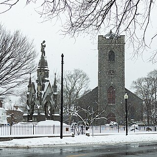
Saint Thomas, once known as Saint Thomas in the East, is a suburban parish situated at the south eastern end of Jamaica, within the county of Surrey. It is the birthplace of Paul Bogle, designated in 1969 as one of Jamaica's seven National Heroes. Morant Bay, its chief town and capital, is the site of the Morant Bay Rebellion in 1865, of which Bogle was a leader.

Saint Catherine is a parish in the south east of Jamaica. It is located in the county of Middlesex, and is one of the island's largest and most economically valued parishes because of its many resources. It includes the first capital of Jamaica, Spanish Town, originally known as San Jago de la Vega or Santiago de la Vega.

Holsworthy is a market town and civil parish in the Torridge district of Devon, England, 36 miles (58 km) west of Exeter. The River Deer, a tributary of the River Tamar, forms the western boundary of the parish, which includes the village of Brandis Corner. According to the 2011 census the population of Holsworthy was 2,641; it was estimated at 3,287 in 2019.

St. James is a suburban parish, located on the north-west end of the island of Jamaica in the county of Cornwall. Its capital is Montego Bay. Montego Bay was officially named the second city of Jamaica, behind Kingston, in 1981, although Montego Bay became a city in 1980 through an act of the Jamaican Parliament. The parish is the birthplace of the Right Excellent Samuel Sharpe, one of Jamaica's seven National Heroes.

St Peter is one of the twelve parishes of Jersey in the Channel Islands. It is around 6.5 kilometres (4.0 mi) north-west of St Helier. The parish has a population of 5,003. It has a surface area of 10.6 square kilometres (4.1 sq mi).

Saint Andrew is a parish, situated in the southeast of Jamaica in the county of Surrey. It lies north, west and east of Kingston, and stretches into the Blue Mountains. As of the 2011 census, it had a population of 573,369, the highest of any of the parishes in Jamaica.
Colonel Sir Thomas Modyford, 1st Baronet was a planter of Barbados and Governor of Jamaica from 1664 to 1671.

Sir John Peter Grant, GCMG, KCB,, was a British colonial administrator who served as Lieutenant-Governor of Bengal (1859–1862) and as Governor of Jamaica.

Saint John Parish was one of the historic parishes of Jamaica created following colonisation of the island by the British. It was in the centre of the island in Middlesex County but was abolished in 1866 when it was merged into Saint Catherine Parish.
Saint Thomas in the Vale Parish was one of the historic parishes of Jamaica created following colonisation of the island by the British. It was in the centre of the island in Middlesex County but was abolished in 1866 when it was merged into Saint Catherine Parish.
