Manchester Parish

Last updated

Manchester
Manchesta
Manchester in Jamaica.svg
Manchester in Jamaica
Country Jamaica
County Middlesex
Capital Mandeville
Major towns Christiana
Porus
Williamsfield
Area
  Total830 km2 (320 sq mi)
  Rank6th
Population
 (2012) [1]
  Total190,812
  Density230/km2 (600/sq mi)

The Parish of Manchester is a parish located in west-central Jamaica, in the county of Middlesex. Its capital, Mandeville, is a major business centre. Its St. Paul of the Cross Pro-Cathedral is the episcopal see of the Latin Catholic Diocese of Mandeville.

Contents

History

Taino/Arawak settlement in the parish was substantiated when in 1792, a surveyor found three carvings, believed to be Amerindian Zemi, in a cave in the Carpenter's Mountains. [2] They are now at the British Museum.

Park Crescent, Mandeville (2012) Park Crescent, Mandeville.jpg
Park Crescent, Mandeville (2012)

Manchester was formed in 1814, by an Act of the House of Assembly, making it one of the newest parishes of Jamaica. It was formed as a result of the amalgamation of portions of the parishes St. Elizabeth, Clarendon and the entirety of Vere. The amalgamation was done in response to a petition from the inhabitants of Mile Gully, May Pen and Carpenters Mountain who complained that they were too far away from an administrative centre. Manchester was named in honour of William Montagu, 5th Duke of Manchester, the then Governor of Jamaica. He was governor for 19 years, setting the record as the longest-serving governor of the island. The capital town, Mandeville, established in 1816, was named after his eldest son, Lord Mandeville.

No sugar estates can be found in the parish; slaves worked on coffee plantations. After emancipation, the ex-slaves became independent coffee farmers. The irish potato was first introduced to Jamaica at Bethany, a town in the parish. Citrus also became an important crop, as in 1920, the citrus fruit ortanique, a cross between the orange and tangerine, was developed by Charles Jackson.

Many of Jamaica's businesses were started in Mandeville; the Mandeville Hotel, one of the oldest in the Caribbean, began operations in 1875. The first "Free Library" in Jamaica was established in 1938, and is the oldest Parish Library.

MegaMart, Mandeville under construction in December 2012. MegaMart, Mandeville.jpg
MegaMart, Mandeville under construction in December 2012.

The growth of the town was given a substantial stimulus when Alcan Bauxite Company opened operations there. It built houses for its then mostly expatriate staff. The relatively high wages lured many educated Jamaicans there. Mandeville continues to grow rapidly due to it being considered one of the most attractive towns in Jamaica and the cleanest of them all.[ citation needed ]

Mandeville boasts no fewer than 14 shopping centres, two hospitals (one public and one private), medical centres and many doctors. Next to Kingston, it provides the best medical services in the island, a major asset for tourism development.

Population

The population of Manchester is 190,812. [1] Mandeville, the capital and chief town of the parish, has a Mayor, Donovan Mitchell and a deputy mayor, Rohan Kennedy It has a population of over 30,485.

Geography

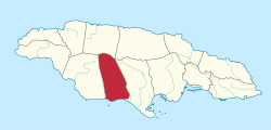
Mandeville, the parish capital is located at latitude 17°51'N, longitude 77°38'W. Manchester is bordered by St. Elizabeth in the west, Clarendon in the east and by Trelawny in the north. Manchester covers an area of 830 km2, making it Jamaica's sixth-largest parish. It has three mountain ranges the Carpenters Mountains, the May Day Mountains, and the Don Figuerero Mountains. The highest point is 2,770 feet (840 m) above sea level in the Carpenters Mountains. Manchester is divided into four political districts (constituencies): North-West, North-East, Central and Southern Manchester.[ citation needed ]

Mile Gully Mountain (2010) Mile Gully Mountain, Manchester.jpg
Mile Gully Mountain (2010)

Over 90% of the parish's surface is limestone so there is an abundance of cockpits, sinkholes, caves and underground passages. Gourie Cave, near Christiana, is the longest of the over 100 caves in the parish, as well as the longest known cave in Jamaica (3505m). [3] Smokey Hole Cave, in Cross Keys, is the deepest known cave on the island (194m). [4] Oxford Cave, near Auchtembeddie, in the NW part of the parish, is another of the major speleological sites found in Manchester, and was once noted as a roosting site for the now possibly extinct bat species Phyllonycteris aphylla . [5] Manchester also has large bauxite deposits, with parts of the parish having been strip-mined as a result, notably in William's Field, Hope, and Blue Mountain.

The parish offers a variety of climate, vegetation and scenery. The capital, Mandeville, is situated at an elevation of 626 m (2,054 ft). The town is noted for its climate, and temperatures range from a low of 12.7 °C (55 °F) in December and January, to a high of 33 °C (91 °F) in July and August. There are very few rivers in the parish, and the existing ones are rather small; Alligator Hole River, Alligator Pond River, Gut River, Hector's River, Two Rivers, and Swift River. Hector's River runs along the border of Manchester and Trelawny, sinks at Troy where it flows underground for approximately six kilometers and rises below Oxford Cave as One Eye River. Despite this, water supply is generally scarce; the southern districts often suffer drought.

Commerce

There is no large-scale cultivation of crops as the area is generally mountainous. Crops such as sugar cane require large tracts of flat land. Bananas, coffee and pimento, annatto, ginger are grown, and the parish is noted for its citrus; oranges, ortaniques and grapefruit, much of which are exported. Christiana, 28 km (17 mi) north of Mandeville, is the second largest town of the parish. The Christiana Land Authority assists agricultural development in the region. Irish potato is grown considerably in the Christiana area and it is the centre of a large banana and ginger-growing district.

Windalco, Alumina plant in the background (Kirkvine, Manchester) Windalco, Alumina plant.jpg
Windalco, Alumina plant in the background (Kirkvine, Manchester)

Manchester is a centre of the bauxite mining industry. The first bauxite mining companies were Alcan and Alpart. Alcan, a large world-renowned Canadian company, had a strong presence in the town and was one of the main employers. It lured many Jamaicans because of high salaries and the benefits offered. Alpart, short for Aluminum Partners of Jamaica, was initially formed as a joint venture of Kaiser Aluminum, Reynolds Aluminum, and Anaconda. It is still in operation in Nain St Elizabeth parish; however, it is now jointly owned by UC Rusal of Russia and Hydro Aluminum of Norway.

The parish created the Manchester Local Sustainable Development Plan in 2007 to improve the community over the next 20 years.

Television

Special attractions

Captain Alexander Woodburn Heron's tomb at the top of Shooter's Hill, now called "Heron Hill" by the locals. [6]

Roxborough Estate is the birthplace of Jamaican National Hero and its first premier, Norman Washington Manley.

Education

High schools

Secondary high


Technical high


Private high


Universities

There are several notable tertiary institutions, the Northern Caribbean University (NCU), a Seventh-day Adventist institution, formerly called West Indies College, the Church Teacher's College, Mandeville, The Catholic College, Knox Community College, Cobbla and Mandeville Campuses. There are also other religious-based institutions located in the parish: Regent College of the Caribbean (the former Jamaica Bible College) as well as Bethel Bible College.

Notable people

Related Research Articles

<span class="mw-page-title-main">Economy of Jamaica</span> National economy

The economy of Jamaica is heavily reliant on services, accounting for 70% of the country's GDP. Jamaica has natural resources and a climate conducive to agriculture and tourism. The discovery of bauxite in the 1940s and the subsequent establishment of the bauxite-alumina industry shifted Jamaica's economy from sugar, and bananas.

<span class="mw-page-title-main">Saint Ann Parish</span> Parish of Jamaica

Saint Ann is the largest parish in Jamaica. It is situated on the north coast of the island, in the county of Middlesex, roughly halfway between the eastern and western ends of the island. It is often called "the Garden Parish of Jamaica" on account of its natural floral beauty. Its capital is Saint Ann's Bay. Saint Ann comprises New Seville, the first Spanish settlement in Jamaica.

<span class="mw-page-title-main">Ocho Rios</span> Town in Middlesex, Jamaica

Ocho Rios is a town in the parish of Saint Ann on the north coast of Jamaica, and is more widely referred to as Ochi by locals. Beginning as a sleepy fishing village, Ocho Rios has seen explosive growth in the last decade to become a popular tourist destination featuring duty-free shopping, a cruise-ship terminal, world-renowned tourist attractions and several beaches and acclaimed resorts. In addition to being a port of call for cruise ships, Ocho Rios also hosts cargo ships at the Reynolds Pier for the exportation of sugar, limestone, and in the past, bauxite. The estimated population of the town in 2011 was 16,671, which is nearly 10% of the total population of St. Ann. The town is served by both Sangster International Airport and Ian Fleming International Airport. Scuba diving and other water sports are offered in the town's vicinity.

<span class="mw-page-title-main">Saint Catherine Parish</span> Parish of Jamaica

Saint Catherine is a parish in the south east of Jamaica. It is located in the county of Middlesex, and is one of the island's largest and most economically valued parishes because of its many resources. It includes the first capital of Jamaica, Spanish Town, originally known as San Jago de la Vega or Santiago de la Vega.

<span class="mw-page-title-main">Saint Mary Parish, Jamaica</span> Parish of Jamaica

Saint Mary is a parish located in the northeast section of Jamaica. With a population of 114,227 it is one of Jamaica's smallest parishes, located in the county of Middlesex. Its chief town and capital is Port Maria, located on the coast. It is also the birthplace of established dancehall reggae artists, such as Capleton, Lady Saw, Ninjaman, Sizzla, and Tanya Stephens. Other notable residents of St. Mary parish include bestselling author Colin Simpson, who is the great-great grandson of noted slavery abolitionist James Phillippo, famed Jamaican writer and community activist Erna Brodber, and acclaimed music producer Chris Blackwell who is credited with "discovering" Bob Marley.

<span class="mw-page-title-main">Saint Elizabeth Parish</span> Parish of Jamaica

Saint Elizabeth, one of Jamaica's largest parishes, is located in the southwest of the island, in the county of Cornwall. Its capital, Black River, is located at the mouth of the Black River, the widest on the island.

<span class="mw-page-title-main">Clarendon Parish, Jamaica</span> Parish of Jamaica

Clarendon is a parish in Jamaica. It is located on the south of the island, roughly halfway between the island's eastern and western ends. Located in the county of Middlesex, it is bordered by Manchester on the west, Saint Catherine in the east, and in the north by Saint Ann. Its capital and largest town is May Pen.

<span class="mw-page-title-main">Portland Parish</span> Parish of Jamaica

Portland, with its capital town Port Antonio, is a parish located on Jamaica's northeast coast. It is situated to the north of St Thomas and to the east of St Mary in Surrey County. It is one of the rural areas of Jamaica, containing part of the Blue Mountains, where the Jamaican Maroon communities of Moore Town and Charles Town are located.

<span class="mw-page-title-main">Trelawny Parish</span> Parish of Jamaica

Trelawny is a parish in the county of Cornwall in northwest Jamaica. Its capital is Falmouth. It is bordered by the parishes of Saint Ann in the east, Saint James in the west, and Saint Elizabeth and Manchester in the south. Trelawny is known for producing several Olympic sprinters.

<span class="mw-page-title-main">May Pen</span> Town in Middlesex, Jamaica

May Pen is the capital and largest town in the parish of Clarendon in Middlesex County, Jamaica. It is located on the Rio Minho river, and is a major market centre for the parish. The population was 61,548 at the 2011 census increasing from 59,550 in 2001, including the surrounding suburbs of Sandy Bay, Mineral Heights, Hazard, Palmers Cross, Denbigh, Race Track, and Four Paths among others. The town has a mayor.

<span class="mw-page-title-main">Mandeville, Jamaica</span> City in Middlesex, Jamaica

Mandeville is the capital and largest town in the parish of Manchester in the county of Middlesex, Jamaica. In 2005, the town had an estimated population of 50,000, and including the immediate suburbs within a radius of 16 km (9.9 mi) the total population was about 72,000. It is located on an inland plateau at an altitude of 628 m (2061 feet), and is 103 km (64 mi) west of Kingston. It is the only parish capital of Jamaica not located on the coast or on a major river.

Linstead is a town in the parish of St. Catherine, Jamaica in the West Indies. In 1991 its population was 14,144. It is located 12 mi/19 km NNW of Spanish Town.

<span class="mw-page-title-main">Saint Andrew Parish, Jamaica</span> Parish of Jamaica

Saint Andrew is a parish, situated in the southeast of Jamaica in the county of Surrey. It lies north, west and east of Kingston, and stretches into the Blue Mountains. As of the 2011 census, it had a population of 573,369, the highest of any of the parishes in Jamaica.

<span class="mw-page-title-main">Discovery Bay, Jamaica</span>

Discovery Bay is a town in Saint Ann Parish on the northern coast of Jamaica. The city is also known locally as Dry Harbour, and gives its name to the Dry Harbour Mountains in St. Ann. There is a dispute as to whether Christopher Columbus first landed in Discovery Bay or Sevilla la Nueva in 1494. Near to the city are Puerto Seco Beach and several historic sites, such as the Green Grotto Caves and Columbus Park. Visitors to the Green Grotto Caves can see relics of the native Taíno Arawak lifestyle there. It is said that many Spaniards escaped the English invasion of 1655 through secret passages in the caves with the help of Arawaks and African slaves, in exchange for the slaves' freedom.

<span class="mw-page-title-main">Northern Caribbean University</span> University in Jamaica

Northern Caribbean University (NCU) is a private, liberal-arts institution owned and operated by the Jamaica Union Conference (JAMU) and the Atlantic Caribbean Union Mission (ACUM) of Seventh-day Adventists, and is located in Jamaica. With its main campus only 2 miles south of Mandeville town, in Manchester, and three other campuses situated in Kingston, Montego Bay and Salem Runaway Bay, St. Ann, the university offers a number of professional, pre-professional and vocational programmes in a spiritually wholesome and aesthetically pleasing atmosphere. Established in 1907, NCU currently enjoys an average yearly enrollment of over five thousand students, from up to 35 countries.

The Jamaican Caves Organisation (JCO) is an all-volunteer caving organisation devoted to the preservation, exploration and documentation of caves in Jamaica. It is currently the only non-profit group in Jamaica dedicated to education, research and advocacy about caves.

<span class="mw-page-title-main">Rail transport in Jamaica</span>

The Railways of Jamaica, constructed from 1845, were the second British Colony after Canada's Champlain and St Lawrence Railroad of 1836 to receive a railway system. Construction started only twenty years after the Stockton & Darlington Railway commenced operations in the United Kingdom.

<span class="mw-page-title-main">Manchester High School, Jamaica</span> Secondary school in Mandeville, Jamaica

Manchester High School is a coeducational secondary school located at 4 Perth Road in the town of Mandeville, Jamaica.

References

  1. 1 2 "Population by Parish". Statistical Institute of Jamaica. Retrieved 16 September 2015.
  2. British Museum Collection
  3. Gourie Cave - JCO Report
  4. Smokey Hole Cave - JCO Report
  5. Oxford Cave - JCO Report
  6. "Captain Herons Tomb". Archived from the original on 11 February 2017. Retrieved 16 March 2013.

18°03′N77°32′W / 18.050°N 77.533°W / 18.050; -77.533