Floyd County is a county located in the U.S. state of Indiana. Its county seat is New Albany. The population of the county was 80,484 as of the 2020 United States Census. Floyd County has the second-smallest land area in the entire state. It was formed in the year 1819 from neighboring Clark and Harrison counties.

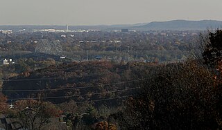
New Albany is a city in Floyd County, Indiana, United States, situated along the Ohio River, opposite Louisville, Kentucky. The population was 37,841 as of the 2020 census. The city is the county seat of Floyd County. It is bounded by I-265 to the north and the Ohio River to the south, and is considered part of the Louisville, Kentucky Metropolitan Statistical Area. The mayor of New Albany is Jeff Gahan, a Democrat; he was re-elected in 2023.

Saint Mary-of-the-Woods, often called St. Mary's, is an unincorporated community in Sugar Creek Township in northwestern Vigo County, in the U.S. state of Indiana. The community is part of the Terre Haute Metropolitan Statistical Area. A large portion of Saint Mary-of-the-Woods along U.S. Route 150 is taken up by the grounds of the Sisters of Providence of Saint Mary-of-the-Woods, which contain the motherhouse of the Sisters of Providence as well as Saint Mary-of-the-Woods College. Although Saint Mary-of-the-Woods is unincorporated, it has a post office, with the ZIP code of 47876. It had a population of 797 at the 2010 census.

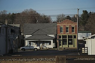
Mount St. Francis is an unincorporated community in southwestern Lafayette Township of Floyd County in the hills of the southern part of the U.S. state of Indiana, across the Ohio River from Louisville, Kentucky. Although Mount St. Francis is unincorporated, it has a post office, with the ZIP code of 47146. The post office was established in 1937.
Edwardsville is an unincorporated community in Georgetown Township, Floyd County, Indiana. The Duncan Tunnel is located at Edwardsville.

Franklin Township is one of five townships in Floyd County, Indiana. As of the 2010 census, its population was 1,499 and it contained 621 housing units. Franklin Township, along with Lafayette Township, are the only two townships in the county without an incorporated community, and is by far the least populous township in the county.
Georgetown Township is one of five townships in Floyd County, Indiana. As of the 2010 census, its population was 9,632 and it contained 3,733 housing units.

Greenville Township is one of five townships in Floyd County, Indiana. As of the 2010 census, its population was 6,746 and it contained 2,532 housing units.
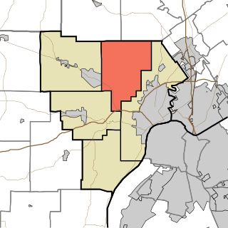
Lafayette Township is one of five townships in Floyd County, Indiana. As of the 2010 census, its population was 7,449 and it contained 2,856 housing units, although it remains one of the two townships in the county without an incorporated community, along with Franklin Township.

New Albany Township is one of five townships in Floyd County, Indiana. As of the 2010 census, its population was 49,252 and it contained 22,226 housing units.

Bennettsville is an unincorporated community in Carr Township, Clark County, Indiana.
Broom Hill is an unincorporated community in Carr Township, Clark County, Indiana.
Hamburg is an unincorporated community in Silver Creek Township, Clark County, Indiana. Parts of Hamburg are within the municipal boundaries of Clarksville and Sellersburg.
Otisco is an unincorporated community in Charlestown Township, Clark County, Indiana.
Watson is an unincorporated community in Utica Township, Clark County, Indiana.
Saint Joseph is an unincorporated community in New Albany Township, Floyd County, Indiana.
Scottsville is an unincorporated community in Lafayette Township, Floyd County, Indiana.
Duncan is an unincorporated community in Georgetown Township, Floyd County, Indiana.

Heritage Lake is an unincorporated community and census-designated place in Floyd Township, Putnam County, in the U.S. state of Indiana. Its population was 2,880 as of the 2010 census. The community is located in eastern Putnam County on the shores of its namesake lake. The lake is 318 acres in size.


