

Saint Medan was a saint, apparently of the early British or Irish period, whose existence and name are inferred from the name Kirkmaiden in Wigtownshire, but who is also associated with Angus and Aberdeenshire.


Saint Medan was a saint, apparently of the early British or Irish period, whose existence and name are inferred from the name Kirkmaiden in Wigtownshire, but who is also associated with Angus and Aberdeenshire.
There is a Kirkmaiden both in the Rinns of Galloway and also on the other side of Luce Bay in the parish of Glasserton near Monreith in the Machars – both in Wigtownshire in Scotland. A legend relates how the saint with her nuns is said to have travelled from the one location to the other across Luce Bay, using a rock as a boat. [1]
Some points about the name suggest problems in transmission. First, the name "Medan" sounds similar to the English word "maiden": this may mean that an originally masculine name was interpreted later by ill-informed or unsophisticated Anglophones as a woman's. Second, the name may well begin with the Gaelic element "mo" meaning "my" – an honorific or a diminutive.
The name has been related to several women saints recorded elsewhere. The element "edan" is similar to "Etáin", a name occurring once in the 15th century in Scotland, and argued as the virgin saint of Tumna near Boyle in County Roscommon in the diocese of Elphin – though another authority derives Cill Medoin in the diocese of Tuam not from an apocryphal saint Etáin but prosaically from the Irish for "middle church". Again, the name may be a version of Modwena (Moninne or Darerca), who was abbess of Cill Sléibe Cuilinn in Killevy near Slieve Gullion and died on 5 July 517 or 519; it is said that she founded a number of churches in Scotland. There is a 1901 dedication to a female St Medan in Troon in Ayrshire. [2]
There are other perhaps stronger arguments for the name being that of a man. The name is similar to a man's name, Muadán, which occurs in commemorations on both sides of the Irish Sea, including Glendaruel in Argyll, and has been glossed as a version of "my Aedan": 16 saints bore the name Aedan, including the well-known Aedan of Lindisfarne. Again, a male saint named Medan was buried at Bodmin and perhaps commemorated at Tregavethan, both in Cornwall. [3] A male Modan is the saint of Rosneath, Falkirk, Kirkton of Airlie in Forfar, Fraserburgh and Fintray in Aberdeenshire, and Freswick in Caithness. [4] The church at Kingoldrum in Angus, which was given to Arbroath Abbey in 1211-14 by William the Lion, was dedicated to St Medan; not far from it is a St Medan's Well, and it is thought that originally it was a Celtic establishment. [5] St Medan is also said to have been one of the three companions of St Drostan, the evangeliser of Aberdeenshire and founder of Deer Abbey. [6]
There is no consensus about these possibilities.
Near the Kirkmaiden at Monreith in the Machars there is a golf course named St Medan's. [7]


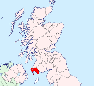
Wigtownshire or the County of Wigtown is one of the historic counties of Scotland, covering an area in the south-west of the country. Until 1975, Wigtownshire was an administrative county used for local government. Since 1975 the area has formed part of Dumfries and Galloway for local government purposes. Wigtownshire continues to be used as a territory for land registration, being a registration county. The historic county is all within the slightly larger Wigtown Area, which is one of the lieutenancy areas of Scotland and was used in local government as the Wigtown District from 1975 to 1996.

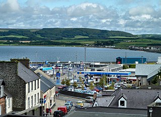
Port William is a fishing village in the parish of Mochrum in the historical county of Wigtownshire, Dumfries and Galloway, in Scotland with a population of approximately 460.
Saint Drostan, also Drustan, was the founder and abbot of the monastery of Old Deer in Aberdeenshire. His relics were translated to the church at New Aberdour and his holy well lies nearby.
Drummore (drum-ORE; is the southernmost village in Scotland, located at the southern end of the Rhins of Galloway in Dumfries and Galloway: it has two satellite clachans, called Kirkmaiden and Damnaglaur.

The Machars is a peninsula in the historical county of Wigtownshire in Galloway in the south-west of Scotland. Its name is derived from the Gaelic word Machair meaning low-lying or level land, known as "links" on the east coast of Scotland. Although there are no high peaks in The Machars, it is not flat and would best be described as undulating or rolling. The North Atlantic Drift or Gulf Stream creates a mild climate, and dolphins and basking sharks are frequently seen in the seas.

Clan MacDowall or MacDouall is a Lowlands Scottish clan.
Mochrum is a coastal civil and Church of Scotland parish situated to the east of Luce Bay on the Machars peninsula and 8 miles (13 km) southwest of Wigtown and in the historical county of Wigtownshire in Galloway, Scotland. It covers 22,000 acres (8,900 ha) and is approximately 10 miles (16 km) in length and 5 miles (8.0 km) in breadth. The parish contains the eponymous village of Mochrum, as well as Port William and the clachan of Elrig.
Glasserton is a civil parish in Dumfries and Galloway, south-west Scotland. It is on the Machars peninsula, in the traditional county of Wigtownshire. The parish is about 8 miles (13 km) in length, varying in breadth from 1 to 3 miles, and contains 13,477 acres (54.54 km2).
Kirkmaiden is a parish in the Rhins of Galloway, the most southerly in Scotland; the present Church of Scotland parish has the same name as and is approximately coterminous with the original pre-Reformation parish.
Stoneykirk is an area and a village in the heart of the Rhins of Galloway, Wigtownshire, in the administrative council area of Dumfries and Galloway, Scotland nearly 10 miles (16 km) in length and 3+1⁄2 miles (5.6 km) in breadth, bounded on the east by the bay of Luce, and on the west by the Irish Channel, 5 miles (8 km) south of Stranraer.

Elrig is a clachan or hamlet in the historical county of Wigtownshire in Dumfries and Galloway, Scotland. Located in the Machars peninsula, it is about 3 miles (5 km) north of Port William.
Kirkinner is a village in the Machars, in the historical county of Wigtownshire in Dumfries and Galloway, Scotland. About 3 miles (4.8 km) southwest of Wigtown, it is bounded on the east by the bay of Wigtown, along which it extends for about three miles, and on the north by the river Bladnoch.
Monreith is a small seaside village in the Machars, in the historical county of Wigtownshire, Scotland.

Inch is a civil parish in Dumfries and Galloway, southwest Scotland. It lies on the shore of Loch Ryan, in the traditional county of Wigtownshire.
Penninghame in Wigtownshire, Dumfries and Galloway, Scotland, is a civil parish area, 8 miles from Wigtown. The area is approx 16 miles in length, and from 5 to 6 miles' width, bounded on the north and east by the River Cree, and on the west by the Bladnoch; comprising nearly 38,000 acres, of which 12,000 were arable, 600 woodland and plantations, 1600 meadow, and the remainder hill pasture, moorland, moss, etc.
Old Luce is a civil parish in Dumfries and Galloway, Scotland. It lies in the Machars peninsula, in the traditional county of Wigtownshire. The parish is around 10 miles (16 km) long and 8 miles (13 km) broad, and contains 40,350 acres (16,330 ha).