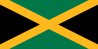
Jamaica is an island country situated in the Caribbean Sea. Spanning 10,990 square kilometres (4,240 sq mi) in area, it is the third-largest island of the Greater Antilles and the Caribbean. Jamaica lies about 145 kilometres (90 mi) south of Cuba, and 191 kilometres (119 mi) west of Hispaniola ; the British Overseas Territory of the Cayman Islands lies some 215 kilometres (134 mi) to the north-west.
Politics in Jamaica takes place in the framework of a representative parliamentary democratic constitutional monarchy. The 1962 Constitution of Jamaica established a parliamentary system whose political and legal traditions closely follow those of the United Kingdom. As the head of state, Queen Elizabeth II - on the advice of the Prime Minister of Jamaica - appoints a governor-general as her representative in Jamaica. The governor-general has a largely ceremonial role. Jamaica constitutes an independent Commonwealth realm.
The parishes of Jamaica are the main units of local government in Jamaica. They were created following the English Invasion of Jamaica in 1655. This administrative structure for the Colony of Jamaica developed slowly. However, since 1 May 1867 Jamaica has been divided into the current fourteen parishes. These were retained after independence in 1962. They are grouped into three historic counties, which no longer have any administrative relevance. Every parish has a coast; none are landlocked.

Saint Thomas, once known as Saint Thomas in the East, is a suburban parish situated at the south eastern end of Jamaica, within the county of Surrey. It is the birthplace of the Right Honourable Paul Bogle, designated in 1969 as one of Jamaica's seven National Heroes. Morant Bay, its chief town and capital, is the site of the Morant Bay Rebellion in 1865, of which Bogle was a leader.

St Catherine is a parish in the south east of Jamaica. It is located in the county of Middlesex, and is one of the island's largest and most economically valued parishes because of its many resources. It includes the first capital of Jamaica, Spanish Town, originally known as San Jago de la Vega or Santiago de la Vega.

Clarendon is a parish in Jamaica. It is located on the south of the island, roughly halfway between the island's eastern and western ends. Located in the county of Middlesex, it is bordered by Manchester on the west, Saint Catherine in the east, and in the north by Saint Ann. Its capital and largest town is May Pen.
Port Morant is a town in Saint Thomas Parish, southeastern Jamaica. It was, in the early years of European settlement, one of the island's chief ports, with export of bananas and production of rum being major industries. Following the English conquest of Jamaica in 1655, General Luke Stokes arrived from Nevis with 1,600 people who settled near Port Morant in 1656.
Tacky's War, or Tacky's Rebellion, was an uprising of Akan slaves and other Akan tribes including Ashanti, Fanti, Nzema and Akyem. These uprisings occurred in the Colony of Jamaica in the 1760s, and were led by a Fanti royal and warlord called Tacky (Takyi) in eastern Jamaica, and Dahomean war chief or coastal headman Apongo in the western end of the island.
Colonel Sir Thomas Modyford, 1st Baronet was a planter of Barbados and Governor of Jamaica from 1664 to 1671.

Runaway Bay is a town in Saint Ann Parish on the northern coast of Jamaica and is considered one of the most naturally beautiful places on the island. It is a notable tourist destination located 16 km (9.9 mi) west of Ocho Rios, and slightly east of Discovery Bay, where Christopher Columbus landed in 1494. Ocean View Beach is a private beach situated at Runaway Bay. It consists of a series of hotel resort complexes and beaches.
Fulke Rose was a British physician and early colonist of Jamaica. He was one of the principal buyers in Jamaica of slaves taken by the Royal African Company and had extensive land-holdings on the island. He continued to practice medicine in Jamaica and with Hans Sloane attended the former privateer Henry Morgan towards the end of Morgan's life.

Saint George Parish was one of the historic parishes of Jamaica created following colonisation of the island by the British. It was on the north side of the island in Surrey County but was abolished in 1866 when it was divided between Saint Mary and Portland parishes.
Saint David Parish was one of the historic parishes of Jamaica created following colonisation of the island by the British. It was in the east of the island in Surrey County
Saint Dorothy Parish was one of the historic parishes of Jamaica created following colonisation of the island by the British. It was on the south side of the island in Middlesex County to the west of Port Royal and Kingston but was abolished in 1866 when it was merged into Saint Catherine Parish.
Saint John Parish was one of the historic parishes of Jamaica created following colonisation of the island by the British. It was in the centre of the island in Middlesex County but was abolished in 1866 when it was merged into Saint Catherine Parish.
Vere Parish was one of the historic parishes of Jamaica created following colonisation of the island by the British. It was in the south of the island in Middlesex County but was abolished in 1866 when it was merged into Clarendon Parish.
Francis Rose was a plantation owner in Jamaica. He was active in the politics of the island and was elected to serve in the House of Assembly of Jamaica multiple times, becoming speaker in 1702, and later president of the Council of Jamaica.
George Nedham (Needham) was a supporter of the Royalist cause during the English Civil War who, following their defeat at the Battle of Worcester in 1651, emigrated to the West Indies. First he went to Antigua, and later migrated to Jamaica. Here he married the daughter of Governor Thomas Modyford and became a prominent planter in the colony.

The 1944 Jamaica hurricane was a deadly major hurricane that swept across the Caribbean Sea and Gulf of Mexico in August 1944. Conservative estimates placed the storm's death toll at 116. The storm was already well-developed when it was first noted passing westward over the Windward Islands into the Caribbean Sea on August 16. A ship near Grenada with 74 occupants was lost, constituting a plurality of the deaths associated with the storm. The following day, the storm intensified into a hurricane, reaching its peak strength on August 20 with maximum sustained winds of 120 mph (195 km/h). At this intensity, the major hurricane made landfall on Jamaica later that day, traversing the length of the island. The damage wrought was extensive, with the strong winds destroying 90 percent of banana trees and 41 percent of coconut trees in Jamaica; the overall damage toll was estimated at "several millions of dollars". The northern coast of Jamaica saw the most severe damage, with widespread structural damage and numerous homes destroyed across several parishes. In Port Maria, the storm was considered the worst since 1903.
