Dhemaji is a small town and the headquarters of the Dhemaji district in the state of Assam, India. It is situated on the north bank of the Brahmaputra River and serves as an important administrative and commercial centre for the surrounding area.The town is known for its serene environment, traditional Assamese culture, and proximity to natural attractions like hills, rivers and forests.

Dhubri is a city and the administrative centre of Dhubri district in the Indian state of Assam. It is an old town on the bank of the Brahmaputra river, with historical significance. In 1883, the town was first constituted as a Municipal Board under the British regime. It is situated about 277.4 kilometres (172 mi) west from Dispur, the state capital of Assam.
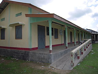
Kokrajhar is a town in the Bodoland Territorial Region, an autonomous territory in Assam, one of the North Eastern states of India.
Dhekiajuli is a town and a municipal board in Sonitpur district in the state of Assam, India.
Gossaigaon is one of the fastest-developing towns and the hometown of the state's youngest Raimona National Park in the Bodoland region of Assam, India. This is a sub-divisional headquarter of Kokrajhar district. It shares its boundaries with the neighboring state of West Bengal in the west and Dhubri district to the south. It is one of the BTR's proposed districts. Gossaigaon is well connected by ground transportation and rails. The town serves as a direct route by road to the state's youngest Rupsi Airport located in the southernmost part of the town. Madati and Sankosh are some of the prominent rivers that flow through the heart of the town, and forested areas include such saleable trees as Shorea robusta (sal), Tectona grandis (teak). This place practices organic farming as well as modern agriculture, following recent scientific developments.
Makum is a town and a town area committee in Tinsukia district in the Indian state of Assam. It should not be mistaken for Makum Pathar. It is the meeting point of three premier towns of upper Assam namely Tinsukia Digboi and Doomdooma. The National Highway-37 and National Highway-38 meet at Makum. Makum railway station is the easternmost railway junction of the Indian Railways. The rail line became operational on 16 July 1883.
Mhowgaon is a Nagar Panchayat under Sub Division Dr. Ambedkar Nagar (Mhow) in Indore district in the Indian state of Madhya Pradesh. The total geographical area of Mhowgaon nagar panchayat is 13.5 km2 and it is the smallest city by area in the sub district. The population density of the city is 2309 persons per km2. Mhowgaon is divided into 15 wards for which elections are held every 5 years. Among them, Mhowgaon Ward No. 2 is the most populous ward with a population of 3440 and Mhowgaon Ward No. 15 is the least populous ward with a population of 957. Mhowgaon Nagar Panchayat has total administration over 6,373 houses to which it supplies basic amenities like water and sewerage. It is also authorized to build roads within Nagar Panchayat limits and impose taxes on properties coming under its jurisdiction.

Salap is a census town in Domjur CD Block of Howrah Sadar subdivision in Howrah district in the Indian state of West Bengal. It is a part of Kolkata Urban Agglomeration.
Sapatgram is a town and a Municipality Board Area in Dhubri district in the Indian state of Assam.
Satwas is a town and a Nagar Panchayat in Dewas district in the Indian state of Madhya Pradesh. Satwas is around 136.8 km (85.0 mi) from Dewas.
Talcher Thermal Power Station Township is a census town in Anugul district in the Indian state of Odisha. Talcher Thermal Power Station is one of the thermal power stations of NTPC Ltd.

Unchahar is a town and nagar panchayat in Raebareli district in the Indian state of Uttar Pradesh. It serves as the headquarters of a tehsil as well as a community development block. It is located on Lucknow Allahabad Highway, 115 km from Lucknow, 85 km from Allahabad. The place is well connected by rail and roads to nearby cities of Kanpur, Lucknow, and Allahabad. Unchahar is also a constituency of Uttar Pradesh Legislative assembly.
Lakhiganj is a village, a small Bazaar (market), a post office and a Gaon Panchayat in the Dhubri district of Assam, around 8 km north from Bilasipara,. It is situated on the Bilasipara-Kokrajhar state highway, around 12 km from Kokrajhar town and 9 km from Fakiragram railway station. The bazaar hosts weekly market on Monday and Friday. It has a small township comprising people of different backgrounds and as such they represent a mixed culture. The people of this Bazzar area basically speak Goalpariya, Assamese, although Marawari, Bihari and Bengalis’ are also there. The people are primarily dependent on small-scale business. However, it is surprising that this the place where Motram Surajmal Dugar first established a small firm in 1906 and now it is a big business house, named "the MS Dugar group of companies" operate all over India.
Narahia is a large village in Madhubani district of the Indian state of Bihar. Narahia is also called for the Mithalanchal land of Bihar.
Khoirabari is a small town in Udalguri district in the Indian state of Assam. Khoirabari serves as the Sub-divisional headquarters of Khoirabari Sub-division. The total geographical area of town is 56.93 hectares. Khoirabari Town has a total population of 873 peoples, out of which male population is 443 while female population is 430. Literacy rate of Khoirabari town village is 80.64% out of which 85.10% males and 76.05% females are literate.
Dimow is a Medium-sized village in Sissiborgaon tehsil, Dhemaji district in the Indian state of Assam. It is situated at a distance of 48 km from its district headquarters Dhemaji and 16 km from nearest town Silapathar.

Sissiborgaon is a village and tehsil of Dhemaji district, Assam state, India. Sissiborgaon is a populated developed village.
Udharbond is a Tehsil or Block in Cachar district in the state of Assam, India. It is located 11 km from District headquarters Silchar.
Assam Gramin Vikash Bank is the only regional rural bank of Assam, India. It is under the ownership of Ministry of Finance, Government of India. The bank was formally launched on 12 January 2006 after amalgamation of Pragjyotish Gaonlia Bank, Lakhimi Gaonlia Bank, Cachar Gramin Bank and Subansiri Gaonlia Bank, which were sponsored by erstwhile United Bank of India now Punjab National Bank. As per Government of India directives for forming of state wise Regional Rural Banks Assam Gramin Vikash Bank was further amalgamated with Langpi Dehangi Rural Bank which was sponsored by State Bank of India to form present Assam Gramin Vikash Bank w.e.f 1 April 2019 without changing of the name of the newly formed entity.
Gara is a village in Rohtas district of Bihar state, India. It is located in Kochas community development block.The total geographical area of Gara is 3.87 KM2. Gara village is a gram panchayat.The nearest police station is Kochas Police station. Gara is part of Kargahar vidhan sabha seat of State Assembly and Sasaram Lok Sabha constituency.

