Bullitt County is a county in the U.S. state of Kentucky located in the far western Bluegrass region known as the Knobs. As of the 2010 census, the population was 74,319. The county seat is Shepherdsville. The county was founded in 1796.

Shepherdsville is a home rule-class city on the Salt River in Bullitt County, Kentucky, in the United States. It is the seat of its county, located just south of Louisville. The population was 11,222 during the 2010 U.S. Census.

Bubble gum is a type of chewing gum, designed to be inflated out of the mouth as a bubble.

The Utah Stars were an American Basketball Association (ABA) team based in Salt Lake City, Utah, USA.

Chewing gum is a soft, cohesive substance designed to be chewed without being swallowed. Modern chewing gum is composed of gum base, sweeteners, softeners/plasticizers, flavors, colors, and, typically, a hard or powdered polyol coating. Its texture is reminiscent of rubber because of the physical-chemical properties of its polymer, plasticizer, and resin components, which contribute to its elastic-plastic, sticky, chewy characteristics.

The gums or gingiva, consist of the mucosal tissue that lies over the mandible and maxilla inside the mouth. Gum health and disease can have an effect on general health.

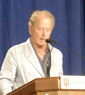
Don Gummer is an American sculptor. His early work concentrated on table-top and wall-mounted sculpture; but, in the mid-1980s, he shifted his focus to large free-standing works, often in bronze. In the 1990s, he added a variety of other materials, such as stainless steel, aluminum and stained glass. His interest in large outdoor works also led him to an interest in public art. He is the husband of actress Meryl Streep.
Walter E. Diemer was an accountant and inventor of bubble gum.

Dried shredded squid is a dried, shredded, seasoned, seafood product, made from squid or cuttlefish, commonly found in coastal Asian countries, Russia, and Hawaii. The snack is also referred to as dried shredded cuttlefish.
Bullitt's Lick is a historic salt lick three miles south of Shepherdsville in Bullitt County, Kentucky. It was the first commercial supplier of salt in Kentucky, and the first industry in Kentucky as well, supplying jobs for many residents, including slaves.

Clarks River National Wildlife Refuge is a bottomland hardwood forest located in western Kentucky near Benton. The refuge lies along the East Fork of the Clarks River and is seasonal home to over 200 different species of migratory birds. The bottom lands are dominated with overcup oaks, bald cypress, and tupelo-gum, and the slightly higher, better drained areas are covered with willow oak, swamp chestnut oak, red oak, sweet gum, sycamore, ash and elm.
Reunion, a public sculpture by Don Gummer, is located on the Indiana University-Purdue University Indianapolis campus, located near downtown Indianapolis, Indiana. The sculpture consists of two interlocking metal forms that have separate bases that eventually unite with one another. Reunion is located on the east side of the Herron School of Art and Design and is approximately 253 cm in height and approximately 167 cm wide. Reunion was created in 1992 as a model for a larger Reunion sculpture located in Japan. Reunion is made from cast bronze.

Gum Corners is an unincorporated community located in Russell County, Kentucky, United States.

The London, Kentucky micropolitan area is made up of three counties in the Eastern Coalfield region of Kentucky. Before 2013, the area was officially known as the Corbin-London, KY Combined Statistical Area, and consisted of the Corbin Micropolitan Statistical Area and the London Micropolitan Statistical Area. The Corbin micropolitan area consisted of Whitley County, and the London micropolitan area consisted of Laurel County.

Gum Tree is an unincorporated community located in Monroe County, Kentucky, United States. It is concentrated around the intersection of Kentucky Route 678, Kentucky Route 870, and Kentucky Route 1366, northwest of Tompkinsville, north of Gamaliel, west of Mud Lick, Kentucky, and east of Flippin, Kentucky. Gum Tree is home to one of Monroe County's voting precincts, which had over 900 registered voters as of 2014.
Kentucky Route 223 (KY 223) is a 16.7-mile-long (26.9 km) state highway in the U.S. state of Kentucky. The highway travels through mostly rural areas of Knox County. It has a northern loop in the route.


