Related Research Articles

Greendale Township is a civil township of Midland County in the U.S. state of Michigan. As of the 2000 census, the township population was 1,788.

The St. Joseph River is an 86.1-mile-long (138.6 km) tributary of the Maumee River in northwestern Ohio and northeastern Indiana in the United States, with headwater tributaries rising in southern Michigan. It drains a primarily rural farming region in the watershed of Lake Erie.

The Feather River is the principal tributary of the Sacramento River, in the Sacramento Valley of Northern California. The river's main stem is about 73 miles (117 km) long. Its length to its most distant headwater tributary is just over 210 miles (340 km). The main stem Feather River begins in Lake Oroville, where its four long tributary forks join—the South Fork, Middle Fork, North Fork, and West Branch Feather Rivers. These and other tributaries drain part of the northern Sierra Nevada, and the extreme southern Cascades, as well as a small portion of the Sacramento Valley. The total drainage basin is about 6,200 square miles (16,000 km2), with approximately 3,604 square miles (9,330 km2) above Lake Oroville.

Bear River is a small clear slow-moving river in the U.S. state of Michigan. 14.7 miles (23.7 km) long, it is the largest tributary of Little Traverse Bay in the northwest of the lower peninsula. Traverse Bay is on Lake Michigan. The river is formed as the outflow of Walloon Lake on the boundary between Charlevoix County and Emmet County, draining from the southeast end of the lake at 45°15′40″N84°56′01″W near the community of Walloon Lake in Melrose Township. M-75 has its northern terminus in a junction with US 131 nearby.
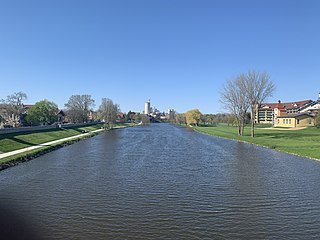
The Belle River is a 73.5-mile-long (118.3 km) river in the U.S. state of Michigan, flowing into the St. Clair River in Marine City at 42°42′25″N82°29′50″W.

Pine River may refer to any of the following rivers in the U.S. state of Michigan:
The Wood River is a 47.7-mile-long (76.8 km) tributary of the St. Croix River in western Burnett County, Wisconsin, United States. It follows a meandering course in a generally westward direction. Its banks are mostly low and marshy, though there are high sandbanks in places. Although it flows through a few communities, for most of its course it flows through relatively natural settings.
The Cass River is a 61.5-mile-long (99.0 km) river in the Thumb region of the U.S. state of Michigan. It drains large portions of Sanilac and Tuscola counties and smaller portions of Genesee, Huron, Lapeer, and Saginaw counties.

The Chippewa River is a stream in Michigan, United States, that runs 91.8 miles (147.7 km) through the central Lower Peninsula. The Chippewa is a tributary of the Tittabawassee River and is thus part of the Saginaw River drainage basin. The river is named after the Chippewa people.
Tygarts Creek is a tributary of the Ohio River in Carter and Greenup counties of northeastern Kentucky in the United States. It is 88 miles (142 km) long and drains an area of 339.6 square miles (880 km2). Via the Ohio, it is part of the watershed of the Mississippi River. Tygarts Creek is named for early Kentucky explorer Michael Tygart, who eventually drowned in the creek, somewhere near the mouth.

The Cedar River is a 29.0-mile-long (46.7 km) river in the U.S. state of Michigan, flowing through Clare County and Gladwin County.
Coldwater River is a 13.1-mile-long (21.1 km) stream in the U.S. state of Michigan. Located in Isabella County, the river rises as the outflow of Littlefield Lake in western Gilmore Township. The river flows mostly south and empties into the Chippewa River at 43°37′22.231″N84°57′38.243″W on the western boundary of Deerfield Township, about two miles east of Lake Isabella.
Cedar Creek may refer to several small streams in the U.S. state of Michigan:
The Kawkawlin River is a 17.5-mile-long (28.2 km) stream in the U.S. state of Michigan that flows into Saginaw Bay of Lake Huron at 43°39′30″N83°53′00″W, approximately 1 mile (1.6 km) west of the mouth of the Saginaw River.

The Saganing River, also known as Saganing Creek, is a 10.0-mile-long (16.1 km) stream in the U.S. state of Michigan.

The Pine River is a 103-mile-long (166 km) river in the Lower Peninsula of the U.S. state of Michigan. The Pine River is a tributary of the Chippewa River and is thus part of the Saginaw River drainage basin.
Tate Creek is a stream in Georgia, and is a tributary of the Chestatee River. The creek is approximately 3.97 miles (6.39 km) long.
Swan Creek is a stream in the Ozarks of southern Missouri. It is a tributary of the White River downstream from the Lake Taneycomo dam.
Dry Creek is a stream in Oregon County, in the Ozarks of southern Missouri in the United States. It is a tributary to the Eleven Point River.
References
- ↑ U.S. Geological Survey Geographic Names Information System: Salt River in Macomb County
- 1 2 U.S. Geological Survey. National Hydrography Dataset high-resolution flowline data. The National Map, accessed November 7, 2011
- ↑ U.S. Geological Survey, 2003. Water Resources Data: Michigan. Fistler Drain and Kirkham Drain, accessed October 10, 2021
- ↑ U.S. Geological Survey Geographic Names Information System: South Branch Salt River in Isabella County
- ↑ U.S. Geological Survey Geographic Names Information System: Salt River in Midland County
| | This Macomb County, Michigan location article is a stub. You can help Wikipedia by expanding it. |
| | This Midland County, Michigan location article is a stub. You can help Wikipedia by expanding it. |
| | This Isabella County, Michigan location article is a stub. You can help Wikipedia by expanding it. |