
The Shire of Colac Otway is a local government area in the Barwon South West region of Victoria, Australia, located in the south-western part of the state. It covers an area of 3,438 square kilometres (1,327 sq mi) and in June 2018 had a population of 21,503. It includes the towns of Apollo Bay, Beeac, Beech Forest, Birregurra, Colac, Cressy, Forrest, Johanna, Kennett River, Lavers Hill, Warrion and Wye River. It came into existence on 23 September 1994 through the amalgamation of the local government areas of City of Colac, Shire of Colac, part of the Shire of Otway and part of the Shire of Heytesbury.
This article lists extreme locations on Earth that hold geographical records or are otherwise known for their geophysical or meteorological superlatives. All of these locations are Earth-wide extremes; extremes of individual continents or countries are not listed.
Ambaji (Ambājī) is a census town in Banaskantha district in the state of Gujarat, India.
Rapar is a city and a municipality in Kutch district (Kachchh) in the Indian state of Gujarat.

The Bonaparte Indian Band a.k.a. Bonaparte First Nation, is a member band of the Shuswap Nation Tribal Council of the Secwepemc (Shuswap) people.
The Lytton First Nation, a First Nations band government, has its headquarters at Lytton in the Fraser Canyon region of the Canadian province of British Columbia. While it is the largest of all Nlaka'pamux bands, unlike all other governments of the Nlaka'pamux (Thompson) people, it is not a member of any of the three Nlaka'pamux tribal councils, which are the Nicola Tribal Association, the Fraser Canyon Indian Administration and the Nlaka'pamux Nation Tribal Council.
The Kluskus First Nation is the band government of the Lhoosk’uz, a Dakelh people whose main reserve located on the Chilcotin Plateau 130 km west of the city of Quesnel, British Columbia, Canada. The First Nation is a member of the Carrier-Chilcotin Tribal Council, which includes both Tsilhqot'in and Carrier (Dakelh) communities.
Ampani is a town in the Kalahandi district of the state of Odisha, in India. It is a gram panchayat that comes under Kokasara tehsil. It is 15 km from its main town and blocks Kokasara.
Simri Bakhtiyarpur is a subdivision and town in the Saharsa district of Bihar state, India.
The Port of Jakhau is a fair weather port on the Gulf of Kutch, Kutch District, in the state of Gujarat, India situated on Godia Creek. It provides an anchorage port. The port boasts of entire Gujarat's fishing community and almost all types of boats.
Palanswa or Palansva is a village of Vaghela Royal kingdom in Gujarat, India.Its one and only Vaghela Jagir(Kingdom) in kutch others are of Jadeja's Jagir(Kingdom). The Palasva's Fort have permission of Jail. Palasva also known as King Meghrajsinh Vaghela's place and palace. It lies in the Kutch district in the Taluka of Raapar. The village is located on Indian National Highway No 8A.
Surat Railway Station is a major railway station serving Surat, beside Gothangam, Kosad, Utran, Udhna Junction, Bhestan, Niyol and Sachin. It is under the administrative control of the Western Railway zone of the Indian Railways. Surat is A1 – category railway station of Western Railway Zone of Indian Railways. It is on the Ahmedabad–Vadodara–Mumbai rail route. The railway station was built in 1860.

Kutch State was a state within India from 1947 to 1956. Its capital was Bhuj.
The Gandhidham–Samakhiali section is a rail line belonging to the Western Railway of Kutch district in Gujarat state, India. It passes through Bhimasar, Chirai and Bhachau.
The Gandhidham–Palanpur section belongs to the Western Railway of Kutch district of Gujarat state.
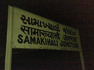
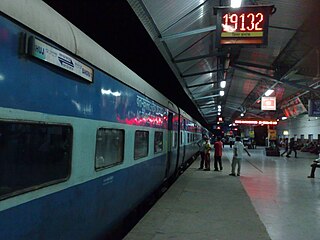
Samakhiali Junction railway station is a railway station belonging to the Western Railway of Ahmedabad division.
The Gandhidham–Ahmedabad main line belongs to Western Railway of Ahmedabad Division in Gujarat State.

Palanpur Junction railway station is a major railway station located in Palanpur, Gujarat, India. The railway station is under the administrative control of Western Railway of Indian Railways. Palanpur Junction railway station has five platforms and a total of six tracks.

Kumbhariya is a village of historical, archaeological and religious importance with cultural heritage in Danta Taluka of Banaskantha district, Gujarat, India.


