
Nadiad is a city in the state of Gujarat, India and the administrative centre of the Kheda district. The city is managed by the Nadiad Municipal Corporation. It is known for the Santram Mandir, the Mai Mandir, the historic Swaminarayan temple built in 1824, and the Anand and Hari Om Ashram. Nadiad is located 90 kilometres (56 mi) away from Gandhinagar, the capital of Gujarat. It has a major railway junction and is a main station on the Ahmedabad-Mumbai route. It is the birth place of Sardar Vallabhbhai Patel, the first Deputy Prime Minister of India.

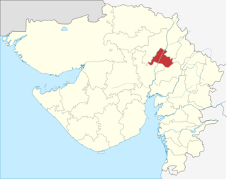
Anand is the administrative centre of Anand District in the state of Gujarat, India. It is administered by Anand Municipality. It is part of the region known as Charotar, consisting of Anand and Kheda districts.

Narmada district is an administrative district in the state of Gujarat in India. The district headquarters are located at Rajpipla. The district is bounded by Vadodara district in the north, by Maharashtra state in the east, by Tapi district in the south and by Bharuch district in the west. The district occupies an area of 2,755 km² and has a population of 590,297. It was 10.44% urban as of 2011. As of 2011, it is the third least populous district of Gujarat, after Dang and Porbandar.

Navsari is an administrative district in the state of Gujarat in India, with its headquarters at the city of Navsari. The district covers an area of 2,211 square kilometres, and had a population of 1,329,672 in 2011. The district was formed in 1997 after Valsad district was bifurcated into Valsad and Navsari districts.
Gandhinagar district is an administrative division of Gujarat, India, whose headquarters are at Gandhinagar, the state capital. It was organized in 1964.

Vadodara District is a district in the eastern part of the state of Gujarat in western India. The city of Vadodara (Baroda), in the western part of the district, is the administrative headquarters. Vadodara District covers an area of 7,794 km². As of 2011, the district had a population of 4,165,626 of which 49.6% were urban, 50.4% were rural, 5.3% were scheduled castes and 27.6% were scheduled tribes. As of 2011 it is the third most populous district of Gujarat, after Ahmadabad and Surat.
Padra is a town and a municipality in the Vadodara district in the Indian state of Gujarat. Padra is located about 16 kilometres from Vadodara city.

Pardi is a town and a municipality in Valsad district in the Indian state of Gujarat. Historically, there is a Hill in the middle of the town facing the lake where it is said Shivaji built the Killa (Fort). It's from this Killa (Fort) that the town is also called Killa-Pardi. Roughly 14 km south of the district headquarters city of Valsad, Pardi has a rail station on the Mumbai-Vadodara line of Western Railway (India). National Highway 8 bisects the town in east and west regions. The town has a municipality office and a court. The city centre also known for the Bus Stop at the intersection of Roads from Chival (East), Umarsadi (West), Damni Zampa (South) and Valsadi Zampa (North). Pardi has a wonderful lake called Talav spread over 99 acres which is proposed to be made tourist place in the near future.

Veraval is a municipality and the headquarters of Gir Somnath district in the Indian state of Gujarat. It is 6 km from Somnath. It is also known for the hub of fishing industries in India.

Bodeli is a city and taluka in Chhota Udaipur district in the eastern part of the state of Gujarat, India.
Rupal is a village in Gandhinagar District of Gujarat state, India. It is located 13 km towards north from District headquarters Gandhinagar. Gujarati is the local language here.
Geratpur is a large village in Ahmedabad district in the Indian state of Gujarat.
Bhestan is a town and locality in Surat city of Surat district in the Indian state of Gujarat.

Samlaya Junction railway station is a railway station on the Western Railway network in the state of Gujarat, India. Samlaya Junction railway station is 26 km from Vadodara railway station. Passenger, MEMU, Express and Superfast trains halt at Samlaya Junction railway station.
Nabipur is a village in Bharuch district in the Indian state of Gujarat.
Kathana is a large village in Anand district in the Indian state of Gujarat.
Kim is a census town in Surat district in the Indian state of Gujarat.
Barejadi is a village in Ahmedabad district in the Indian state of Gujarat.
Itola is a village in Vadodara district in the Indian state of Gujarat.
Amirgadh is a town in Banaskantha district in the Indian state of Gujarat.

