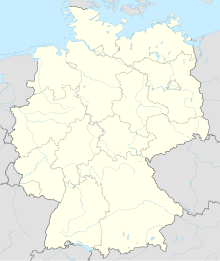
The Harz, also called the Harz Mountains, is a highland area in northern Germany. It has the highest elevations for that region, and its rugged terrain extends across parts of Lower Saxony, Saxony-Anhalt, and Thuringia. The name Harz derives from the Middle High German word Hardt or Hart. The name Hercynia derives from a Celtic name and could refer to other mountain forests, but has also been applied to the geology of the Harz. The Brocken is the highest summit in the Harz with an elevation of 1,141.1 metres (3,744 ft) above sea level. The Wurmberg is the highest peak located entirely within the state of Lower Saxony.

The Rammelsberg is a mountain, 635 metres (2,083 ft) high, on the northern edge of the Harz range, south of the historic town of Goslar in the North German state of Lower Saxony. The mountain is the location of an important silver, copper, and lead mine. When it closed in 1988, it had been the only mine still working continuously for over 1,000 years. Because of its long history of mining and testimony to the advancement and exchange of technology over many centuries, the visitor mine of Rammelsberg was inscribed as a UNESCO World Heritage Site in 1992.

Sankt Andreasberg is a former independent city in the district of Goslar, in Lower Saxony, Germany. Since 1 November 2011, it has formed part of the town Braunlage. It is situated in the Harz, approximately 7 km (4.3 mi) west of Braunlage proper, and 20 km (12 mi) east of Osterode am Harz.
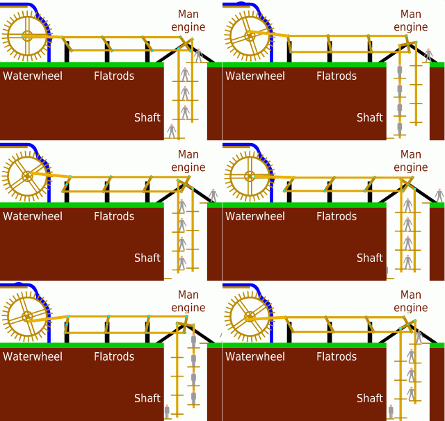
A man engine is a mechanism of reciprocating ladders and stationary platforms installed in mines to assist the miners' journeys to and from the working levels. It was invented in Germany in the 19th century and was a prominent feature of tin and copper mines in Cornwall until the beginning of the twentieth century.
At 893 metres above sea level, the Rehberg in the Harz mountains is the fourth highest mountain in the German state of Lower Saxony, and the fifth-highest in the Harz.
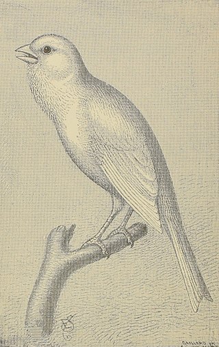
Harz Roller is the name of a breed of domestic canary bred in the Upper Harz mountains of Germany. The birds were bred in the Upper Harz between Lautenthal and Sankt Andreasberg in the middle of the 19th century and achieved European-wide fame. Since 2001 there has been a Harz Roller Museum in Sankt Andreasberg.

The Upper Harz is the northwestern and higher part of the Harz mountain range in Germany. The exact boundaries of this geographical region may be defined differently depending on the context. In its traditional sense, the term Upper Harz covers the area of the seven historical mining towns (Bergstädte) - Clausthal, Zellerfeld, Andreasberg, Altenau, Lautenthal, Wildemann and Grund - in the present-day German federal state of Lower Saxony. Orographically, it comprises the Harz catchment areas of the Söse, Innerste and Grane, Oker and Abzucht mountain streams, all part of the larger Weser watershed.

The Großer Knollen is a 687.4-metre-high (2,255 ft) mountain in the southwestern part of the Harz in Lower Saxony, Germany.
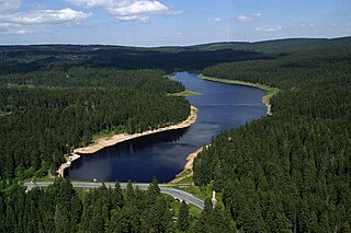
The Oderteich is an historic reservoir about seven kilometres northeast of Sankt Andreasberg in the Upper Harz in central Germany. It was built by miners from St. Andreasberg in the years 1715 to 1722 and, today, is an important component of the water supply network known as the Upper Harz Water Regale. Moreover, for 170 years, from the time it was completed to the end of the 19th century, the Oderteich had the largest dam in Germany. The dam lies at a height of 725 m above NN by the B 242 federal highway, about a kilometre west of its intersection with the B 4.

The Harz Witches' Trail is a footpath, just under 100 km long, in Germany that runs from Osterode through the Harz mountains and over its highest peak, the Brocken, to Thale. It is a project by the Harz Transport Association and Harz Club and is part of the system of trails known as the Harzer Wandernadel.

The Upper Harz Water Regale is a system of dams, reservoirs, ditches and other structures, much of which was built from the 16th to 19th centuries to divert and store the water that drove the water wheels of the mines in the Upper Harz region of Germany. The term regale, here, refers to the granting of royal privileges or rights in this case to permit the use of water for mining operations in the Harz mountains of Germany.

Mining in the Upper Harz region of central Germany was a major industry for several centuries, especially for the production of silver, lead, copper, and, latterly, zinc as well. Great wealth was accumulated from the mining of silver from the 16th to the 19th centuries, as well as from important technical inventions. The centre of the mining industry was the group of seven Upper Harz mining towns of Clausthal, Zellerfeld, Sankt Andreasberg, Wildemann, Grund, Lautenthal und Altenau.
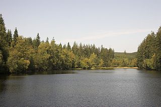
The Silberteich is a man-made reservoir, of a type called a Kunstteich, and lies on the upper reaches of the Brunnenbach stream between Braunlage and Sankt Andreasberg in the Harz Mountains of Germany. It was built as part of the historic Upper Harz Water Regale.
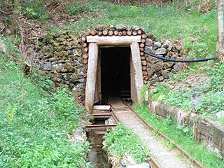
The Roter Bär Pit in Sankt Andreasberg in the Upper Harz is an iron ore mine that was worked from about 1800 until the 1860s. Today it is operated as a show mine under the name of Roter Bär Pit Educational Mine by the Sankt Andreasberg Society for History and Archaeology. The name Roter Bär means "Red Bear".

Heinrich Friedrich Trute called Wilhelm Trute was a German miner and breeder of singing canaries, the Harz Roller.

The Maaßener Gaipel is a pub catering for day trippers on the northeastern hillside of the Kranichsberg at a height of 420 m above NN, situated above the mining town of Lautenthal in the Harz Mountains of central Germany. The name goes back to the above-ground workings of the Maaßener Treibschacht or Maaßen Hoisting Shaft 51°51′49″N10°17′25″E, which was located immediately east of the inn. Gaipel is a common expression in the Upper Harz for a headframe and goes back to the use of a horse whim which in German is a Pferdegöpel. Whims were used to transport men and materiel up and down mineshafts, for example using man engines, and also to operate water management equipment. Maaßen is shorthand for the name of the local pit which was the Grube Zweite, Dritte, Vierte, Fünfte und Sechste Maß nach der Sachsenzeche. Maaß, also variously spelt Maaß, Maas or Mas, is a unit of length for a pit field (Grubenfeld) and in mining in the Upper Harz measured 28 Lachter or 53.8 metres. The pub was built in 1924 on the initiative of the Harz Club on the terrain of the old mine shaft. But decades before the area had already become a popular destination with walkers due to its views of the mining town and the valley of the Laute.

The Grünhirscher Stollen is an adit for water drainage in Sankt Andreasberg, in the Harz mountains. It was created during mining in the Upper Harz and named after the valley Grüner Hirsch between the mountains Galgenberg and Glockenberg. It leads from the Samson Pit to the south-west of the Galgenberg.

The Sieberstollen is an adit for water drainage in Sankt Andreasberg, in the Harz mountains. It was created during mining in the Upper Harz and named after the river Sieber into which it discharges its water. The opening position is in the Sieber Valley.

Silberhütte was once a village in the formerly free mining town of Sankt Andreasberg in the Harz mountains in Germany, but since its merger on 1 November 2011 it has been part of the borough of Braunlage. The name of the village goes back to the silver works that was existed here until 1912 and which smelted the ores from the mines around Sankt Andreasberg.
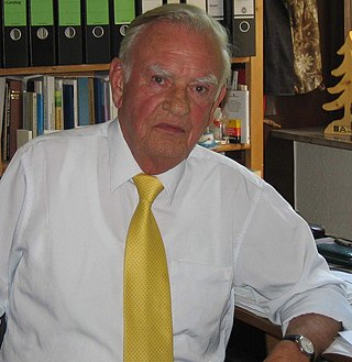
Werner Grübmeyer was a German politician. He was a member of the Christian Democratic Union (CDU).

