
San Antonio, officially the City of San Antonio, is the seventh-most populous city in the United States, and the second-most populous city in both Texas and the Southern United States, with 1,547,253 residents in 2019. Founded as a Spanish mission and colonial outpost in 1718, the city became the first chartered civil settlement in present-day Texas in 1731. The area was still part of the Spanish Empire, and later of the Mexican Republic. It is the state's oldest municipality, having celebrated its 300th anniversary on May 1, 2018.

Bexar County is a county in the U.S. state of Texas. As of the 2010 census, the population was 1,714,773, and a 2019 estimate put the population at 2,003,554. It is the 16th-most populous county in the nation and the fourth-most populated in Texas. Its county seat is San Antonio, the second-most populous city in Texas and the seventh-largest city in the United States.

San Antonio, or unofficially San Ann as the locals call it, is a city in Pasco County, Florida, United States. It is a suburban city included in the Tampa-St. Petersburg-Clearwater, Florida Metropolitan Statistical Area. It lies within Florida's 5th congressional district. The population was 1,138 at the 2010 census. It was established as a Catholic colony by Judge Edmund F. Dunne. The city derives its name from Saint Anthony of Padua. Saint Leo University is located nearby.

Hill Country Village is a city in Bexar County, Texas, United States. The population was 985 at the 2010 census. It is an enclave of San Antonio and is part of the San Antonio Metropolitan Statistical Area. It is the 7th wealthiest location in Texas by per capita income.

Orange Walk District is a district in the northwest of the nation of Belize, with its district capital in Orange Walk Town.

The Pomona Valley is located in the Greater Los Angeles Area between the San Gabriel Valley and San Bernardino Valley in Southern California. The valley is approximately 30 miles east of downtown Los Angeles, which can often be seen from nearby foothills. It ranges from the city of San Dimas from the far west to Rancho Cucamonga to the far east portion of the valley. The alluvial valley is formed by the Santa Ana River and its tributaries.
The Cahuilla, also known as ʔívil̃uqaletem or Ivilyuqaletem, are a Native American people of the various tribes of the Cahuilla Nation, living in the inland areas of southern California. Their original territory included an area of about 2,400 square miles (6,200 km2). The traditional Cahuilla territory was near the geographic center of Southern California. It was bounded to the north by the San Bernardino Mountains, to the south by Borrego Springs and the Chocolate Mountains, to the east by the Colorado Desert, and to the west by the San Jacinto Plain and the eastern slopes of the Palomar Mountains.

Kalayaan, officially the Municipality of Kalayaan, is a 3rd class municipality in the province of Laguna, Philippines. According to the 2015 census, it has a population of 23,269 people.

San Antonio de Oriente is a municipality in the Honduran department of Francisco Morazán.

Bourgoin-Jallieu is a commune in the Isère department in the region of Auvergne-Rhône-Alpes in France. The city had 28,494 inhabitants in 2018 and lies 35 kilometres east-southeast of Lyon. It was formed by the merger of the former communes Bourgoin and Jallieu in 1965.
Thompson is a primarily residential community in San Antonio, Texas. The neighborhood is 6 miles (9.7 km) west of Downtown San Antonio located between U.S. Highway 90 and Port San Antonio, with the Union Pacific railroad tracks and Lackland AFB servings as its east and west boundaries, respectively. Thompson is a collection of individual residential areas that were developed independently over a wide span of time. The area is the gateway to Port San Antonio and saw heaviest development during the 1940s, 50s and 60s. Many residents and families in the community were once stationed at or otherwise employed at the former Kelly AFB which gives the area its strong working-class and military tradition.

San Antonio de Padua, or plainly Padua, is a city in the Greater Buenos Aires, in Argentina. It is located in Merlo Partido. The city has an area of 6.25 km2 (2 sq mi) and a population of around 38,000.
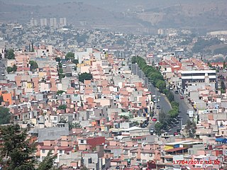
Tultitlán de Mariano Escobedo is the seat of the municipality of Tultitlán located in the northeastern part of the State of México in Mexico. It lies adjacent to the northern tip of the Federal District and is part of the Greater Mexico City urban area. Both the city and the municipality are interchangeably known as San Antonio Tultitlán or simply Tultitlán, a name which comes from Náhuatl meaning "among the tule plants". "de Mariano Escobedo" was added to the city's name in 1902 in honor of the general who fought in the Mexican–American War and for the liberals during the period of La Reforma with Benito Juárez.

San Antonio–New Braunfels is an eight-county metropolitan area in the U.S. state of Texas defined by the Office of Management and Budget (OMB). The metropolitan area straddles South Texas and Central Texas and is on the southwestern corner of the Texas Triangle. The official 2018 U.S. Census estimate showed the metropolitan area's population at 2,550,960—up from a reported 1,711,103 in 2000—making it the 24th largest metropolitan area in the United States. Austin–Round Rock lies about 80 miles northeast of Greater San Antonio.

Alamo Heights is an incorporated city that is surrounded by the city of San Antonio in Bexar County in the U.S. state of Texas. At the time of the 2010 census, the population of Alamo Heights was 7,031. It is part of the Greater San Antonio metropolitan area. A portion of the University of the Incarnate Word is in Alamo Heights.

San Antonio is a village in the Canelones Department of southern Uruguay.

San Isidro is a barangay in Parañaque, Metro Manila, Philippines with a population of 2,582 in 549 households as of the latest census.

San Antonio is a district of the León Cortés Castro canton, in the San José province of Costa Rica.
San Antonio is an administrative division in southern Metro Manila, the Philippines. It is a collection of sixteen gated communities on the east side of Parañaque abutting the city of Muntinlupa, and the informal settlements surrounding them. The barangay is a long strip along the north side of Dr. Santos Avenue stretching from South Luzon Expressway to just west of San Antonio Avenue by the Jaka Plaza commercial center. It is bordered by Marcelo Green to the north, the Muntinlupa village of Sucat across the expressway to the east, BF Homes Parañaque across Dr. Santos Avenue to the south, and San Isidro and Moonwalk to the west. It extends to the northwest along San Antonio Avenue and also shares a border with Don Bosco further north and northwest. The village is part of the Parañaque 2nd district.
