
Southern California is a geographic and cultural region that generally comprises the southern portion of the U.S. state of California. It includes the Los Angeles metropolitan area, the second most populous urban agglomeration in the United States. The region generally contains ten of California's 58 counties: Imperial, Kern, Los Angeles, Orange, Riverside, San Bernardino, San Diego, Santa Barbara, San Luis Obispo and Ventura counties.

San Bernardino County, officially the County of San Bernardino, is a county located in the southern portion of the U.S. state of California, and is located within the Inland Empire area. As of the 2020 U.S. Census, the population was 2,181,654, making it the fifth-most populous county in California and the 14th-most populous in the United States. The county seat is San Bernardino.

Highland is a city in San Bernardino County, California, United States. The population of the city was 53,104 as of the 2010 census, up from 44,605 at the 2000 census. The term Highland also refers to a geographical area of the city of San Bernardino, and parts of unincorporated San Bernardino County. Highland is generally divided into two regions, East Highlands and Highland

Running Springs is a census-designated place (CDP) in San Bernardino County, California, United States. The population was 5,268 at the 2020 census, up from 4,862 at the 2010 census. Running Springs is situated 17 miles west of the city of Big Bear Lake.

San Bernardino is a city and county seat of San Bernardino County, California, United States. Located in the Inland Empire region of Southern California, the city had a population of 222,101 in the 2020 census, making it the 18th-largest city in California. San Bernardino is the economic, cultural, and political hub of the San Bernardino Valley and the Inland Empire. The governments of El Salvador, Guatemala, and Mexico have established the metropolitan area’s only consulates in the downtown area of the city. Additionally, San Bernardino serves as an anchor city to the 3rd largest metropolitan area in California and the 13th largest metropolitan area in the United States; the San Bernardino-Riverside MSA.

California State University, San Bernardino is a public research university in San Bernardino, California. Founded in 1965, it is one of the 23 general campuses of the California State University system. The main campus sits on 441 acres (178 ha) in the University District of San Bernardino, with a branch campus of 40 acres (16 ha) in Palm Desert, California, opened in 1986. Cal State San Bernardino's fall 2020 enrollment was 19,404. In fall 2018, it had 310 full-time faculty, of which 220 were on the tenure track.

The Central Valley Project (CVP) is a federal power and water management project in the U.S. state of California under the supervision of the United States Bureau of Reclamation (USBR). It was devised in 1933 in order to provide irrigation and municipal water to much of California's Central Valley—by regulating and storing water in reservoirs in the northern half of the state, and transporting it to the water-poor San Joaquin Valley and its surroundings by means of a series of canals, aqueducts and pump plants, some shared with the California State Water Project (SWP). Many CVP water users are represented by the Central Valley Project Water Association.

The Cucamonga Valley is a region of southwestern San Bernardino County and northwestern Riverside County, in southern California. It is located below the San Gabriel Mountains in the Inland Empire region.

The San Bernardino Mountains are a high and rugged mountain range in Southern California in the United States. Situated north and northeast of San Bernardino and spanning two California counties, the range tops out at 11,503 feet (3,506 m) at San Gorgonio Mountain – the tallest peak in all of Southern California. The San Bernardinos form a significant region of wilderness and are popular for hiking and skiing.

Arrowhead Springs is a highly mountainous neighborhood in the 81-square-mile (210 km2) municipality of San Bernardino, California, officially annexed to the city on November 19, 2009. The neighborhood lies below the Arrowhead geological monument, which is California Historical Landmark #977.

The Victor Valley is a valley in the Mojave Desert and subregion of the Inland Empire, in San Bernardino County in Southern California.
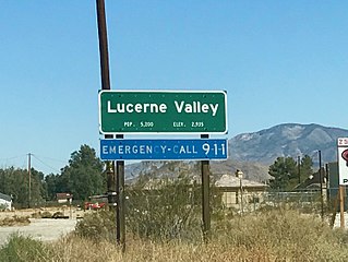
Lucerne Valley is a census-designated place (CDP) and valley landform in the southern Mojave Desert, in western San Bernardino County, California.

The Metropolitan Water District of Southern California is a regional wholesaler and the largest supplier of treated water in the United States. The name is usually shortened to "Met," "Metropolitan," or "MWD." It is a cooperative of fourteen cities, eleven municipal water districts, and one county water authority, that provides water to 19 million people in a 5,200-square-mile (13,000 km2) service area. It was created by an act of the California State Legislature in 1928, primarily to build and operate the Colorado River Aqueduct. Metropolitan became the first contractor to the State Water Project in 1960.

The San Bernardino Valley is a valley in Southern California located at the south base of the Transverse Ranges. It is bordered on the north by the eastern San Gabriel Mountains and the San Bernardino Mountains; on the east by the San Jacinto Mountains; on the south by the Temescal Mountains and Santa Ana Mountains; and on the west by the Pomona Valley. Elevation varies from 590 feet (180 m) on valley floors near Chino to 1,380 feet (420 m) near San Bernardino and Redlands. The valley floor is home to over 80% of the more than 4 million people of the Inland Empire region.

Alta Loma is one of three unincorporated areas that became part of the city of Rancho Cucamonga, California, United States in 1977. The community is located at 34.15°N 117.60°W in the foothills of the south face of the San Gabriel Mountain range, near Cucamonga Peak and Mount San Antonio. Its ZIP codes are 91701 and 91737. Elevation ranges from 1,400 feet (430 m) to 3,000 feet (910 m). The name comes from the Spanish words for "high hill." Alta Loma had previously been known as "Iamosa".
Etiwanda is the easternmost of three formerly unincorporated communities that became part of Rancho Cucamonga, California, in 1977.

San Timoteo Canyon is a river valley canyon southeast of Redlands, in the far northwestern foothills of the San Jacinto Mountains in the Inland Empire region of Southern California.

Crafton is an unincorporated community in San Bernardino County, California, United States, located east of Redlands, south of Mentone and west of Yucaipa, California.

Lake Arrowhead is an artificial lake located in the San Bernardino Mountains on Little Bear Creek, a tributary of Deep Creek and the Mojave River. It has a surface area of approximately 780 acres (320 ha) and a capacity of 48,000 acre⋅ft (59,000 dam3). It is surrounded by the unincorporated community of Lake Arrowhead in San Bernardino County, California.

Conservation Garden Park is located on the grounds of Jordan Valley Water Conservancy District at 8215 South 1300 West, West Jordan, Utah. The project consists of approximately six acres of demonstration gardens and waterwise landscape exhibits and the new Education Center which was completed and opened to the public in summer 2011. The Center is designed to LEED Platinum standards, showcases the best available environmental building technologies, and broadens the theme of the gardens to include conservation of energy and natural resources.

