| San Dimas Biosphere Reserve and Experimental Forest | |
|---|---|
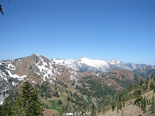
 View down San Dimas Canyon | |
| Location | Angeles National Forest, Los Angeles County, USA |
| Nearest city | Glendora, California |
| Coordinates | 34°12′N117°46′W / 34.200°N 117.767°W |
| Area | 6,495 hectares (25.08 sq mi) |
| Governing body | United States Forest Service |
The San Dimas Biosphere Reserve and Experimental Forest is an experimental forest located in the front range of the San Gabriel Mountains of southern California. San Dimas constitutes a protected field laboratory jointly managed by the Angeles National Forest and the Pacific Southwest Research Station of the United States Forest Service under the designation San Dimas Experimental Forest. It was designated as a UNESCO Biosphere Reserve in 1976 and withdrawn from the programme in July 2018. [1] [2] [3]
An experimental forest, or experimental range, as defined by the United States Forest Service, is "an area administered ... 'to provide for the research necessary for the management of the land.'"

The San Gabriel Mountains are a mountain range located in northern Los Angeles County and western San Bernardino County, California, United States. The mountain range is part of the Transverse Ranges and lies between the Los Angeles Basin and the Mojave Desert, with Interstate 5 to the west and Interstate 15 to the east. This range lies in, and is surrounded by, the Angeles National Forest, with the San Andreas Fault as the northern border of the range.

The Angeles National Forest (ANF) of the U.S. Forest Service is located in the San Gabriel Mountains and Sierra Pelona Mountains, primarily within Los Angeles County in southern California. The ANF manages a majority of the San Gabriel Mountains National Monument.
It encompasses the upper Big Dalton and San Dimas watersheds. The 6,495 hectares (25.08 sq mi) experimental forest was originally established in 1933 and was designated as a biosphere reserve in 1976. [1] [4]
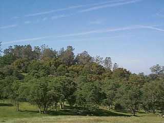
San Dimas is a chaparral-dominated Mediterranean ecosystem. In addition to the chaparral vegetation (including chamise), riparian woodland, sage-buckwheat and barren areas, oak woodland and open yellow pine woodlands are represented. The Fern Canyon Research Natural Area is in the remote eastern part the San Dimas reserve. This 555 hectares (2.14 sq mi) Research Natural Area includes Brown's Flat, a locally unique mountain meadow that supports a relict grove of ponderosa pine (Pinus ponderosa Douglas ex C. Lawson). [4] [5]
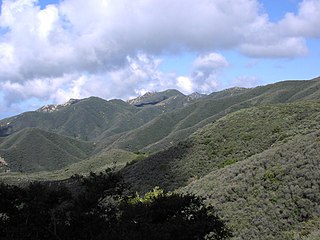
Chaparral is a shrubland or heathland plant community found primarily in the US state of California and in the northern portion of the Baja California Peninsula, Mexico. It is shaped by a Mediterranean climate and wildfire, featuring summer-drought-tolerant plants with hard sclerophyllous evergreen leaves, as contrasted with the associated soft-leaved, drought-deciduous, scrub community of coastal sage scrub, found below the chaparral biome. Chaparral covers 5% of the state of California and associated Mediterranean shrubland an additional 3.5%. The name comes from the Spanish word chaparro, for evergreen oak shrubland.
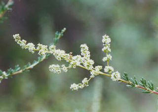
Adenostoma fasciculatum, the chamise or greasewood, is a flowering plant native to Oregon, Nevada, California, and northern Baja California. This shrub is one of the most widespread plants of the chaparral biome.

A riparian forest or riparian woodland is a forested or wooded area of land adjacent to a body of water such as a river, stream, pond, lake, marshland, estuary, canal, sink or reservoir.
In addition to Fern Canyon, the reserve's research facilities include over 50 gauged watersheds, a lysimeter complex, two major dams and reservoirs—San Dimas Dam and Big Dalton Dam—and three plantations of domestic and introduced trees. [5]

A lysimeter is a measuring device which can be used to measure the amount of actual evapotranspiration which is released by plants. By recording the amount of precipitation that an area receives and the amount lost through the soil, the amount of water lost to evapotranspiration can be calculated. Lysimeters are of two types: weighing and non-weighing.

San Dimas Dam is a concrete gravity dam in Los Angeles County, California. The dam and its flood control basin/reservoir are in the San Gabriel Mountains and within the Angeles National Forest. The dam is currently operated by the Los Angeles County Department of Public Works but was originally built by the Los Angeles County Flood Control District in 1922. The dam controls flooding from San Dimas Creek, a major San Gabriel Mountains drainage and tributary of the San Gabriel River. As a flood control facility the San Dimas Reservoir is dry for most of the year, only storing water after significant winter storms. The regulation provided by the dam allows for the efficient diversion of floodwaters from San Dimas Wash to Puddingstone Reservoir, which protects the San Dimas area of the San Gabriel Valley.

Big Dalton Dam is a multiple arch concrete dam in Los Angeles County, California, built for the Los Angeles County Flood Control District and completed in August 1929. The dam is one of the earliest of the multiple arch "double-wall" buttress designs of engineer Fred A. Noetzli. The 991 acre-foot dam provides water conservation and controls flooding from Big Dalton Canyon, a watershed within the San Dimas Experimental Forest, part of the Angeles National Forest in the San Gabriel Mountains. It is about 4 miles northeast of the city of Glendora and is operated by the Los Angeles County Department of Public Works.
Studies at San Dimas have provided valuable information on air pollution, fire effects, erosion, hydrology, and plants and animals in southern California watersheds. The area also provides opportunities for ecological research to many nearby colleges, universities and governmental agencies. [2]

Hydrology is the scientific study of the movement, distribution, and quality of water on Earth and other planets, including the water cycle, water resources and environmental watershed sustainability. A practitioner of hydrology is a hydrologist, working within the fields of earth or environmental science, physical geography, geology or civil and environmental engineering. Using various analytical methods and scientific techniques, they collect and analyze data to help solve water related problems such as environmental preservation, natural disasters, and water management.
Wildfires have frequently burned through the San Dimas area, most recently when the Williams Fire burned much of the forest in September 2002. [4]

A wildfire or wildland fire is a fire in an area of combustible vegetation occurring in rural areas. Depending on the type of vegetation present, a wildfire can also be classified more specifically as a brush fire, bushfire, desert fire, forest fire, grass fire, hill fire, peat fire, vegetation fire, or veld fire.
The forest is currently closed for the general public, except under special written permit. No hunting or other recreational activities are currently allowed. [2]


