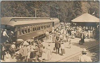
Fortuna is a city on the northeast shore of the Eel River, and is on U.S. Route 101 in west-central Humboldt County, California, United States. The population was 12,516 at the 2020 census, up from 11,926 at the 2000 census.

The Navarro River is a 28.3-mile-long (45.5 km) river in Mendocino County, California, United States. It flows northwest through the Coastal Range to the Pacific Ocean. The main stem of the Navarro River begins less than 1 mile (2 km) south of the town of Philo at the confluence of Rancheria Creek and Anderson Creek. The mouth of the Navarro is 10 miles (16 km) south of the city of Mendocino. State Route 128 starts from the intersection of State Route 1 at the mouth of the Navarro River, and follows the river valley upstream to Philo. The river is close to the highway through the lower canyon but is some distance south of the highway as the Anderson Valley widens upstream of Wendling.

The Northwestern Pacific Railroad is a railroad covering the 62 mi (100 km) stretch between Schellville and Windsor with freight and Sonoma–Marin Area Rail Transit (SMART) commuter trains. Formerly, it was a regional railroad primarily used for logging that served the entire North Coast of California, with a main line running 271 miles (436 km) from Schellville to Eureka, along with an additional portion of the line running from the Ignacio Wye to the edge of San Rafael. The portion of the NWP main line between the Larkspur Station in Marin County and the depot in Healdsburg is currently owned by SMART. The Schellville–Ignacio and Healdsburg–Eureka portions are owned by the North Coast Railroad Authority (NCRA). Private contractor NWPco operates freight service under NCRA lease. California's 2018 Great Redwood Trail Act repurposes the abandoned railroad right-of-way from Eureka to the San Francisco Bay in Marin County for future use as the "Great Redwood Trail" rail-trail.

The Arcata and Mad River Railroad, founded in 1854, was the oldest working railroad in California. It operated on a unique narrow gauge until the 1940s when standard gauge rails were laid. Service ceased in 1983 due to landslides. It is California Historical Landmark #842.
The Pacific Lumber Company, officially abbreviated PALCO, and also commonly known as PL, was one of California's major logging and sawmill operations, located 28 miles (45 km) south of Eureka and 244 miles (393 km) north of San Francisco. Begun in 1863, PALCO was carefully managed over most of the twentieth century by generations of the Simon J. Murphy, Sr. Family or managers chosen by the Murphys from 1905 through 1985. Primary operations existed in massive log storage and milling operations at the historic company town of Scotia, California, located adjacent to US 101 along the Eel River. Secondary mills were located in nearby Fortuna and Carlotta. PALCO had extensive timber holdings exceeding well over 200,000 acres (890 km²) in the Redwood and Douglas-Fir forests of Humboldt County. For generations, it was one of the largest private employers in the entire region, appropriately known as the Redwood Empire.

The Albion River is an 18.1-mile-long (29.1 km) river in Mendocino County, California. The river drains about 43 square miles (110 km2) on the Mendocino Coast and empties into the Pacific Ocean near the town of Albion, California, where California State Route 1 crosses it on the Albion River Bridge. The river's overall direction is east to west, but it moves significantly in the north-south direction. The tributaries of the river include Railroad Gulch, Pleasant Valley Creek, Duck Pond Gulch, South Fork Albion River, Tom Bell Creek, North Fork Albion River, and Marsh Creek. The river's most inland point is only 15 miles (24 km) from the coast, and its highest elevation is about 1,570 feet (480 m) above sea level. There is a large estuary at the mouth of the river, and tidal waters travel up to 5 miles (8 km) upstream. The Albion River was previously used to power a sawmill on the river mouth, but there are no major dams or reservoirs on the river. The river provides recreation, groundwater recharge and industrial water supply for the community of Albion, and wildlife habitat including cold freshwater habitat for fish migration and spawning.

The North Pacific Coast Railroad (NPC) was a common carrier 3 ft narrow-gauge steam railroad begun in 1874 and sold in 1902 to new owners who renamed it the North Shore Railroad (California) (NSR) and which rebuilt the southern section into a standard-gauge electric railway.

Loleta is a census-designated place in Humboldt County, California. Loleta is located 5.5 miles (9 km) south of Fields Landing, and 15 miles (24 km) south of Eureka at an elevation of 46 feet (14 m). The population was 783 at the 2010 census. Residents live in a central community area and rural outskirts. There are two separate Native American reservations on the rural outskirts of Table Bluff, California.

Scotia, formerly known as Forestville until 1888, is a census-designated place in Humboldt County, California. It is located on the Eel River along U.S. Route 101, 8.5 miles (13.7 km) southeast of Fortuna and 244 miles (393 km) north of San Francisco. Scotia has a population of 850.
Alton is an unincorporated community in Humboldt County, California. It is located 3.5 miles (5.6 km) south-southeast of Fortuna, at an elevation of 62 feet. Alton is located along U.S. Route 101 and State Route 36. The ZIP Code is 95540. The community is inside area code 707.

San Francisco and North Pacific Railroad (SF&NP) provided the first extensive standard gauge rail service to Sonoma County and became the southern end of the regional Northwestern Pacific Railroad. Although first conceived of by Asbury Harpending, who had even obtained many of the right of ways, the SF & NP was bought and subsequently constructed by Peter Donahue, who drove the first spike on August 30, 1869.

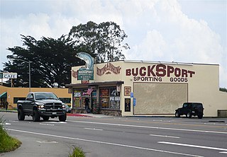
Bucksport was a town in Humboldt County, California. The original location was 2.5 miles (4 km) southwest of downtown Eureka, on Humboldt Bay about 5 miles (8 km) northeast of entrance. at an elevation of 16 feet (4.9 m). Prior to American settlement a Wiyot village named Kucuwalik stood here.

Crannell is a former settlement in Humboldt County, California. It is located 4.5 miles (7.2 km) southeast of Trinidad, at an elevation of 203 feet (62 m).

Andersonia is an unincorporated community in Mendocino County, California. It is located near U.S. Route 101 on the South Fork of the Eel River 1 mile (1.6 km) north-northwest of Piercy, at an elevation of 541 feet.

Scotia Bluffs form a 2-mile (3-kilometer) series of gray sandstone cliffs along the north bank of the Eel River near Rio Dell, California.

The Fort Bragg and Southeastern Railroad was formed by Atchison, Topeka and Santa Fe Railway as a consolidation of logging railways extending inland from Albion, California on the coast of Mendocino County. The railroad and its predecessors operated from August 1, 1885 to January 16, 1930. The line was merged into the regional Northwestern Pacific Railroad in 1907; but planned physical connection was never completed.
Southern Pacific Transportation Company formed the Oregon and Eureka Railroad in 1903 in an agreement to use logging railroads as part of a line connecting Humboldt County (California) sawmills with the national rail network. Northwestern Pacific Railroad offered service over the route from 1911 through 1933. The northern 6-mile (9.7 km) of the line remained in use as a Hammond Lumber Company logging branch until 1948.

The Eel River and Eureka Railroad company was organized on November 14, 1882, by a group of Eureka businessmen led by John M. Vance. One of the other founders of the line was William Carson.
Hammond Lumber Company was a logging and resource extraction company operating in Humboldt County, CA.


