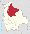
Carrasco is a province in the Cochabamba Department in central Bolivia. Its capital is Totora.

Quillacollo is a province in the Cochabamba Department, Bolivia. It is known for its festival in August where people from all over Bolivia come and pay homage to the Virgin of Urqupiña. Quillacollo is said to be one of the fastest growing cities in Bolivia.

Belisario Boeto is a province in the Bolivian department of Chuquisaca.

Tomina is a province in the Chuquisaca Department in Bolivia. Its seat is Padilla.

Gerlache Strait or de Gerlache Strait or Détroit de la Belgica is a channel/strait separating the Palmer Archipelago from the Antarctic Peninsula. The Belgian Antarctic Expedition, under Lt. Adrien de Gerlache, explored the strait in January and February 1898, naming it for the expedition ship Belgica. The name was later changed to honor the commander himself.

Cercado is a province located in northwestern Bolivia in Beni Department. It has an area of 12,276 km ² with a population estimated by the National Institute of Statistics of Bolivia for 2006 of 94,221 and a density of 7.67 people / km ². Its capital is the city of Trinidad.
Hernando Siles is a province of the department of Chuquisaca, Bolivia. In the 2001 census it had a population of 36,511. It covers an area of 5,473 km², giving it a population density of 6.67/km². Its capital is Monteagudo.
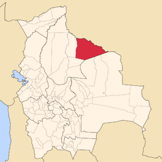
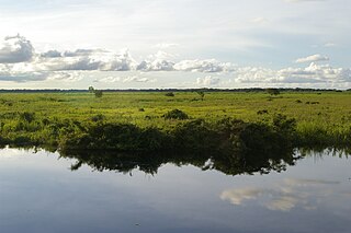
Iténez is a province in the Beni Department, Bolivia.
Marbán is a province in the Beni Department, Bolivia. The capital is Loreto.

Guarayos is a province in the northwestern parts of the Bolivian Santa Cruz Department.

Trinidad Municipality is located in Beni Department in Bolivia.
Manuel María Caballero Province is one of the fifteen provinces of the Bolivian Santa Cruz Department and is situated in the department's western parts. The province name honors deputy Manuel María Caballero from Vallegrande, one of the signatories of the Bolivian constitution of 5 August 1861.

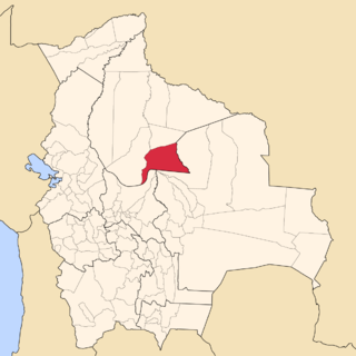
Ichilo is one of the fifteen provinces of the Bolivian Santa Cruz Department and is situated in the department's north-western parts. The province was founded by a decree of 8 April 1926 and is named after Río Ichilo which is forming the province border in the West.
San Andrés Municipality is a municipality of the Beni Department, Bolivia.

Chimoré Municipality is the fourth municipal section of the Carrasco Province in the Cochabamba Department, Bolivia. Its seat is Chimoré.
Pasorapa Municipality is the second municipal section of the Narciso Campero Province in the Cochabamba Department, Bolivia. Its seat is Pasorapa.
Pojo Municipality is the second municipal section of the Carrasco Province in the Cochabamba Department, Bolivia. Its seat is Pojo.
Puerto Villarroel Municipality is the fifth municipal section of the Carrasco Province in the Cochabamba Department, Bolivia. Its seat is Puerto Villarroel.
Villa Serrano is a small town in the Chuquisaca Department, Bolivia. It is the seat of the Belisario Boeto Province. At the time of census 2001 it had 2,877 inhabitants.
Entre Ríos Municipality is the sixth municipal section of the Carrasco Province in the Cochabamba Department in central Bolivia. Its seat Entre Ríos had 3,796 inhabitants at the time of census 2001.