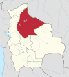
Rurrenabaque is a small town in the north of Bolivia, on the Beni River. It is the capital of Rurrenabaque Municipality. In recent years, it has become popular with international tourism as it is an easy gateway for visits to Madidi National Park, which is within the Bolivian rainforest. It also provides access to the surrounding pampas. Locals commonly refer to the town by its shortened nickname, "Rurre."

Trinidad, officially La Santísima Trinidad, is a city in Bolivia, capital of the department of Beni. The population is 130,000. While historically a peripheral city in Bolivia, Trinidad is today an important center for the Bolivian Bovine industry and has enjoyed a modest economic boom in recent years and has an HDI index of above 0.700.

Cobija is a city in Bolivia, capital of the department of Pando, and is located about 600 km (373 mi.) north of La Paz in the Amazon Basin on the border with Brazil. Cobija lies on the banks of the Rio Acre across from the Brazilian city of Brasiléia. Cobija lies at an elevation of ca. 280 m (920 ft.) above sea level and has a tropical and rainy climate.
Puerto Suárez is an inland river port and municipality in Santa Cruz Department, Bolivia. It is located 10 km west of the border with Brazil.

Mizque, Misk'i is a town in the Cochabamba Department, Bolivia. It is the capital of the Mizque Province. Mizque is located in the valley of the Mizque River, one of the main tributaries of the Río Grande.

Punata is the capital of Punata Province and Punata Municipality in Cochabamba Department, Bolivia. At the time of census 2012 it had a population of 19,559 inhabitants and at the census 2012 the populations rose to 28.707 inhabitants. People from Punata and surrounding areas used to be called “Vallunos” meaning coming from the valleys of Punata and other surrounding small towns. Punata is renowned for its wonderful agricultural market held every Tuesday where people from surrounding towns and rural villages come to sell and buy.
Villamontes or Villa Montes is a town in the Tarija Department in south-eastern Bolivia.
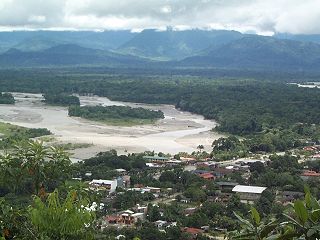
Villa Tunari or Tunari is a location in the department of Cochabamba, Bolivia. It is the seat of the Villa Tunari Municipality, the third municipal section of the Chapare Province. According to the census 2012 the population was 3,213 in the town which is an increment from 2,510 registered during the 2001 census.

San Ignacio de Velasco, is the capital of the José Miguel de Velasco Province and the San Ignacio de Velasco Municipality in the Santa Cruz Department of Bolivia.

Yacuiba is a city in southern Bolivia and the capital city of Gran Chaco Province in the Tarija Department. It lies three kilometers from the Argentine border. It has a population of approximately 80,000 and lies 620 to 680 m (2,034–2,231 ft) above sea level. Yacuiba is one of the cities of fast growth population in Bolivia due to the commerce and boom in hydrocarbon exploitation. It was part of Salta Province of Argentina until its cession to Bolivia in 1900.

San Borja is a city in the Beni Department in northern Bolivia, It is the most populous city in the province of General José Ballivián.
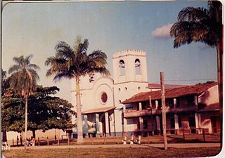
Magdalena is a town on the Itonomas River in the Beni Department in northern Bolivia, capital of the Iténez Province and the Magdalena Municipality.
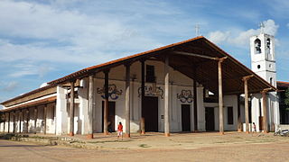
San Ignacio de Moxos is a town in the Beni Department of northern Bolivia.

Concepción is a town in the lowlands of eastern Bolivia. It is known as part of the Jesuit Missions of Chiquitos, declared in 1990 a World Heritage Site, as a former Jesuit Reduction.

Monteagudo is a small town in South Eastern Bolivia. Its name is dedicated to Bernardo de Monteagudo Cáceres (1789-1825) who took part in the Chuquisaca revolution of 25 May 1809.

San Joaquín is a small agricultural town in the Beni Department in the Bolivian lowlands.
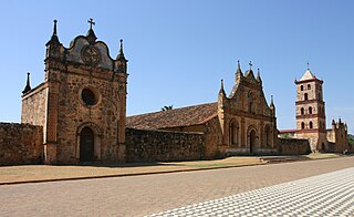
San José de Chiquitos, or simply San José, is the capital of Chiquitos Province in the Santa Cruz Department, Bolivia. It is known as part of the Jesuit Missions of the Chiquitos, which is declared in 1990 a World Heritage Site, as a former Jesuit Reduction.

San Javier is the seat of San Javier Municipality in Ñuflo de Chávez Province, Santa Cruz Department, Bolivia. The mission of San Javier is known as part of the Jesuit Missions of the Chiquitos, declared in 1990 a World Heritage Site, as a former Jesuit Reduction.
San Ramón is a small town in the Beni Department in Bolivia.
Abapó is a town in the Santa Cruz Department of Bolivia. The town is just short of the eastern foothills of the Andes mountains, and on the north bank of the Rio Grande, which runs east then turns north to drain into the Amazon Basin.


