Related Research Articles

Quesnel is a city located in the Cariboo Regional District of British Columbia, Canada. Located nearly evenly between the cities of Prince George and Williams Lake, it is on the main route to northern British Columbia and the Yukon. Quesnel is located at the confluence of the Fraser and Quesnel Rivers. Quesnel's metropolitan area has a population of 23,146 making it the largest urban center between Prince George and Kamloops.

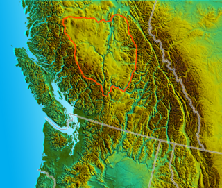
The Cariboo is an intermontane region of British Columbia, Canada, centered on a plateau stretching from Fraser Canyon to the Cariboo Mountains. The name is a reference to the caribou that were once abundant in the region.

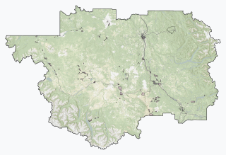
The Cariboo Regional District spans the Cities and Districts of Quesnel, Williams Lake, 100 Mile House, and Wells in the Central Interior of British Columbia.
Williams Lake Indian Reserve, also called the Williams Lake Band Reservation and commonly referred to locally as the Sugarcane Reserve, aka Sugarcane or The Cane or SCB, is an Indian Reserve in British Columbia, Canada, located at the east end of Williams Lake and 12 km east of the city of the same name, on the right bank of the San Jose River. and is home to the Williams Lake Indian Band. The band is part of the Northern Shuswap Tribal Council, also known as the Cariboo Tribal Council, which is one of two tribal councils of the Secwepemc peoples.
Cariboo River Provincial Park is a provincial park in British Columbia, Canada, located between Barkerville and Likely in the upper Cariboo River basin.
Junction Sheep Range Provincial Park is a provincial park in British Columbia, Canada, located near the confluence of the Chilcotin and Fraser Rivers on the west bank of the latter river.

Likely is a community in British Columbia, Canada. It is located in the Cariboo region of the province, and is situated where the west arm of Quesnel Lake empties into the Quesnel River. Roads from Likely lead southwest to Williams Lake, northwest to Quesnel, south to Horsefly, and north to Barkerville. Likely is in the Quesnel Highland, a transition zone between the Cariboo Plateau and the Cariboo Mountains.

Stanley was a gold rush town in the Cariboo region of British Columbia that began during the Cariboo Gold Rush.

Highway 316 is a highway in the Canadian province of Saskatchewan. It runs from Highway 16 near Clavet to Highway 5. Highway 316 is about 17 km (11 mi.) long. This area is an industrial commercial area along Highway #316 which extends from Clavet north to the PCS Patience Lake Mine which is just 10 miles from the city of Saskatoon. Highway 316 is a primary weight highway, and also runs near the Canadian National Railway line which goes from Saskatoon through Clavet. In 1941, the Canadian Pacific Railway ran from Saskatoon through Cheviot and on south eastward.
The Williams Lake First Nation is a First Nations government of the Secwepemc (Shuswap) Nation, located in the Cariboo region of the Central Interior region of the Canadian province of British Columbia, at the city of Williams Lake. It was created when the government of the then-Colony of British Columbia established an Indian Reserve system in the 1860s. It is a member government of the Northern Shuswap Tribal Council. Its main Indian Reserve is Williams Lake Indian Reserve No. 1, a.k.a. "Sugarcane" or "The Cane" or "SCB".
The Esk'etemc First Nation, also known as the Alkali Lake Indian Band, is a First Nations government of the Secwepemc (Shuswap) people, located at Alkali Lake in the Cariboo region of the Central Interior of the Canadian province of British Columbia. It was created when the government of the then-Colony of British Columbia established an Indian Reserve system in the 1860s. It is one of three Secwepemc bands that is not a member of either the Shuswap Nation Tribal Council or the Northern Shuswap Tribal Council.
The Tl'etinqox-t'in Government Office is a First Nations government located in the Chilcotin District in the western Central Interior region of the Canadian province of British Columbia. Governing a reserve communities near Alexis Creek known as Anaham Reserve First Nations or Anaham, it is a member of the Tsilhqot'in Tribal Council aka known as the Tsilhqot'in National Government. The main reserve is officially known as Anahim's Flat No. 1, and is more commonly as Anaham. Other reserves are Anahim's Meadow No. 2 and 2A, and Anahim Indian Reserves Nos. 3 through 18. Anaham, or Anahim and Alexis were chiefs of the Tsilhqot'in during the Chilcotin War of 1864, although they and their people did not take part in the hostilities.
Brandywine Creek, also formerly known as the Long John River after a local prospector and trapper, is a tributary of the Cheakamus River in the Pacific Ranges of the Coast Mountains in British Columbia, Canada, entering that stream via Daisy Lake, just below Brandywine Falls. The creek is about 14 km in length and originates on the south slope of Brandywine Mountain in Brandywine Meadows, at the southern end of the Powder Mountain Icefield and is the next basin immediately southwest of that of the Callaghan Valley, the site of the Nordic events facility for the 2010 Olympics. The creek's valley has been partially logged. An unnamed hot spring lies in its upper reaches, near Mount Fee.
Cottonwood River is a tributary of the Fraser River in the Central Interior of British Columbia, Canada. Rising at the confluence of the Swift River and Lightning Creek at Coldspring House in the Cariboo goldfields of the northern Cariboo Plateau, it flows northwest and then turns southwest to join the Fraser just north of the city of Quesnel, which is at the confluence of the Quesnel River with the Fraser.
Cottonwood Canyon is a canyon along the Fraser River in the North Cariboo region of the Central Interior of British Columbia, Canada. It is located west of the Cariboo Mountains on the Fraser River south of its confluence with the east-flowing West Road River and north of its confluence with the northwest-flowing Cottonwood River just northwest of the city of Quesnel, The first European explorer was Simon Fraser (explorer) who ran the rapids on the first of June, 1808. One of his canoes became stranded and had to be pulled out of the canyon with a rope. It was one of the obstacles for gold rush-era steamboats operating on the Fraser from Quesnel to Fort George and up the Nechako and Stuart Rivers to Stuart Lake.
The Leq' a: mel First Nation, formerly known as the Lakahahmen First Nation, is a First Nations band government whose community and offices are located in the area near Deroche, British Columbia, Canada, about 12 kilometres east of the District of Mission. They are a member government of the Sto:lo Nation Chiefs Council, which is one of two tribal councils of the Sto:lo.

Williams Lake is a lake in the city of the same name in the Cariboo region of the Central Interior of British Columbia, Canada. Williams Lake Indian Reserve No. 1, a.k.a. "Sugarcane Reserve" is located around the east end of the lake. British Columbia provincial highway 97, the Cariboo Highway, runs along the lake's northern side.
Lindell Beach is a rural farming village in the Columbia Valley of the Lower Mainland region of the province of British Columbia, Canada, lying south of the City of Chilliwack. It is located at the south end of Cultus Lake which is the main waterbody in the Columbia Valley in the South Fraser Valley, and just north of the boundary of the United States.
The Lillooet Land District is one of the 59 cadastral subdivisions of British Columbia, which were created by the Lands Act of the Colony of British Columbia in 1859, defined as "a territorial division with legally defined boundaries for administrative purposes". The land district's boundaries came to be used as the boundary of the initial Lillooet riding for the provincial Legislature from 1871, when the colony became a province. In addition to use in descriptions of land titles and lot surveys, the Land District was also the basis of the Lillooet Mining District.
The Cariboo Land District is a cadastral survey subdivision of the province of British Columbia, Canada, created with rest of those on Mainland British Columbia via the Lands Act of the Colony of British Columbia in 1860. The British Columbia government's BC Names system, a subdivision of GeoBC, defines a land district as "a territorial division with legally defined boundaries for administrative purposes" All land titles and surveys use the Land District system as the primary point of reference, and entries in BC Names for placenames and geographical objects are so listed.
References
- ↑ "John Tresierra". Williams Lake Tribune. Black Press Media. September 24, 2006. Retrieved 20 August 2021.
- ↑ Whitehead, Margaret (1981). The Cariboo Mission: The History of the Oblates. Victoria, British Columbia: Sono Nis Press. p. 45.
Coordinates: 52°07′00″N122°02′00″W / 52.11667°N 122.03333°W