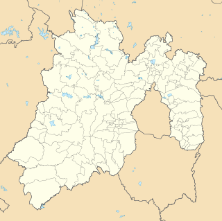
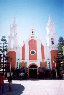
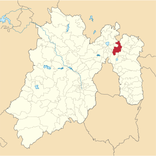
Teoloyucan is a city and municipality located in State of Mexico, Mexico. It lies 45 km north of the Federal District in the northeastern part of the state of México, and is part of the Greater Mexico City urban area. During the colonial period the area's name had a number of variations, including Teohuilloyocan, Teohuilloyucan, Theoloyucan, Teoloyucan Coaquileque and Tehuilloyocan. The name comes from Nahuatl meaning place of glass or place of crystal rock.

Zumpango is a municipality located to northeastern part of the state of Mexico in Zumpango Region. It lies directly north of the Mexico City within the Greater Mexico City urban area. This area is under rapid development large scale housing projects; however, transportation and other infrastructure have not kept up with the growing population. The city of Zumpango lies near Lake Zumpango, the last of the five interconnected lakes which covered much of the Valley of Mexico in the pre Hispanic period. The name Zumpango is derived from the Nahuatl word “Tzompanco” which means string of scalps.

Zumpango de Ocampo is a city and the municipal seat of municipality of Zumpango, State of Mexico and it is also the regional seat of the Zumpango Region, an administrative sub-division. It is currently an important urban center of the state and according to the 2010 census, it had a total population of 50,742 inhabitants.

Tequixquiac is a municipality located in the Zumpango Region of the State of Mexico in Mexico. The municipality is located 84 kilometres (52 mi) north of Mexico City within the valley that connects the Valley of Mexico with the Mezquital Valley. The name comes from Nahuatl and means "place of tequesquite waters". The municipal seat is the town of Santiago Tequixquiac, although both the town and municipality are commonly referred to as simply "Tequixquiac".

Huehuetoca is a municipio (municipality) in State of Mexico, central Mexico, and also the name of its largest town and municipal seat.

Eduardo Neri is one of 81 municipalities of Guerrero, in south-western Mexico. The municipal capital is Zumpango del Río. The municipality covers an area of 1289.6 km².

Zumpango del Río is the capital of Eduardo Neri Municipality, within the state of Guerrero, in central−western Mexico.

Apaxco is a municipality located in the Zumpango Region in Mexico. The municipal territory is located at a southern pass leading out of the Mezquital Valley about 288 km (179 mi) northeast of the state capital of Toluca. The name Apaxco comes from Nahuatl.

Jaltenco is the municipality located in Zumpango Region, a small municipality on this region, covers an area of 4.7 km², this territory is in the northeastern part of the state of Mexico in Mexico. The municipal seat is San Andrés Jaltenco, although both are commonly called only San Andrés. The municipality is located at a northern pass leading out of the Valley of Mexico to 60 kilometers north of Mexico City and about 200 km northeast of the state capital of Toluca.

Melchor Ocampo is a town and municipality in State of Mexico, Mexico. The municipality covers an area of 32.48 km².

Tecámac is a municipality in State of Mexico in Mexico. The municipality covers an area of 157.34 km². The municipal seat lies in the town (locality) of Tecámac de Felipe Villanueva. Its largest town, Ojo de Agua, with a population of 242,283 inhabitants, is the largest locality in Mexico that is not a municipal seat.

Zitlaltepec de Trinidad Sánchez Santos is a municipality in Tlaxcala in south-eastern Mexico.

The 2011 Zumpango earthquake occurred at 19:47 local time on 10 December with a moment magnitude of 6.5 and a maximum Mercalli intensity of VII. Its epicenter was located in the city Zumpango, Guerrero, roughly equidistant between the metropolitan areas of Mexico City and Acapulco. The quake was felt in Guerrero, Michoacán, Mexico State, Mexico City and Puebla.

Hueypoxtla is the municipality located in Zumpango Region, the northeastern part of the state of Mexico in Mexico. The municipality is located at a northern pass leading out of the Valley of Mexico and Mezquital Valley to—kilometers north of Mexico City and about km northeast of the state capital of Toluca. The name comes from Nahuatl and means "place of great merchants".

Zumpango is a region, located in the north of the State of Mexico in the country of the same name. It is also known as the Region XVI Zumpango and has seen major population growth. It has a surface area of 8.305 km² and occupies 12.8% of the state's territory. The seat of Zumpango Region is Zumpango de Ocampo city.

The Circuito Exterior Mexiquense literally, "Outer Loop of the State of Mexico", also known as the Vía Mexiquense or "'Autopista mexiquense'" is a series of toll roads constructed between 2006 and 2011 by the State of Mexico government, providing an option for motorists to skirt the edge of Greater Mexico City when driving between areas in the State of Mexico to the northwest of Mexico City, northeast of Mexico City and east of Mexico City. Portions carry the Mexican Federal Highway 57D designation, and others carry the State of Mexico State Highway 5D designation.
XHZUM-FM is a radio station in Zumpango on 88.5 MHz, owned by the government of the State of Mexico. It is part of the Radio Mexiquense state radio network.

Lake Zumpango was an endorheic lake formerly located in the Valley of Mexico. It was important area for Mesoamerican cultural development in central Mexico.
Teotlalpan was the pre-Columbian name of a region in the north of Valley of Mexico comprising what is today the Mezquital Valley in the state of Hidalgo and adjacent areas in the State of Mexico. The region was one of two regions settled by Otomí people, the other being the region around Jilotepec and Tula, Hidalgo.. In the 18th century the name of the main part of the region came to be known as Mezquital.

Santa Lucía is a town located in the State of Mexico in Mexico. It belongs to the municipality of Zumpango, being located at its southeast end, within the facilities of the Mexico City Santa Lucía Airport.


