Sanderson is an unincorporated community in Baker County, Florida, United States. The main road through Sanderson is U.S. Route 90, which is intersected by County Roads 229 and 127. Sanderson is also the headquarters of the Baker County Road Department. The town was named after John Pease Sanderson.

Berlin Center is an unincorporated community in central Berlin Township, Mahoning County, in the U.S. state of Ohio. It lies east of the Berlin Lake reservoir.

Damascus is an unincorporated community and census-designated place in southern Mahoning and northern Columbiana counties in the U.S. state of Ohio. As of the 2020 census, it had a population of 418. The community lies at the intersection of U.S. Route 62 and State Routes 173 and 534.
Sanderson is an unincorporated community in Kanawha County, West Virginia, United States.
"Batman and Robin Have an Altercation" is a short story by the American author Stephen King. It was originally published in the September 2012 issue of Harper's Magazine, and later collected in King's short fiction collection The Bazaar of Bad Dreams in 2015.
Blanco is an unincorporated community in Mahoning County, in the U.S. state of Ohio.
Garfield is an unincorporated community in Mahoning County, in the U.S. state of Ohio.
Knaufville is an unincorporated community in Mahoning County, in the U.S. state of Ohio.
New Buffalo is an unincorporated community in Mahoning County, in the U.S. state of Ohio.
Patmos is an unincorporated community in Mahoning County, in the U.S. state of Ohio.
Rosemont is an unincorporated community in Mahoning County, in the U.S. state of Ohio.

Doyleville is an unincorporated community in Gunnison County, in the U.S. state of Colorado. It is located 19 miles (31 km) east of Gunnison on U.S. Highway 50.

Barneston is an extinct town in King County, in the U.S. state of Washington. The GNIS classifies it as a populated place.
Hillhurst is an extinct town in Pierce County, in the U.S. state of Washington.
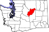
Kerriston is an extinct town in King County, in the U.S. state of Washington. The GNIS classifies it as a populated place.
Raeco is an unincorporated community in King County, in the U.S. state of Washington.
Reiter is an unincorporated community in Snohomish County, in the U.S. state of Washington.
Robe is an unincorporated community in Snohomish County, in the U.S. state of Washington.
Rockdale is an extinct town in the northwest United States, in King County, Washington. The GNIS classifies it as a populated place.
White is an unincorporated community in King County, in the U.S. state of Washington.