Saint Andrews, Washington | |
|---|---|
 Saint Andrews  Saint Andrews | |
| Coordinates: 47°41′59″N119°25′35″W / 47.69972°N 119.42639°W | |
| Country | United States |
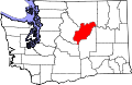
| State | Washington |
| County | Douglas |
| Established | 1890 |
| Elevation | 2,238 ft (682 m) |
| Time zone | UTC-8 (Pacific (PST)) |
| • Summer (DST) | UTC-7 (PDT) |
| GNIS feature ID | 1511287 [1] |
Saint Andrews is an unincorporated community in Douglas County, in the U.S. state of Washington.