Douglas | |
|---|---|
 | |
| Coordinates: 47°37′19″N120°00′09″W / 47.62194°N 120.00250°W [1] | |
| Country | United States |
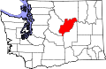
| State | Washington |
| County | Douglas |
| Elevation | 2,379 ft (725 m) |
| ZIP code | 98858 |
| Area code | 509 |
| FIPS code | 17-18440 |
| GNIS feature ID | 1518894 [1] |
Douglas is an unincorporated community located in Douglas County, Washington, east of Waterville. [2] Established in 1883, it is home to approximately 30 residents.[ citation needed ]