Withrow, Washington | |
|---|---|
 Withrow and hills that comprise the terminal moraine for the Okanagan lobe of the Cordilleran Ice Sheet | |
 Withrow | |
| Coordinates: 47°42′17.5″N119°48′31.2″W / 47.704861°N 119.808667°W | |
| Country | United States |
| State | Washington |
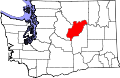
| County | Douglas |
| Elevation | 2,526 ft (770 m) |
| Time zone | UTC-8 (Pacific (PST)) |
| • Summer (DST) | UTC-7 (PDT) |
| Area code | 509 |
| GNIS feature ID | 1512810 [1] |
Withrow is an unincorporated community in Douglas County, Washington, United States. The town is named for J.J. Withrow, a cattleman. [2]