National nature reserves in England were established by English Nature, now Natural England, which manages them either directly or through non-governmental organisations such as the Royal Society for the Protection of Birds or the National Trust.

Holkham National Nature Reserve is England's largest national nature reserve (NNR). It is on the Norfolk coast between Burnham Overy Staithe and Blakeney, and is managed by Natural England with the cooperation of the Holkham Estate. Its 3,900 hectares comprise a wide range of habitats, including grazing marsh, woodland, salt marsh, sand dunes and foreshore. The reserve is part of the North Norfolk Coast Site of Special Scientific Interest, and the larger area is additionally protected through Natura 2000, Special Protection Area (SPA) and Ramsar listings, and is part of both an Area of Outstanding Natural Beauty (AONB) and a World Biosphere Reserve. Holkham NNR is important for its wintering wildfowl, especially pink-footed geese, Eurasian wigeon and brant geese, but it also has breeding waders, and attracts many migrating birds in autumn. Many scarce invertebrates and plants can be found in the dunes, and the reserve is one of the only two sites in the UK to have an antlion colony.

The natterjack toad is a toad native to sandy and heathland areas of Europe and the United Kingdom. Adults are 60–70 mm (2.4–2.8 in) in length, and are distinguished from common toads by a yellow line down the middle of the back and parallel paratoid glands. They have relatively short legs, which gives them a distinctive gait, contrasting with the hopping movement of many other toad species.

Gibraltar Point national nature reserve is an area of about 4.3 km2 (1.7 sq mi) on the coast of Lincolnshire, England.

The Duddon Estuary is the sandy, gritty estuary of the River Duddon that lies between Morecambe Bay and the North Lonsdale coast.
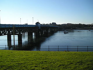
Walney Island, also known as the Isle of Walney, is an island off the west coast of England, at the western end of Morecambe Bay in the Irish Sea. Within the boundaries of the historic county of Lancashire, it is part of Barrow-in-Furness, separated from the mainland by Walney Channel, which is spanned by the Jubilee Bridge. Walney is the largest island of the Furness Islands group, both in population and size, as well as the largest English island in the Irish Sea. Its population at the 2011 UK Census was 10,651, distributed evenly across the island's two Wards of Walney North and Walney South.

Hodbarrow RSPB Reserve is a nature reserve run by the Royal Society for the Protection of Birds (RSPB) on the edge of the Lake District National Park in Cumbria, England. It is on the Duddon Estuary near the town of Millom and covers an area of 3.28 hectares.
Arnside and Silverdale National Landscape in England, is on the border between Lancashire and Cumbria, adjoining Morecambe Bay. One of the smallest National Landscapes, it covers 29 square miles (75 km2) between the Kent Estuary, the River Keer and the A6 road. It was designated in 1972.

Priddy Mineries is a nature reserve previously run by the Somerset Wildlife Trust. It is in the village of Priddy, on the Mendip Hills in Somerset.

Saltfleetby-Theddlethorpe Dunes is a national nature reserve on the coast of Lincolnshire, England, in the parishes of Saltfleetby and Theddlethorpe. It is managed in part by Natural England; in part by the Lincolnshire Wildlife Trust, and consists of 1,377 acres (557 ha) of sand dunes, salt marsh, sand and mudflats. It is on Rimac Road and sometimes referred to as Rimac.

Red Rocks (SSSI) is an area of sand dunes and reed beds at the mouth of the Dee Estuary and to the west of Hoylake on the Wirral Peninsula, England.

The Solway Coast is a designated Area of Outstanding Natural Beauty in northern Cumbria, England. It incorporates two areas of coastline along the Solway Firth, the first running from just north of the city of Carlisle, at the estuary of the rivers Esk and Eden, in a westerly direction as far as Silloth-on-Solway, including the villages of Bowness-on-Solway, Burgh-by-Sands, Port Carlisle, and Skinburness. The second area begins just north of the hamlet of Beckfoot, and runs south down the coast to the southern end of Allonby Bay near the village of Crosscanonby. Included in this area are the villages of Mawbray and Allonby, and the hamlets of Dubmill, Hailforth and Salta. The hamlet of Wolsty lies just outside the AONB. Beginning at Silloth, the B5300 coast road runs in a south-westerly direction, entering the AONB just north of Beckfoot, and exiting near Crosscanonby.

Askam and Ireleth is a civil parish close to Barrow-in-Furness in Westmorland and Furness, Cumbria, England. Historically part of Lancashire, it originally consisted of two separate coastal villages with different origins and histories which, in recent times, have merged to become one continuous settlement. In the 2001 census the parish had a population of 3,632, reducing at the 2011 census to 3,462.

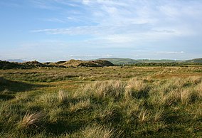
North Walney Nature Reserve is a national nature reserve on Walney Island, England. The reserve, which has an area of 646.5 ha, is notable as a habitat of natterjack toads. It is one of the sites in the Duddon Estuary which support one-fifth of the national population of the rare amphibian.

South Walney is one of two nature reserves on Walney Island, England. The nature reserve has an area of 130 ha leased from Holker estates. It has been managed by the Cumbria Wildlife Trust since 1963. The reserve is notable for being a colony for gulls and grey seals.

Roanhead refers to the limestone outcrop of Roanhead Crag in Cumbria and the farmland behind it, but in recent years the term has been taken to mean the sandy beaches adjoining Sandscale Haws extending to Snab Point. The Irish Sea lies to the west of Roanhead, whilst the Duddon Estuary and Walney Channel are due north and south respectively. The beach is noted for its abundance of sand dunes and strong, often dangerous coastal currents. Today the beach is a National Trust conservation area, and a two-mile stretch of the Cumbria Coastal Way runs through it.

Waxcap grassland is short-sward, nutrient-poor grassland that supports a rich assemblage of larger fungi, particularly waxcaps, characteristic of such habitats. Waxcap grasslands occur principally in Europe, where they are declining as a result of agricultural practices. The fungal species are consequently of conservation concern and efforts have been made in the United Kingdom and elsewhere to protect both the grasslands and their characteristic fungi. Over 20 species of European waxcap grassland fungi are assessed as globally "vulnerable" or "endangered" on the IUCN Red List of threatened species.

The North Norfolk Coast Site of Special Scientific Interest (SSSI) is an internationally important protected area in Norfolk, England. The SSSI is a long, narrow strip of coastal land that starts between Old Hunstanton and Holme-next-the-Sea, and runs east for about 43 km (27 mi) to Kelling. The southern boundary runs roughly west to east except where it detours around towns and villages, and never crosses the A149 coast road. It has an area of 7,700 ha (19,027 acres), and is additionally protected through Natura 2000, Special Protection Area (SPA) and Ramsar listings; it is also part of the Norfolk Coast Area of Outstanding Natural Beauty (AONB). Scolt Head Island and the coast from the Holkham National Nature Reserve to Salthouse are a Biosphere Reserve.

The North Norfolk Coast Site of Special Scientific Interest (SSSI) is an area of European importance for wildlife in Norfolk, England. It comprises 7,700 ha (19,027 acres) of the county's north coast from just west of Holme-next-the-Sea to Kelling, and is additionally protected through Natura 2000, Special Protection Area (SPA) listings; it is also part of the Norfolk Coast Area of Outstanding Natural Beauty (AONB). The North Norfolk Coast is also designated as a wetland of international importance on the Ramsar list and most of it is a Biosphere Reserve.