Andhra Pradesh is a state in the south-eastern coastal region of India. It is the seventh-largest state by area covering an area of 162,975 km2 (62,925 sq mi) and tenth-most populous state with 49,386,799 inhabitants, with the state capital being Amaravati and the largest city being Visakhapatnam. It is bordered by Telangana to the north-west, Chhattisgarh to the north, Odisha to the north-east, Tamil Nadu to the south, Karnataka to the west and the Bay of Bengal to the east. It has the second longest coastline in India after Gujarat, of about 974 km (605 mi). Andhra State was the first state to be formed on a linguistic basis in India on 1 October 1953. On 1 November 1956, Andhra State was merged with the Telugu-speaking areas of the Hyderabad State to form Andhra Pradesh. The state was then reorganised in June 2014 to form a separate Telangana state.

India is a federal union comprising 28 states and 8 union territories, for a total of 36 entities. The states and union territories are further subdivided into districts and smaller administrative divisions.

Ongole is a city in Prakasam district of the Indian state of Andhra Pradesh. It is the headquarters of Prakasam district and also the mandal headquarters of Ongole mandal in Ongole revenue division. Ongole cattle, an indigenous breed of oxen, derived its name from Ongole.

West Godavari district is one of the twenty six districts in the andhra region of the Indian state of Andhra Pradesh. The administrative headquarters of the district is situated at Bhimavaram. As of 2011 census of India, the district has an area of 7,742 km2 (2,989 sq mi) and a population of 1,779,935 It is bounded by Eluru District to the north, Krishna district and Bay of Bengal to the south, East Godavari district to the east, and Eluru District, Kolleru Lake and Upputeru Drain to the west.

Vizianagaram is a city and the headquarters of Vizianagaram district in the Indian state of Andhra Pradesh. It is central Eastern Ghats, about 24 km (15 mi) west of the Bay of Bengal and 40 km (25 mi) north-northeast of Visakhapatnam. The city has a population of 228,025 and was established as the capital of Vizianagaram estate by Raja Vijayaram Raj of Pusapati dynasty. The rulers had a notable role in the history of the region in 18th century and were patrons of education and arts.
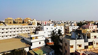
Kavali is a town in Nellore district of Andhra Pradesh of India. It also serves as headquarters of Kavali mandal and Kavali revenue division.It is one of the few cities from Andhra Pradesh which were selected for Atal Mission for Rejuvenation and Urban Transformation (AMRUT) Scheme.

Vizianagaram district is one of the eleven districts in the Coastal Andhra region of the Indian state of Andhra Pradesh with its headquarters located at Vizianagaram. The district is bounded on the east by the district of Srikakulam, southwest by the City of Bheemunipatnam, southeast by the Bay of Bengal, and northwest by the state of Odisha. It was formed on 1 June 1979, with some parts carved from the neighbouring districts of Srikakulam and Visakhapatnam. The district is named after the princely state of Vizianagaram. It is the least populous district in Andhra Pradesh.

Kadapa district is one of the twenty six districts in the Indian state of Andhra Pradesh. It is also one of the eight districts in the Rayalaseema region. Kadapa is the administrative headquarters for this district. The district was renamed as YSR District in honour of Y. S. Rajasekhara Reddy, commemorating former chief minister of united Andhra Pradesh.

Srikakulam district is one of the twenty-six districts in the Coastal Andhra region of the Indian state of Andhra Pradesh, with its headquarters located at Srikakulam. It is one of the nine coastal districts, located in the extreme northeastern direction of the state. It was formerly known as Chicacole.

Tuni is a town in Kakinada district of the Indian state of Andhra Pradesh. It is a major commercial marketing center for more than 40 surrounding villages in the district. Tuni is a border point for the district of Kakinada. It is known for mango export, with nearly 250 varieties. It is also famous for betel leaves and jute bags. A variety of cashew nuts are produced in Tuni.

Durgi is a village in Palnadu district of the Indian state of Andhra Pradesh. It is the mandal headquarters of Durgi mandal in Gurazala revenue division. In 15th century, Durgi stone craft was originated in the village.
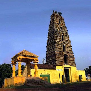
Chebrolu is a village in Guntur district of the Indian state of Andhra Pradesh. It is the headquarters of Chebrolu mandal in Tenali revenue division. It was once a Buddhist site and territorial capital of Kakatiya dynasty. The Archaeological excavations revealed Buddhist artefacts of Satavahana and Ikshavaku period.
Atchutapuram is a neighbourhood in Visakhapatnam district, located in the Indian state of Andhra Pradesh.

Duggirala is a village in Guntur district of the Indian state of Andhra Pradesh. It is the mandal headquarters of Duggirala mandal in Tenali revenue division. It is one of the major turmeric trading centres in the country.
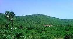
Karempudi is a village in Palnadu district of the Indian state of Andhra Pradesh. It is the headquarters of Karempudi mandal in Gurazala revenue division.

Kollipara is a village in Guntur district of the Indian state of Andhra Pradesh. It is the headquarters of Kollipara mandal in Tenali revenue division. And it was one of the capital for Pericchedi
Kollur is a village in Guntur district in the Indian state of Andhra Pradesh. It is the headquarters of Kollur mandal in Tenali revenue division.
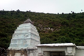
Machavaram is a village in Palnadu district of the Indian state of Andhra Pradesh. It is the headquarters of Machavaram mandal in Gurazala revenue division.
Namburu is a village in the Guntur district of the Indian state of Andhra Pradesh. It is located in Pedakakani mandal of Guntur revenue division.

Amaravati is the capital of the Indian state of Andhra Pradesh. It is located on the banks of river Krishna in Palnadu district.