
The Caribbean Sea is a sea of the Atlantic Ocean in the tropics of the Western Hemisphere. It is bounded by Mexico and Central America to the west and southwest, to the north by the Greater Antilles starting with Cuba, to the east by the Lesser Antilles, and to the south by the northern coast of South America. The Gulf of Mexico lies to the northwest. The entire Caribbean Sea area, the numerous islands of the West Indies, and adjacent mainland coastal regions are collectively known as the Caribbean.
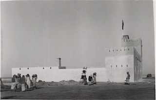
The Hawar Islands are an archipelago of desert islands; all but one are owned by Bahrain, while the southern, small, and uninhabited Jinan Island is administered by Qatar as part of its Al-Shahaniya municipality. The archipelago is situated off the west coast of Qatar in the Gulf of Bahrain of the Persian Gulf.

The Isle of Man is an island in the Irish Sea, between Great Britain and Ireland in Northern Europe, with a population of almost 85,000. It is a British Crown dependency. It has a small islet, the Calf of Man, to its south. It is located at 54°15′N4°30′W.

The Spencer Gulf is the westernmost and larger of two large inlets on the southern coast of Australia, in the state of South Australia, facing the Great Australian Bight. It spans from the Cape Catastrophe and Eyre Peninsula in the west to Cape Spencer and Yorke Peninsula in the east.

The Bismarck Sea lies in the south-western Pacific Ocean within the Papua New Guinean exclusive economic zone. It is located north-east of the island of New Guinea and south of the Bismarck Archipelago. It has coastlines in districts of the Islands Region, Momase Region, and Papua Region.

The Southern California Bight is a 692-kilometer-long stretch of curved coastline that runs along the west coast of the United States and Mexico, from Point Conception in California to Punta Colonet in Baja California, plus the area of the Pacific Ocean defined by that curve. This includes the Channel Islands of California and the Coronado Islands and Islas de Todo Santos of Baja California.

Butrint National Park is a national park in Vlorë County, southern Albania. It is located 18 kilometres (11 mi) south of Sarandë. The park encompasses 9,424 hectares (94.24 km2) of hilly terrain with freshwater lakes, wetlands, salt marshes, open plains, reed beds and islands. The park's significance for conservation is reflected in the large number of species with over 1,200 different animals and plants. Its mandate includes the protection of the lake and lagoon of Butrint, the natural channel of Vivari, the islands of Ksamil and as well the archaeological site, that provides valuable remains of ancient civilisations.
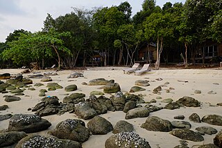
Koh Kong, or Outer Koh Kong, is an island in the Gulf of Thailand, in the coastal waters of Cambodia, around 10 km (6 mi) south of Koh Kong town, as it is part of Koh Kong Province. It is Cambodia's largest island.

Elkhorn Slough is a 7-mile-long (11 km) tidal slough and estuary on Monterey Bay in Monterey County, California. It is California's second largest estuary and the United States' first estuarine sanctuary. The community of Moss Landing and the Moss Landing Power Plant are located at the mouth of the slough on the bay.

Lake Skadar – also called Lake Scutari, Lake Shkodër and Lake Shkodra – lies on the border of Albania and Montenegro, and is the largest lake in Southern Europe. It is named after the Albanian city of Shkodër which lies at its southeastern coast. It is a karst lake.
Beryozovye Islands, alternatively spelled Berezovye Islands, is an island group in Leningrad Oblast, Russia.
Tubli Bay is a bay in the east of Bahrain, between Bahrain Island and Sitra island. The body of water is directly south of the Manama peninsula. The island of Nabih Saleh lies in the bay.

Bu Tinah is a tiny archipelago amid extensive coral formations and seagrass beds some 25 km south of Zirku and 35 north of Marawah in the United Arab Emirates. Found in the waters of Abu Dhabi, it is protected as a private nature reserve. Bu Tinah Island, rich in biodiversity, lies within the Marawah Marine Biosphere Reserve with a territory of more than 4,000 km2. The biosphere reserve is the region's first and largest UNESCO-designated marine biosphere reserve. It has been a recognized UNESCO site since 2001. Closed to visitors, fishing and the collection of turtle eggs are prohibited on Bu Tinah Island; the ban being enforced by patrols. An Environment Agency-Abu Dhabi Ranger Station is located on the island.

Bertha's Beach Important Bird Area comprises 3,300 hectares of coastal wetlands at the entrance to Choiseul Sound, on the east coast of East Falkland, in the Falkland Islands. It lies about 8 kilometres (5.0 mi) south-east of Mount Pleasant Airport and 40 km south-west of Stanley. It has been identified by BirdLife International as an Important Bird Area (IBA) because of its significancer for a variety of migratory waders and other waterbirds. Overlapping it is the 4000 ha Bertha's Beach Ramsar site, recognising it as a wetland of international importance.

The Cierva Point and offshore islands Important Bird Area is a 6540 ha tract of land and sea on the Danco Coast of the Antarctic Peninsula.
The Ilhéu de Curral Velho and adjacent coast Important Bird Area lies in the southeastern part of the island of Boa Vista in the Cape Verde archipelago off the coast of north-west Africa in the Atlantic Ocean. It is a 986 ha site consisting of the Ilhéu de Curral Velho, as well as the area opposite it on Boa Vista centred on the deserted village of Curral Velho. It was designated as a Ramsar wetland of international importance on July 18, 2005.

Dalnevostochny Morskoy Nature Reserve is Russia's first marine reserve, covering large portions of the sea and 30 islands in Peter the Great Gulf, on the west side of the Sea of Japan. It has the highest class of environmental protection as a federal 'zapovednik'. There are four distinct areas with different biological and protection regimes, covering 63,000 ha (240 sq mi) of sea area, additional land on included islands, a 500-meter conservation strip of coastline along the marine area, and a conservation buffer zone inland to a width of 3 miles. The reserve is situated on the continental coast south of Vladivostok in the Russian Far East. The administrative district is Khasansky District of Primorsky Krai. It was formally established in 1978. The reserve is part of the UNESCO "Far East Reserve" MAB Biosphere Reserve, noted for its protection of marine biodiversity, and as a re-population area for open seas fisheries.
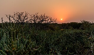
Dungonab Bay or Dongonab Bay is a body of water on the coastline of Sudan on the Red Sea.

The Albanian Adriatic Sea Coast stretches in the south-eastern Adriatic Sea beginning at the Gulf of Drin in the north, across the port cities of Shëngjin, Durrës, and Vlorë, to the Bay of Vlorë in the south, where the Albanian Riviera and the Albanian Ionian Sea Coast begin.

The Albanian Ionian Sea Coast is a coastline of the north-eastern Ionian Sea, that encompasses the south-western border of the Republic of Albania, stretching from the southern half of Karaburun Peninsula, across the historical region of Labëria, the city of Sarandë, the mountains of the Ceraunians, and the Albanian Riviera, to the Lake of Butrint, where the Strait of Corfu separates the country from Greece.

