Santa Cruz District, Santa Cruz, Guanacaste

Last updated
Santa Cruz
Aerial photo of the town of Santa Cruz in Costa Rica.jpg
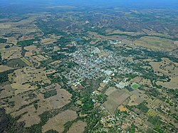
The town of Santa Cruz, administrative center of the canton and district of Santa Cruz
Santa Cruz District, Santa Cruz, Guanacaste
Santa Cruz district
Costa Rica location map.svg
Red pog.svg
Santa Cruz
Santa Cruz district location in Costa Rica
Coordinates: 10°12′54″N85°36′52″W / 10.2148723°N 85.6145086°W / 10.2148723; -85.6145086
Country Flag of Costa Rica.svg  Costa Rica
Province Guanacaste
Canton Santa Cruz
Area
  Total289.6 km2 (111.8 sq mi)
Elevation
50 m (160 ft)
Population
 (2011)
  Total21,544
  Density74/km2 (190/sq mi)
Time zone UTC−06:00
Postal code
50301

Santa Cruz is a district of the Santa Cruz canton, in the Guanacaste province of Costa Rica. [1] [2]

Contents

Geography

Santa Cruz has an area of 289.6 km2 [3] and an elevation of 50 metres. [1]

Villages

Administrative center of the district is the town of Santa Cruz.

Other villages in the district are Ángeles, Arado, Bernabela, Cacao, Cinto, Conga, Cuatro Esquinas, Chibola, Chircó, Chumico, Guayabal, Hato Viejo, Lagunilla, Lechuza, Limón, Moya, Puente Negro. Retallano (partly), Rincón, Río Caño Viejo, San Juan, San Pedro and Vistamar.

Demographics

Historical population
CensusPop.
1883 660
1927 3,976
1950 5,23231.6%
1963 8,02853.4%
1973 10,67232.9%
1984 12,86620.6%
2000 17,48635.9%
2011 21,54423.2%

Instituto Nacional de Estadística y Censos [4]
Centro Centroamericano de Población [5]

For the 2011 census, Santa Cruz had a population of 21,544 inhabitants. [6]

Transportation

Road transportation

The district is covered by the following road routes:

Related Research Articles

Turrialba is a canton in the Cartago province of Costa Rica. The head city is in Turrialba district.

Varablanca is a district of the Heredia canton, in the Heredia province of Costa Rica.

La Cruz is a district of the La Cruz canton, in the Guanacaste province of Costa Rica. It is located in the north of the country, near the border with Nicaragua.

San Miguel is a district of the Cañas canton, in the Guanacaste province of Costa Rica.

Santa Cecilia is a district of the La Cruz canton, in the Guanacaste province of Costa Rica.

Santa Elena is a district of the La Cruz canton, in the Guanacaste province of Costa Rica.

San Pablo is a district of the Nandayure canton, in the Guanacaste province of Costa Rica. Located on the Nicoya Peninsula.

Bolsón is a district of the Santa Cruz canton, in the Guanacaste province of Costa Rica.

Tempate is a district of the Santa Cruz canton, in the Guanacaste province of Costa Rica.

Cartagena is a district of the Santa Cruz canton, in the Guanacaste province of Costa Rica.

Cuajiniquil is a district of the Santa Cruz canton, in the Guanacaste province of Costa Rica.

Diriá is a district of the Santa Cruz canton, in the Guanacaste province of Costa Rica.

Cabo Velas is a district of the Santa Cruz canton, in the Guanacaste province of Costa Rica.

Santa María is a district of the Dota canton, in the San José province of Costa Rica.

El General is a district of the Pérez Zeledón canton, in the San José province of Costa Rica. Its head village is General Viejo.

Santa Cruz is a district of the León Cortés Castro canton, in the San José province of Costa Rica.

Santa Eulalia is a district of the Atenas canton, in the Alajuela province of Costa Rica.

Santa Cruz is a district of the Turrialba canton, in the Cartago province of Costa Rica.

Santa Teresita is a district of the Turrialba canton, in the Cartago province of Costa Rica.

Santa Isabel is a district of the Río Cuarto canton, in the Alajuela province of Costa Rica.

References

  1. 1 2 "Declara oficial para efectos administrativos, la aprobación de la División Territorial Administrativa de la República N°41548-MGP". Sistema Costarricense de Información Jurídica (in Spanish). 19 March 2019. Retrieved 26 September 2020.
  2. División Territorial Administrativa de la República de Costa Rica (PDF) (in Spanish). Editorial Digital de la Imprenta Nacional. 8 March 2017. ISBN   978-9977-58-477-5.
  3. "Área en kilómetros cuadrados, según provincia, cantón y distrito administrativo". Instituto Nacional de Estadística y Censos (in Spanish). Retrieved 26 September 2020.
  4. "Instituto Nacional de Estadística y Censos" (in Spanish).
  5. "Sistema de Consulta de a Bases de Datos Estadísticas". Centro Centroamericano de Población (in Spanish).
  6. "Censo. 2011. Población total por zona y sexo, según provincia, cantón y distrito". Instituto Nacional de Estadística y Censos (in Spanish). Retrieved 26 September 2020.