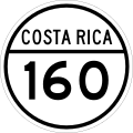
National Route 160 (Costa Rica)

Last updated
CR RNS 160.svg
National Secondary Route 160
Ruta nacional secundaria 160
River Crossing Ostional.jpg
River crossing between Nosara and Ostional during wet season.
Route information
Maintained by Ministry of Public Works and Transport
Length229.035 km (142.316 mi)
Major junctions
Southeast endCR RNP 21.svg Route 21 (Naranjo ferry terminal)
Major intersectionsCR RNT 621.svg Route 621 (Road to Paquera ferry terminal)
CR RNT 624.svg Route 624 (Road to Montezuma)
CR RNS 163.svg Route 163 (Road to Jicaral)
CR RNS 158.svg Route 158 (Road to Mansión)
CR RNS 150.svg Route 150 (Sámara)
CR RNT 928.svg Route 928 (Seco river)
CR RNS 152.svg Route 152 (Tamarindo)
Northwest endCR RNP 21.svg Route 21 (Santa Cruz)
Location
Country Costa Rica
Provinces Guanacaste, Puntarenas
Highway system
CR RNS 159.svg Route 159 CR RNS 161.svg Route 161

National Secondary Route 160, or just Route 160 (Spanish : Ruta Nacional Secundaria 160, or Ruta 160) is a National Road Route of Costa Rica, located in the Guanacaste, Puntarenas provinces. [1] The road is between Naranjo ferry terminal and Route 21 in Nicoya peninsula, and again with Route 21 at Santa Cruz, Guanacaste.

Contents

Description

A mostly gravel road, it approximately follows the coastline of southern section of the Nicoya Peninsula. It starts at the end of Route 21 at the Naranjo ferry terminal, and goes south to the Paquera ferry terminal, this section is paved. From there it turns west and goes near the beach and airport of Tambor and then the town of Cóbano. The northwest bound segment of the road from here to Puerto Carrillo can only be driven in the dry season, and only with off-road capable vehicles. There are many river and creek crossings without bridges.

From Puerto Carrillo the road continues its general northwest direction but becomes a well maintained gravel road that can be driven during the dry season. In the wet season there is a highly chance for a needed river crossing between Nosara and Ostional. It passes many beaches and tourist areas including Sámara, Nosara and the Ostional Wildlife Refuge. At Veintisiete de Abril the road turns to a northeaster direction, becomes paved and continues until it meets again with Route 21 at Santa Cruz

In Guanacaste province the route covers Nicoya canton (Sámara, Nosara districts), Santa Cruz canton (Santa Cruz, Veintisiete de Abril, Cuajiniquil districts), Nandayure canton (Zapotal, Bejuco districts), Hojancha canton (Puerto Carrillo district).

In Puntarenas province the route covers Puntarenas canton (Paquera, Cóbano districts).

History

Proper asphalt roads and three new bridges are being constructed since April 2018, in the segment between the ferry terminals. [2] [3]

Related Research Articles

<span class="mw-page-title-main">Liberia, Costa Rica</span> District in Guanacaste, Costa Rica

Liberia is a district and the largest city in the Guanacaste Province of Costa Rica, located 215 kilometres (134 mi) northwest of the national capital, San José, in the canton with the same name, of which it is the head city or capital. It is a major center for the country's tourism industry.

<span class="mw-page-title-main">Nicoya Peninsula</span>

The Nicoya Peninsula is a peninsula on the Pacific coast of Costa Rica. It is divided into two provinces: Guanacaste Province in the north, and the Puntarenas Province in the south. It is located at 10°N 85.4166667°W. It varies from 19 to 37 miles (60 km) wide and is approximately 75 miles (121 km) long, forming the largest peninsula in the country. It is known for its beaches and is a popular tourist destination.

<span class="mw-page-title-main">Nosara</span> District in Nicoya canton, Guanacaste province, Costa Rica

Nosara is a district of the Nicoya canton, in the Guanacaste province of Costa Rica.

<span class="mw-page-title-main">Santa Cruz (canton), Costa Rica</span> Canton in Guanacaste province, Costa Rica

Santa Cruz is a canton in the Guanacaste province of Costa Rica. The head city is in Santa Cruz district.

<span class="mw-page-title-main">Carrillo (canton)</span> Canton in Guanacaste province, Costa Rica

Carrillo is a canton in the Guanacaste province of Costa Rica. The head city is in Filadelfia district.

Puntarenas is a canton in the Puntarenas province of Costa Rica. The head city is Puntarenas.

Sámara is a district of the Nicoya canton, in the Guanacaste province of Costa Rica.

<span class="mw-page-title-main">Puerto Carrillo</span> District in Hojancha canton, Guanacaste province, Costa Rica

Puerto Carrillo is a district of the Hojancha canton, in the Guanacaste province of Costa Rica.

Veintisiete de Abril is a district of the Santa Cruz canton, in the Guanacaste province of Costa Rica.

Lepanto is a district of the Puntarenas canton, in the Puntarenas province of Costa Rica.

Paquera is a district of the Puntarenas canton, in the Puntarenas province of Costa Rica.

Cóbano is a district of the Puntarenas canton, in the Puntarenas province of Costa Rica.

National Tertiary Route 929, or just Route 929 is a National Road Route of Costa Rica, located in the Guanacaste province. It is a road in the Nicoya Peninsula, it starts at Route 906 and ends at Puerto Humo, on the shores of Tempisque river.

National Primary Route 21, or just Route 21 is a National Road Route of Costa Rica, located in the Guanacaste, Puntarenas provinces.

National Secondary Route 152, or just Route 152 is a National Road Route of Costa Rica, located in the Guanacaste province.

National Secondary Route 158, or just Route 158 is a National Road Route of Costa Rica, located in the Guanacaste province.

National Tertiary Route 904, or just Route 904 is a National Road Route of Costa Rica, located in the Guanacaste province.

National Tertiary Route 909, or just Route 909 is a National Road Route of Costa Rica, located in the Guanacaste province.

National Tertiary Route 920, or just Route 920 is a National Road Route of Costa Rica, located in the Guanacaste province.

National Tertiary Route 928, or just Route 928 is a National Road Route of Costa Rica, located in the Guanacaste province.

References

  1. "GeoPortal". Ministerio de Obras Públicas y Transporte de Costa Rica. Retrieved 28 May 2020.
  2. Cabezas, Yaslin (9 April 2019). "Ruta entre Paquera y Playa Naranjo tendrá cierres a partir de hoy" . Retrieved 21 September 2019.
  3. Recio, Patricia (7 May 2019). "Asfaltado entre Paquera y playa Naranjo tiene 10% de avance a un año de haber iniciado" . Retrieved 21 September 2019.