National Route 618 (Costa Rica)

Last updated
CR RNT 618.svg
National Tertiary Route 618
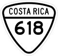
Ruta nacional terciaria 618
Route information
Maintained by Ministry of Public Works and Transport
Length6.345 km (3.943 mi)
Location
Country Costa Rica
Provinces Puntarenas
Highway system
CR RNT 617.svg Route 617 CR RNT 619.svg Route 619

National Tertiary Route 618, or just Route 618 (Spanish : Ruta Nacional Terciaria 618, or Ruta 618) is a National Road Route of Costa Rica, located in the Puntarenas province. [1]

Contents

Description

This route is the access road to Manuel Antonio National Park.

In Puntarenas province the route covers Quepos canton (Quepos district).

Junction list

The route is completely within Quepos district.

kmmiDestinationsNotes
0.00.0CR RNS 235.svg Route 235 Southeast of Quepos
6.33.9Entrance to Manuel Antonio National Park

History

This route was severely damaged in November 2020 due to Hurricane Eta. [2]

References

  1. "GeoPortal". Ministerio de Obras Públicas y Transporte de Costa Rica. Archived from the original on 22 September 2020. Retrieved 30 May 2020.
  2. "Reparar hundimiento en vía principal de Manuel Antonio costará ₡80 millones" . Retrieved 25 November 2020.