National Road Network of Costa Rica

Last updated
National Road Network
Red Vial Nacional
CR RNP 1.svg CR RNS 126.svg CR RNT 606.svg
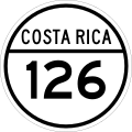
National Primary, Secondary and Tertiary Routes shield examples.
Map Red Vial Nacional Costa Rica.svg
Map of the routes as of May 2020.
System information
Maintained by Ministry of Public Works and Transport
Length35,330 km [1]  (21,950 mi)
Formed1948
Highway names
Ruta 1..39National Primary Route
Ruta 100..257National Secondary Route
Ruta 301..939National Tertiary Route
System links

National Road Network of Costa Rica (Spanish : Red Vial Nacional), are a series of numbered road routes that are managed through Costa Rica by the Ministry of Public Works and Transport (MOPT) and its subagency the National Road Council (Conavi). [1]

Contents

According to the Inter-American Development Bank, in 2019 Costa Rica had the worst road network in Latin America, due to being under maintained, and having structural defects and deterioration in around 49% of the National Primary Routes network. Other countries in the area report an average of 20% in the same metric. [2]

There are no high speed express routes but there are some two-lane trunk roads. Potholes are common in primary road routes. Many of the secondary or tertiary road routes are made of gravel or dirt. [3]

See also

Related Research Articles

<span class="mw-page-title-main">Santa Ana, Costa Rica</span> District in Santa Ana canton, San José province, Costa Rica

Santa Ana is a district and head city of the Santa Ana canton, in the San José province of Costa Rica. The city acts as seat to the municipal government of the Santa Ana Canton.

La Unión is a canton in the Cartago province of Costa Rica. The head city is in Tres Ríos district.

<span class="mw-page-title-main">Aserrí (canton)</span> Canton in San José province, Costa Rica

Aserrí is the sixth canton in the San José province of Costa Rica. The head city of the canton is the homonymous Aserrí.

<span class="mw-page-title-main">Carrillo (canton)</span> Canton in Guanacaste province, Costa Rica

Carrillo is a canton in the Guanacaste province of Costa Rica. The head city is in Filadelfia district.

Mata Redonda is a district of the San José canton, in the San José province of Costa Rica.

San Vito, originally named San Vito de Java, is a district and head city of the Coto Brus canton, in the Puntarenas province of Costa Rica. It is located about 271 kilometres (168 mi) southeast of the capital San José, and close to the Panama border.

<span class="mw-page-title-main">Roads in Puerto Rico</span> National, interstate, forest and municipal roadways in Puerto Rico

The Roads in Puerto Rico are the national, forest and municipal roadways that make up the approximately 14,400 kilometers (8,900 mi) roads through the terrain of Puerto Rico. The highways serve the more than 3 million residents, and 3-4 million tourists who visit each year.

<span class="mw-page-title-main">National Route 39 (Costa Rica)</span> National Primary Route around San José, Costa Rica

National Primary Route 39, or just Route 39 is a National Road Route of Costa Rica, located in the San José province. Its official name is Paseo de la Segunda República, is also known as Carretera de Circunvalación, and is an incomplete ring road encircling the central districts of San José canton, the capital of the country.

<span class="mw-page-title-main">National Route 35 (Costa Rica)</span> Road in Costa Rica

National Primary Route 35, or just Route 35 is a National Road Route of Costa Rica, located in the Alajuela province, and it is a road that serves the central north area of Costa Rica.

National Secondary Route 239, is a road in Costa Rica between Ciudad Colón, San José province and Parrita, Puntarenas province. It is the main access road of the Puriscal canton of San José province. From Puriscal to Parrita, the road is dirt and gravel.

National Tertiary Route 606, or just Route 606 is a National Road Route of Costa Rica, located in the Guanacaste, Puntarenas provinces. It is known as Carretera a Monteverde, between Route 1 in Puntarenas province and Monteverde. It is the main access road to the dairy farms and tourist-attraction rain forests of Monteverde.

National Tertiary Route 502, or just Route 502, known as Carretera de Getsemaní, is a National Road Route of Costa Rica, located in the Heredia province, it is a road between Route 113 and Route 114.

<span class="mw-page-title-main">National Route 1 (Costa Rica)</span> Highway in Costa Rica

National Primary Route 1, formally known as Carretera Interamericana Norte, is the northern segment of the Pan-American Highway that traverses Costa Rica.

<span class="mw-page-title-main">National Route 2 (Costa Rica)</span> Highway in Costa Rica

National Primary Route 2, formally known as Carretera Interamericana Sur, is the southern segment of the Pan-American Highway that traverses Costa Rica.

National Secondary Route 243, or just Route 243 is a National Road Route of Costa Rica, located in the San José, Puntarenas provinces. It connects Route 2 and Route 34.

<span class="mw-page-title-main">National Route 34 (Costa Rica)</span> Highway in Costa Rica

National Primary Route 34, official name Carretera Pacífica Fernández Oreamuno, and popularly known as Carretera Costanera Sur, or just Route 34, is a National Road Route and scenic route of Costa Rica, located in the Alajuela, Puntarenas provinces that connects Route 27 and Route 2 mostly along the central and south Pacific coast of the country, and is the recommended route over the Pan-American Highway when traveling between the south of the country to the Greater Metropolitan Area.

National Secondary Route 237, or just Route 237 is a National Road Route of Costa Rica, located in the Puntarenas province.

National Tertiary Route 612, or just Route 612 is a National Road Route of Costa Rica, located in the Puntarenas province. In Puntarenas province the route covers Coto Brus canton. As the main road between San Vito town and Elena town on Pittier district, MOPT announced on 22 October 2020 works to improve the road for a total of CRC ₡ 2,988,388,595.20 over 164 days.

National Tertiary Route 934, or just Route 934 is a National Road Route of Costa Rica, located in the Guanacaste province.

References

  1. 1 2 "GeoPortal". Ministerio de Obras Públicas y Transporte. Retrieved 20 May 2020.
  2. Garza, Jeffry (10 August 2020). "Costa Rica es el país de Latinoamérica con la red vial pavimentada en peor estado". La República. Retrieved 13 August 2020.
  3. Canales, Danny (16 June 2008). "Diez causas alimentan huecos en las carreteras". La República. Retrieved 21 May 2020.
  4. 1 2 3 4 5 "Definiciones relacionadas con el Capítulo de Vialidad. Plan Regular Urbano Distrital". Sistema Costarricen de Información Jurídica. Retrieved 21 May 2020.