 | ||||
|---|---|---|---|---|
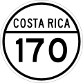
| Ruta nacional secundaria 170 | ||||
| Route information | ||||
| Maintained by Ministry of Public Works and Transport | ||||
| Length | 22.885 km (14.220 mi) | |||
| Location | ||||
| Country | Costa Rica | |||
| Provinces | Alajuela, Guanacaste | |||
| Highway system | ||||
| ||||
National Secondary Route 170, or just Route 170 (Spanish : Ruta Nacional Secundaria 170, or Ruta 170) is a National Road Route of Costa Rica, located in the Alajuela, Guanacaste provinces. [1]