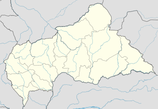
Alindao Airport is an airstrip serving Alindao, a small town in the Basse-Kotto prefecture of the Central African Republic. The runway is 2 kilometres (1.2 mi) southwest of the town.

Santa Rita Airport is a rural airstrip serving the lightly populated pampa region of the Beni Department of Bolivia. The nearest town is Santa Rosa de Yacuma, 50 kilometres (31 mi) southwest.
San Gerónimo Airport is an airstrip serving Algarrobo, a Pacific coastal city in the Valparaíso Region of Chile. The airstrip is 4.6 kilometres (2.9 mi) inland from the coast.
Atacalco Airport Spanish: Aeropuerto Atacalco, is a rural airstrip 10 kilometres (6.2 mi) southeast of Recinto (es), a community in the Bío Bío Region of Chile.
El Tapihue Airport (Spanish: Aeropuerto El Tapihue, is an airstrip 6 kilometres east of Casablanca, a city in the Valparaíso Region of Chile.
Fundo Loma Larga Airport Spanish: Aeropuerto Fundo Loma Larga, is an airport serving the Loma Larga winery 5 kilometres (3.1 mi) north of Casablanca, a city in the Valparaíso Region of Chile.
Cerro Castillo Airport Spanish: Aeropuerto de Cerro Castillo, is an airstrip serving the village and border station at Cerro Castillo, in the Magallanes Region of Chile. Cerro Castillo is 6 kilometres (3.7 mi) west of the border with Argentina.
Chaitén Airfield was an airport serving Chaitén, a town in the Los Lagos Region of Chile. The airport was damaged and closed after the 2008 eruption of Chaitén Volcano.
For the airport in Mexico see Francisco Sarabia International Airport
La Obra Airport Spanish: Aeropuerto La Obra, is an airstrip serving Cumpeo, a small town in the Río Claro commune of the Maule Region in Chile. The airstrip is 6 kilometres (3.7 mi) southwest of the town.
La Montaña Airport Spanish: Aeropuerto de La Montaña, is an airstrip 27 kilometres (17 mi) east of Curicó, a city in the Maule Region of Chile.
Fundo Tehuén Airport, is an airstrip 6.8 kilometres (4.2 mi) northwest of Frutillar, a town in the Los Lagos Region of Chile.
Quenac Airport is an airstrip serving Isla Quenac (es), an island in the Los Lagos Region of Chile. The island is in the archipelago between the Gulf of Ancud and the Gulf of Corcovado.
Isla Talcan Airport is an airstrip serving Isla Talcan, an island in the Gulf of Corcovado, in the Los Lagos Region of Chile.
Los Alerces Airport is an airstrip 16 kilometres (9.9 mi) north-northeast of Chaitén, a coastal city in the Los Lagos Region of Chile. The airstrip is in an open mountain valley 6 kilometres (3.7 mi) north of the Chaitén volcano caldera.
Hacienda Lipangue Airport Spanish: Aeropuerto de Hacienda Lipangue, is an airstrip 6 kilometres (3.7 mi) southwest of Lampa, a city in the Santiago Metropolitan Region of Chile.
Huayanay Airport, is an airstrip 36 kilometres (22 mi) northwest of Ovalle, a city in the Coquimbo Region of Chile.
Santa Marta Airport is an airstrip 10 kilometres (6 mi) southeast of San Carlos, a town in the Bío Bío Region of Chile.
Santo Domingo Airport is an airport serving Santo Domingo, a Pacific coastal town in the Valparaíso Region of Chile.
Viñamar Airport Spanish: Aeropuerto Viñamar, is an airstrip serving the Viñamar winery southeast of Casablanca, a city in the Valparaíso Region of Chile.


