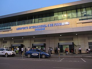
Quatro de Fevereiro International Airport, is the main international airport of Angola. It is located in the southern part of the capital Luanda, situated in the Luanda Province. Quatro de Fevereiro means 4 February, which is an important national holiday in Angola, marking the start of the armed struggle against the Portuguese colonial regime on 4 February 1961. In 2009, about 1.8 million passengers were counted.

Welwitschia Mirabilis International Airport is an airport serving the Atlantic port city of Moçâmedes, the capital of Namibe Province in Angola. The runway is 6.8 kilometres (4.2 mi) south of the city.

Catumbela Airport is an airport in Catumbela, a coastal city in the Benguela Province of Angola. After having been expanded and restored, the airport opened in 2012 and due to its capacity and size, would indicate annual passenger movement of around 2.2 million. Cutumbela Airport will form an alternative to the airport in Luanda. The national certification process for Benguela Province's Catumbela airport is expected to be completed in February 2019, providing that the security standards complies with the 'Empresa Nacional de Navegação Aérea' regarding the infrastructure. The airport boasts two boarding bridges and a 3,700-metre runway, 18 migration service-counters and 16 check-in counters. It also provides executive and first class facilities complete with restaurants and bars.
Negage Airport is an airport serving Negage, a town and municipality in Uíge Province in Angola. It was formerly a Portuguese military airbase.

Cabinda Airport is an airport serving Cabinda, a city in the Cabinda Province, an exclave of Angola.
Soyo Airport is an airport serving Soyo, a city in Zaire Province in Angola.
The Albano Machado Airport is a public airport southeast of Huambo, the capital of Huambo Province, Angola. It was formerly named the Nova Lisboa Airport, since in colonial times the city was called Nova Lisboa, or New Lisbon.

Rundu Airport is an airport serving Rundu, the capital of the Kavango Region in Namibia. The airport is 6 kilometres (3.7 mi) southwest of the center of Rundu.
Catoca Airport is an airport in the Lunda Sul Province of Angola. It serves the Catoca diamond mine.
Saurimo Airport is a public use airport serving the city of Saurimo in Lunda Sul Province, Angola. It was formerly known as Henrique de Carvalho Airport.
Uíge/Carmona Airport is a public use airport on the west side of Uíge, the capital of Uíge Province in Angola.
Camaxilo Airport is an airport serving Camaxilo in Lunda Norte Province, Angola. The runway is 3.8 kilometres (2.4 mi) south of the village.
Chitato Airport is an airport serving Dundo, Angola. The runway is 3 kilometres (1.9 mi) northwest of the city.
N'zeto Airport is an airport serving N'zeto, a town in Zaire Province, Angola. The runway is 2.5 kilometres (1.6 mi) south of the town, along the Atlantic coast.
Waku Kungo Airport is an airport serving Waku-Kungo in Cuanza Sul Province, Angola. The runway is 6.5 kilometres (4.0 mi) south of Waku-Kungo, near the village of Cela.

Dilolo Airport is an airstrip serving the town of Dilolo in Katanga Province, Democratic Republic of the Congo. The runway is 7.5 kilometres (4.7 mi) south of the town, near the Angola border.
Bungo is a town and municipality in Uíge Province, Angola.
Cuilo Pombo is a town and commune of Angola, located in the province of Uíge.
Sanza Pompo is a town and commune of Angola, located in the province of Uíge.


