The Sapphire Coast is the marketing and tourist name for the Bega Valley Shire region in South East, New South Wales, Australia. It stretches from Bermagui in the north to the Victorian border in the south.
The Sapphire Coast is known for its clean beaches, clear water and great quality of life. The area is very popular with retirees and seachangers.
The Sapphire Coast is halfway between Melbourne and Sydney, on the far south coast of New South Wales. By car, it is only a 3-hour drive from Canberra via Cooma or a 6-7 hour drive from either Melbourne or Sydney.
NSW TrainLink, V/Line and Premier Motor Service provide regular coach services from Sydney, Melbourne and Canberra, local bus services can get you around once you're here, or there are numerous car rental companies to rent a car and explore the wonders of the Sapphire Coast.
Self drive and touring options abound with coastal drives along the Princes Highway, Sapphire Coast Drive and the Tathra-Bermagui Road or discover the hinterland and countryside attractions. The temperate climate of the Sapphire Coast region is ideal for enjoying nature and outdoors all year round. Spring and autumn are great times to be outdoors for adventures and the whales are passing by in late winter and spring, between June and November.
The average maximum temperature sits around 24°C in summer while minimum temperatures range between 16°C in summer and 7°C during winter.
The Australian Capital Territory, formerly known as the Federal Capital Territory until 1938 and commonly referred to as the ACT, is a federal territory of Australia containing the Australian capital city of Canberra and some surrounding townships. It is located in the south-east of the country and is an enclave within the state of New South Wales. Founded after Federation as the seat of government for the new nation, all important institutions of the Australian federal government are centred in the territory.
New South Wales is a state on the east coast of Australia. It borders Queensland to the north, Victoria to the south, and South Australia to the west. Its coast borders the Coral and Tasman Seas to the east. The Australian Capital Territory is an enclave within the state. New South Wales' state capital is Sydney, which is also Australia's most populous city. In March 2019, the population of New South Wales was over 8 million, making it Australia's most populous state. Just under two-thirds of the state's population, 5.1 million, live in the Greater Sydney area. Inhabitants of New South Wales are referred to as New South Welshmen.
There are many forms of transport in Australia. Australia is highly dependent on road transport. There are more than 300 airports with paved runways. Passenger rail transport includes widespread commuter networks in the major capital cities with more limited intercity and interstate networks. The Australian mining sector is reliant upon rail to transport its product to Australia's ports for export.
Tathra is a seaside town on the Sapphire Coast found on the South Coast, New South Wales, Australia. As at the 2016 census, Tathra had a population of 1,675.
Greater Western Sydney (GWS) is a large region of the metropolitan area of Greater Sydney, New South Wales, Australia that generally embraces the north-west, south-west, central-west, and far western sub-regions within Sydney's metropolitan area and encompasses 13 local government areas: Blacktown, Canterbury-Bankstown, Camden, Campbelltown, Cumberland, Fairfield, Hawkesbury, Hills Shire, Liverpool, Parramatta, Penrith, Wollondilly and the western portion of the City of Parramatta Council. It includes Western Sydney, which has a number of different definitions, although the one consistently used is the region composed of the nine local government authorities which are all members of the Western Sydney Regional Organisation of Councils (WSROC). The NSW Government's Office of Western Sydney uses the broader Greater Western Sydney definition to refer to the region.
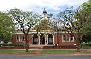
Bombala is a town in the Monaro region of south-eastern New South Wales, Australia, in Snowy Monaro Regional Council. It is approximately 485 kilometres (301 mi) south of the state capital, Sydney, and 80 kilometres (50 mi) south of the town of Cooma. The name derives from an Aboriginal word meaning "Meeting of the waters". The town lies on the banks of the Bombala River. At the 2016 census, Bombala had a population of 1,387.
Mallacoota is a small town in the East Gippsland region of Victoria, Australia. At the 2016 census, Mallacoota had a population of 1,063. At holiday times, particularly Easter and Christmas, the population increases by about 8,000. It is the last official township on Victoria's east coast before the border with New South Wales. Mallacoota has a regional airport YMCO (XMC) consisting of a gravel runway for light planes and an asphalt runway for commercial planes flying from Melbourne.
Griffith is a major regional city in the Murrumbidgee Irrigation Area that is located in the north-western part of the Riverina region of New South Wales, known commonly as the food bowl of Australia. It is also the seat of the City of Griffith local government area. Like the Australian capital, Canberra, and the nearby town of Leeton, Griffith was designed by Walter Burley Griffin and Marion Mahony Griffin. Griffith was named after Arthur Hill Griffith, the first New South Wales Minister of Public Works. Griffith was proclaimed a city in 1987, and had a population of 20,251 in June 2018.
A southerly buster is the colloquial name of an abrupt southerly wind change in the southern regions of New South Wales and Victoria, Australia, which approaches from the southeast, mainly on a hot day, bringing in cool, usually bringing severe weather and a dramatic temperature drop, thus ultimately replacing and relieving the prior hot conditions. Marking the boundary between hot and cool air masses, a southerly buster is sometimes represented by a roll-up cloud perpendicular to the coast, which appears from the south and coexists with the wind change, though sometimes there is little visual signal of the southerly's arrival.
Severe storms in Australia refers to the storms, including cyclones, which have caused severe damage in Australia.
Merimbula Merimbula is a town on the Merimbula Lake, located on the Far South Coast or Sapphire Coast of New South Wales, Australia. At the 2016 census, the population was 3,544.
The South Coast refers to the narrow coastal belt from Shoalhaven district in the north to the border with Victoria in the south in the south-eastern part of the State of New South Wales, Australia. It is bordered to the west by the coastal escarpment of the Southern Tablelands, and is largely covered by a series of national parks, namely Jervis Bay National Park, Eurobodalla National Park, and Ben Boyd National Park. To the east is the coastline of the Pacific Ocean, which is characterised by rolling farmlands, small towns and villages along a rocky coastline, interspersed by numerous beaches and lakes.
The climate of Sydney is humid subtropical, shifting from mild and cool in winter to warm and hot in the summer, with no extreme seasonal differences as the weather is moderated by proximity to the ocean, although more contrasting temperatures are recorded in the inland western suburbs. Despite the fact that there is no distinct dry or wet season, rainfall peaks in the first half of the year and is at its lowest in the second half. Precipitation varies across the region, with areas adjacent to the coast being the wettest. The city receives around 20 thunderstorms per year.
Australia's climate is governed mostly by its size and by the hot, sinking air of the subtropical high pressure belt. This moves north-west and north-east with the seasons. The climate is variable, with frequent droughts lasting several seasons, thought to be caused in part by the El Niño-Southern Oscillation. Australia has a wide variety of climates due to its large geographical size. The largest part of Australia is desert or semi-arid. Only the south-east and south-west corners have a temperate climate and moderately fertile soil. The northern part of the country has a tropical climate, varying between tropical rainforests, grasslands and desert.
High-speed rail in Australia has been under investigation since the early 1980s. Every Federal Government since this time has investigated the feasibility of constructing high speed rail, but to date nothing has ever gone beyond the detailed planning stage. The most commonly suggested route is between Australia's two largest cities, Sydney and Melbourne, which is the world's second busiest air corridor. Various corridors have been proposed for a potential high-speed line.
The Central Tablelands in New South Wales is a geographic area that lies between the Sydney Metropolitan Area and the Central Western Slopes and Plains. The Great Dividing Range passes in a north–south direction through the Central Tablelands and includes the Blue Mountains. The region shares borders with the Hunter, Central West Slopes and Plains, Southern Tablelands, North Western Slopes and Plains, the Sydney Metropolitan Area and the Illawarra.
In Australia, the Federation Drought is the name given to a prolonged period of drought that occurred around the time of Federation in 1901.
Between 1979 and 1983 almost all of eastern Australia was affected by a major drought.
A humid subtropical climate is a zone of climate characterized by hot and humid summers, and cold to mild winters. These climates normally lie on the southeast side of all continents, generally between latitudes 25° and 35° and are located poleward from adjacent tropical climates.
The 2009 Australian dust storm, also known as the Eastern Australian dust storm, was a dust storm that swept across the Australian states of New South Wales and Queensland from 22 to 24 September 2009. The capital, Canberra, experienced the dust storm on 22 September, and on 23 September the storm reached Sydney and Brisbane. Some of the thousands of tons of dirt and soil lifted in the dust storm were dumped in Sydney Harbour and the Tasman Sea.
This page is based on this Wikipedia article Text is available under the CC BY-SA 4.0 license; additional terms may apply. Images, videos and audio are available under their respective licenses.