Musafirkhana is a town and tehsil in Amethi district in Indian state of Uttar Pradesh. The word "Musafirkhana" means "Sarai," or "Dharamshala". Musafirkhana is located 32 km northwest of Amethi, 20 km from Jagdishpur. Gauriganj and Amethi are accessible from Musafirkhana via roadways; the nearest railway station is the Musafirkhana railway station on the Lucknow–Varanasi rail route via Sultanpur, and the nearest airport is the Amausi airport. It is surrounded by more than 100 villages. The town is between 26.37° north latitude and 81.8° east longitude at a height of 102 metres (434 feet) above mean sea level.
Chand Saray, also spelled as Chand Sarai, is a village in Gosainganj block of Lucknow district, Uttar Pradesh, India. It forms the western endpoint of the under construction Purvanchal Expressway. As of 2011, the population of Chand Sarai is 2,222, in 421 households.

Miyanganj, also spelled Mianganj, is a village and corresponding community development block in Hasanganj tehsil of Unnao district, Uttar Pradesh, India. It is located on the road from Lucknow to Bangarmau, just to the west of the crossroads with another route linking Unnao and Sandila.

Fatehganj is a village in Purwa block of Unnao district, Uttar Pradesh, India. It is located on a major district road and has one primary school and no healthcare facilities. As of 2011, its population is 798, in 245 households.

Sarai Thakuri is a village in Hilauli block of Unnao district, Uttar Pradesh, India. As of 2011, its population is 671, in 123 households, and it has one primary school and no healthcare facilities.

Sarai Manihar is a village in Sumerpur block of Unnao district, Uttar Pradesh, India. As of 2011, its population is 1,919, in 352 households, and it has two primary schools and no healthcare facilities.

Sarai Chhatardhari is a village in Shivgarh block of Rae Bareli district, Uttar Pradesh, India. As of 2011, its population is 1,932, in 351 households. It has one primary school and no healthcare facilities.

Thulendi is a village in Bachhrawan block of Rae Bareli district, Uttar Pradesh, India. It is located 6 km from Bachhrawan, the block headquarters, on an elevated plain with clayey soil. A historic village, Thulendi served as a pargana headquarters from the early 1400s until the late 1700s, and it has several old monuments including a fort built under the Jaunpur Sultanate and two large tanks othat are said to be even older. As of 2011, Thulendi's population is 6,616, in 1,195 households.

Sarai Madho is a village in Singhpur block of Rae Bareli district, Uttar Pradesh, India. As of 2011, its population is 1,212, in 219 households. It has no schools and no healthcare facilities.

Sarai Umar is a village in Harchandpur block of Rae Bareli district, Uttar Pradesh, India. As of 2011, its population is 2,434, in 490 households. It has two primary schools and no healthcare facilities.

Sarai Dugosha is a village in the Sataon block of the Rae Bareli district, Uttar Pradesh, India. It is located 14 km from Raebareli, the district headquarters. As of 2011, its population was 1,473, living in 251 households. It has one primary school and no healthcare facilities.

Sarai Mahmud is a village in Khiron block of Rae Bareli district, Uttar Pradesh, India. It is located 17 km from Lalganj, the tehsil headquarters. As of 2011, it has a population of 460 people, in 72 households. It has no schools and no healthcare facilities.

Sarai Muhammad Sharif is a village in Rahi block of Rae Bareli district, Uttar Pradesh, India. It is located 9 km from Rae Bareli, the district headquarters. As of 2011, it has a population of 1,400 people, in 271 households. It has one primary school and no healthcare facilities.

Sarai is a village in Lalganj block of Rae Bareli district, Uttar Pradesh, India. It is located 19 km from Lalganj, the block and tehsil headquarters. As of 2011, it has a population of 902 people, in 173 households. It has one primary school and no healthcare facilities.

Sarai Lakhmi is a village in Dalmau block of Rae Bareli district, Uttar Pradesh, India. It is located 4 km from Dalmau, the block headquarters. As of 2011, it has a population of 871 people, in 166 households. It has one pre-primary school and no healthcare facilities.

Sarai Sri Bakhsh is a village in Jagatpur block of Rae Bareli district, Uttar Pradesh, India. As of 2011, it has a population of 1,671 people, in 260 households. It has one primary school and no healthcare facilities.

Sarai Hardo is a village in Unchahar block of Raebareli district, Uttar Pradesh, India. It is located 30 km from Raebareli, the district headquarters. As of 2011, it has a population of 1,398 people, in 347 households.

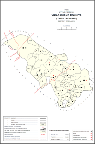
Sarai Akhtiar is a village in Rohaniya block of Rae Bareli district, Uttar Pradesh, India. It is located 40 km from Raebareli, the district headquarters. As of 2011, it has a population of 1,731 people, in 305 households. It has two primary schools and no healthcare facilities, and it hosts both a permanent market and a weekly haat.

Sarai Manik is a village in Dih block of Rae Bareli district, Uttar Pradesh, India. It is located 23 km from Raebareli, the district headquarters. As of 2011, it has a population of 4,433 people, in 878 households. It has two primary schools and no healthcare facilities, and it does not host a permanent market or weekly haat. It belongs to the nyaya panchayat of Dih.

Sarai Kurmi is a village in Lalganj block of Rae Bareli district, Uttar Pradesh, India. It is located 4 km from Lalganj, the block and tehsil headquarters. As of 2011, it has a population of 843 people, in 197 households. It has no healthcare facilities and does not host a permanent market or a weekly haat. It belongs to the nyaya panchayat of Behta Kalan.


